Grand Canyon: Location, Formation & Facts
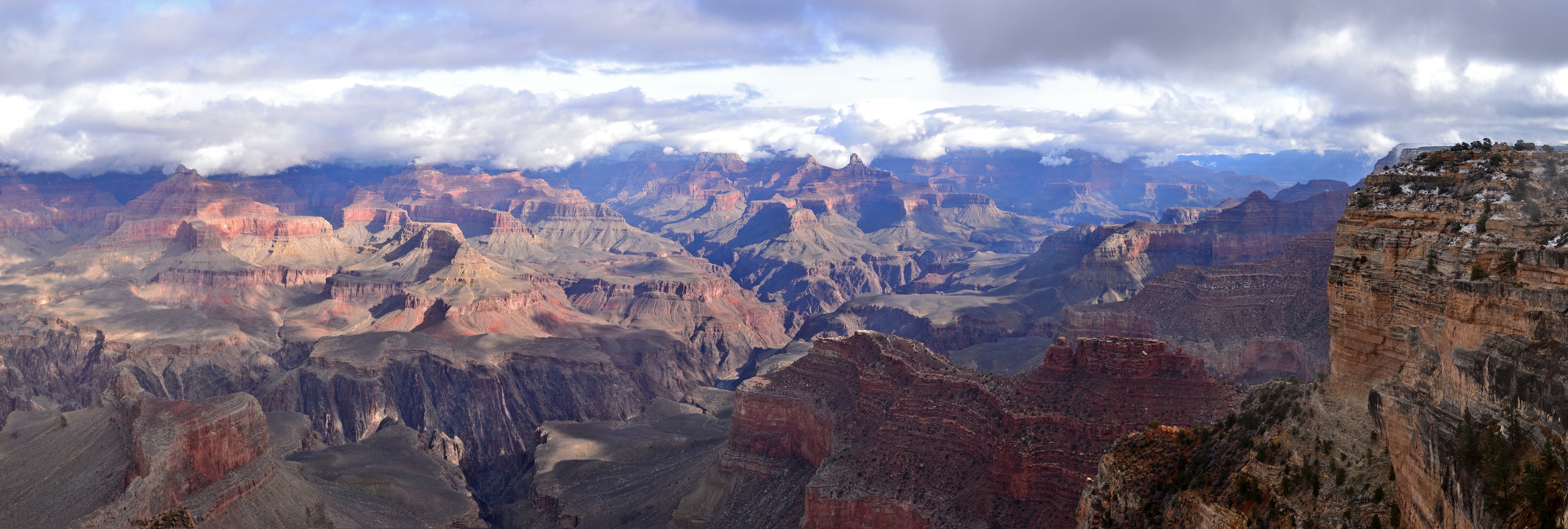
The Grand Canyon is indeed a very big hole in the ground. It is 277 miles (446 km) long, up to 18 miles (29 km) wide and more than a mile (6,000 feet / 1,800 meters) deep. It is the result of constant erosion by the Colorado River over millions of years.
Where is the Grand Canyon?
The Grand Canyon is in the northwest corner of Arizona, close to the borders of Utah and Nevada. Most of the Grand Canyon lies within Grand Canyon National Park and is managed by the National Park Service, the Hualapai Tribal Nation and the Havasupai Tribe.
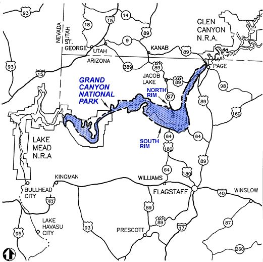
The Colorado River, which flows through the canyon, touches seven states, but the Grand Canyon National Park is within the Arizona state borders. While Arizona is known as the Grand Canyon State, the attached Glen Canyon National Recreation Area is in Utah and the Lake Mead National Recreation Area borders the Grand Canyon in Nevada.
The canyon’s climate is semi-arid, with some sections of the upper plateau dotted with forests, while the canyon bottoms are a series of desert basins. More than 1,500 plant, 355 bird, 89 mammalian, 47 reptile, 9 amphibian and 17 fish species are found in park, according to the National Park Service.
The Grand Canyon is divided into the North Rim and the South Rim. The South Rim is open all year and receives 90 percent of the park’s visitors. The South Rim has an airport and rail service and is also close to many transportation hubs and the Arizona cities of William and Flagstaff, as well as Las Vegas, Nev.
The North Rim is located closer to Utah and has stunning views, but is not nearly as accessible as the South Rim. While only 10 miles (16 kilometers) separate the two rims if you could walk across the canyon, it is only reachable by hikers who tackle the 21 miles (33.8) of the North and South Kaibab Trails, or those who travel 220 miles (354 kilometers) by vehicle. The North Rim is often closed during inclement weather as the roads quickly become dangerous. [Countdown: 7 Amazing Grand Canyon Facts]
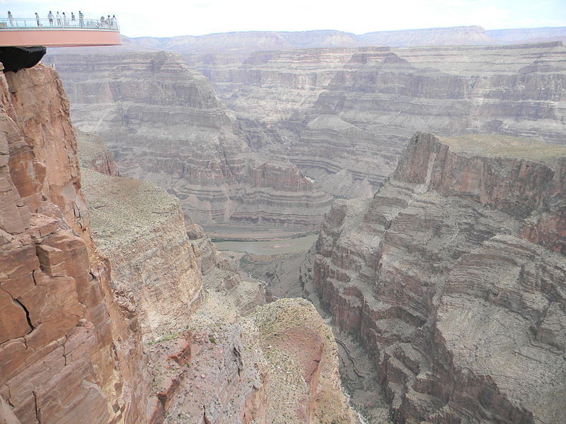
Grand Canyon Skywalk
One popular attraction is the Grand Canyon Skywalk, a horseshoe-shaped glass walkway that is 4,000 feet (1,220 meters) above the canyon floor in the Grand Canyon West area of the main canyon. Since opening in March 2007, about 300,000 visitors have walked the Grand Canyon Skywalk each year.
Commissioned and owned by the Hualapai Indian tribe, the skywalk is an engineering marvel conceived by David Jin, a Las Vegas-based investor who had been involved with tourism and the Hualapai Nation. The project sparked a great deal of controversy regarding the continued commercialization of this natural phenomenon, but proponents argued that it is part of a larger plan to address the tribe’s high unemployment and poverty rates. The tribe unsuccessfully sued Lin regarding management fees.
How was the Grand Canyon formed?
The specific geologic processes and timing that formed the Grand Canyon spark lively debates by geologists. The general scientific consensus, updated at a 2010 conference, holds that the Colorado River carved the Grand Canyon beginning 5 million to 6 million years ago.
However, recent advances in dating techniques have upended the notion of a uniformly young Grand Canyon. The new approach determines when erosion uncovered rocks in the canyon. The big picture: there were two ancestral canyons, one in the west and one in the east. And the western canyon may be as old as 70 million years. [For more on the Grand Canyon's formation, see New Clues Emerge in Puzzle of Grand Canyon's Age]
Nearly 40 identified rock layers form the Grand Canyon’s walls. Because most layers are exposed through the Canyon’s 277-mile length, they afford the opportunity to study geologic evolution through time.
For thousands of years, the area has been continuously inhabited by Native Americans who built settlements within the canyon and its numerous caves. The Pueblo people considered the Grand Canyon ("Ongtupqa" in Hopi) a holy site and made pilgrimages to it.
García López de Cárdenas, an explorer from Spain, was the first European known to have viewed the Grand Canyon. As a member of the 1540 expedition of Francisco Vásquez de Coronado, he led a party from Cibola, the Zuñi country of New Mexico, to find a river mentioned by the Hopi. After a 20-day journey he was the first white man to see the Colorado River and the Grand Canyon.
President Theodore Roosevelt, an avid outdoorsman, advocated for the preservation of the Grand Canyon area and hunted and took in the breathtaking scenery there on numerous occasions. However, it was a long journey for it to become the 15th national park.
Then-Senator Benjamin Harrison introduced unsuccessfully introduced bills in 1882, 1883 and 1886 to make it a national park. Theodore Roosevelt created the Grand Canyon Game Preserve by proclamation in 1906 and Grand Canyon National Monument in 1908.
The Grand Canyon National Park Act was finally signed by President Woodrow Wilson in 1919 and it was considered a major milestone by conservationists. The National Park Service, established in 1916, assumed administration of the park.
– Kim Ann Zimmermann, LiveScience Contributor
Related:
Sign up for the Live Science daily newsletter now
Get the world’s most fascinating discoveries delivered straight to your inbox.
Kim Ann Zimmermann is a contributor to Live Science and sister site Space.com, writing mainly evergreen reference articles that provide background on myriad scientific topics, from astronauts to climate, and from culture to medicine. Her work can also be found in Business News Daily and KM World. She holds a bachelor’s degree in communications from Glassboro State College (now known as Rowan University) in New Jersey.

