Emerald Isle: Ireland from Space

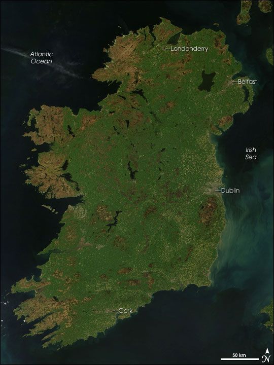
It's called the 'Emerald Isle' for good reason: Ireland's landscape, as seen in a NASA satellite image, is covered in lush green grasses and of course, shamrocks.
Ireland's greeness wouldn't be expected given its location: It sits between 51.5 and 55.5 degrees north latitude, the same latitude range as the much chillier and snowier Newfoundland and Labrador in Canada. But Ireland benefits from the influence of the ocean current known as the North Atlantic Drift, which extends the warm waters of the Gulf Stream northward and gives Eire its mild climate . The island's average temperature in January is a relatively balmy 45 degrees Fahrenheit (7 degrees Celsius). Summers are also mild.
Ireland sees precipitation that ranges from about 31 inches (78.5 centimeters) around Dublin to 118 inches (300 cm) along the west coast. All that rain and the mild temperatures are, naturally, good for vegetation.
The island's greeness is evident in this photo taken by the Moderate Resolution Imaging Spectroradiometer (MODIS) on NASA's Terra satellite on May 2, 2007.
While vegetation is abundant, little of it is forests. Clearing in the 17th century removed most of the country's forests, and despite replanting efforts, Ireland is Europe's least forested country, after Iceland. The island's mild temperatures and humidity have instead blanketed the landscape in abundant grasses.
The brown seen along parts of the west coast are ancient, crystalline rocks deposited well over a billion years ago, according to a NASA statement. Dublin appears as a patch of gray and signs of human habitation are also clear around Londonderry, Belfast and Cork.
Sign up for the Live Science daily newsletter now
Get the world’s most fascinating discoveries delivered straight to your inbox.
Most Popular

