Image Album: Inside the Ice Core Laboratory
Lake E
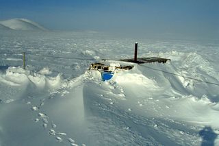
Intense warm climate intervals warmer than scientists thought possible have occurred in the Arctic over the past 2.8 million years. That result comes from the first analyses of the longest sediment cores ever retrieved on land.
They were obtained from beneath remote, ice-covered Lake El'gygytgyn (pronounced El'gee-git-gin) ("Lake E") in the northeastern Russian Arctic. The lake is of interest to scientists because it has never been covered by glaciers.
That has allowed the uninterrupted build-up of sediment at the bottom of the lake, recording hitherto undiscovered information on climate change. Cores from Lake E go far back in time, almost 30 times farther than Greenland ice cores covering the past 110,000 years. The sediment cores from Lake El'gygytgyn reflect the climate and environmental history of the Arctic with great sensitivity.
Autonomous robot
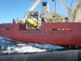
A team of British and American scientists has successfully deployed an autonomous robot submarine on six missions beneath an Antarctic ice shelf using sonar scanners to map the seabed and the underside of the ice as it juts out over the sea. The research is part of a larger, NSF-funded project to study the dynamic Pine Island Glacier and to understand how increasing ocean temperatures triggered by a warming climate may affect the melting of the West Antarctic Ice Sheet (WAIS) and global sea-level rise.
Scientists hope to learn why the glacier has been thinning and accelerating over recent decades. Pine Island Glacier is in the Amundsen Sea, part of the Southern Ocean bordering West Antarctica.
Changes in its flow have been observed since the early 1970s, and, together with neighboring glaciers, it is currently contributing about 0.25 millimeters (less than one-tenth of an inch) annually to global sea-level rise. But the ice shelf, like other ice shelves, serves to hold back movement of the West Antarctic Ice Sheet.
Andrill cores
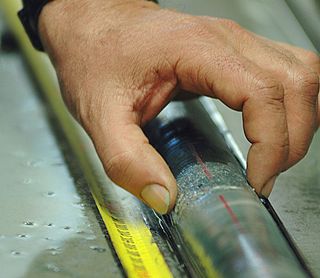
A five-nation scientific team has published new evidence that even a slight rise in atmospheric concentrations of carbon dioxide, one of the gases that drives global warming, affects the stability of the West Antarctic Ice Sheet (WAIS).
The massive WAIS covers the continent on the Pacific side of the Transantarctic Mountains. Any substantial melting of the ice sheet would cause a rise in global sea levels. The research is based on investigations by a 56-member team of scientists conducted on a 1,280-meter (4,100-foot)-long sedimentary rock core taken from beneath the sea floor under Antarctica's Ross Ice Shelf during the first project of the ANDRILL (ANtarctic geological DRILLing) research program the McMurdo Ice Shelf (MIS) Project. The cores retrieved by ANDRILL researchers have allowed them to peer back in time to the Pliocene era, roughly 2 million to 5 million years ago.
During that era, the Antarctic was in a natural climate state that was warmer than today and atmospheric carbon dioxide levels were higher. Data from the cores indicate the WAIS advanced and retreated numerous times in response to forcing driven by climate cycles.
Ice Core
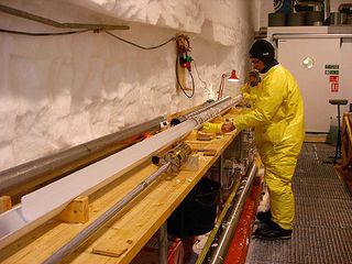
An international research effort on the Greenland ice sheet set a record for single-season deep ice-core drilling in the summer of 2009, recovering more than a mile of ice core that is expected to help scientists better assess the risks of abrupt climate change in the future.
The project, known as the North Greenland Eemian Ice Drilling, or NEEM, was undertaken by 14 nations. The goal was to retrieve ice from the last interglacial episode known as the Eemian Period that ended about 120,000 years ago.
Researchers say the Eemian period is the best analog they have for future warming on Earth.
Compacted snow
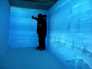
A research team investigating the last 100,000 years of Earth's climate history reached an important milestone in January 2011 when they completed the main ice core to a depth of 3,331 meters (10,928 feet) at West Antarctic Ice Sheet (WAIS) Divide.
As part of the project, the team has been drilling deep into the ice at the WAIS Divide site and recovering and analyzing ice cores for clues about how changes in the concentration of greenhouse gases in the atmosphere have influenced the Earth's climate over time.
The milestone was reached at a depth of 3,331 meters about two miles deep creating the deepest ice core ever drilled by the U.S. and the second deepest ice core ever drilled by any group, second only to the ice core drilled at Russia's Vostok Station as part of a joint French/U.S./Russian collaboration in the 1990s. The ice cores are 13-centimeter (5-inch) diameter cylinders of ice collected from deep in the ice sheet.
Over time, the ice has formed when snow was compacted at the surface by subsequent snowfall. The compacted snow contains dust, chemicals and atmospheric gases, which are trapped in the ice.
Longest ice core
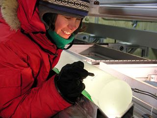
The U.S. Antarctic Program (USAP) has drilled and recovered its longest ice core to date from the polar regions, officially hitting 3,331 meters.
It took five years working from a lonely field camp in one of the stormiest regions of the West Antarctic Ice Sheet (WAIS) to extract the ice, which contains clues about Earth's past climate from the last 100,000 years. The core drilled at a location dubbed WAIS Divide, a high point on the ice sheet where the ice begins to flow in different directions, akin to the Continental Divide in the United States is the second-longest ice core ever recovered anywhere.
The Russians have the record for the deepest ice core, which they drilled in the 1990s at Vostok Station in East Antarctica, to a depth of 3,701 meters.
Sign up for the Live Science daily newsletter now
Get the world’s most fascinating discoveries delivered straight to your inbox.

