Incredible Technology: How Today's Archaeologists Kick Indiana Jones' Butt

Editor's Note: In this weekly series, LiveScience explores how technology drives scientific exploration and discovery.
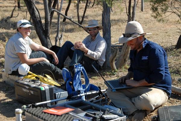
The notion of an archaeologist may bring to mind a khakis-wearing Indiana Jones on hands and knees excavating artifacts with a tiny brush. But nowadays, archaeologists have a lot more sophisticated tools at their fingertips and no less adventure.
From X-ray guns that can identify an artifact's chemical makeup to ground-penetrating radar that can detect buried pyramids, the technologies used to study ancient human civilizations are anything but ancient.
"Like all technology, we get this faster, smaller, better trend," said archaeologist Ellery Frahm of the University of Sheffield, in England. Portability is also critical, Frahm added.
Traditionally, archaeologists have been limited by the number of artifacts they can transport from the field or from a museum to a lab where they can be analyzed. And mapping large areas around or underneath a field site was not feasible. But now, techniques adapted from chemistry, the oil industry and other fields have injected new blood into the study of the past.
Ray guns, not bullwhips
Indiana Jones may be the best-known fictional archaeologist, but his bullwhip pales in comparison with some of the field's actual tools. [10 Modern Tools for Indiana Jones]
Sign up for the Live Science daily newsletter now
Get the world’s most fascinating discoveries delivered straight to your inbox.
"I go out and do archaeology with a ray gun," Frahm told LiveScience, adding, "It doesn't get more sci-fi than that."
Frahm and his colleagues have developed a portable version of X-ray fluorescence (XRF), a common technique for determining the chemical makeup of an artifact. Using a kind of "ray gun," scientists fire X-rays at a sample, boosting the energy of electrons inside the sample, where they emit new X-rays that correspond to specific elements, such as zinc or copper. Art museums use similar techniques to study paintings.
By measuring the wavelength and intensity of the emitted radiation, scientists can figure out what elements are present and their abundance in an artifact. Currently, Frahm and his colleagues are using portable XRF to find the source of stone tools made of obsidian, a volcanic glass formed from fast-cooling lava.
Look before you dig
Archaeologists use some of the most cutting-edge techniques before they even get out their shovels. Remote-sensing methods have allowed scientists to find hidden sites and objects, from Egyptian pyramids to the burial site of Richard III.
"Archaeologists are some of the few scientists who destroy their own data," saidDavid Hurst Thomas, an anthropologist at the American Museum of Natural History in New York. Remote-sensing archaeology is like arthroscopic surgery, Thomas said — scientists don't have to make as big "cuts" anymore.
Thomas has been using remote-sensing methods for nearly 40 years on St. Catherine's Island, off the coast of Georgia. Aided by these tools, he and his colleagues discovered the lost site of the Franciscan mission Santa Catalina de Guale, dating from 1566 to 1680. [History's Most Overlooked Mysteries]
Thomas' team measures soil resistivity, which involves passing an electrical current through the soil and measuring the resistance. The changes correspond to water content, because currents pass faster through water. "It gives you remarkable patterns of what's down there," Thomas told LiveScience.
The team also uses magnetometry — measuring changes in the Earth's magnetic field due to buried buildings and artifacts or natural fluctuations. Subtracting the natural variability from the rest of the magnetic field reveals a map of the archaeological features. Magnetometry is good for finding structural remains, and in fact, that's how Thomas discovered the Franciscan mission.
Then there's ground-penetrating radar, a nondestructive technique in which scientists bounce high-frequency radio waves off the ground and measure the reflected signals, which reveal objects or structures buried in the ground. In the last couple of decades, the radar instruments and associated computing power have vastly improved, Thomas said.

Soil resistivity works well for distinguishing the insides and outsides of buildings, but is less effective in heavily forested areas because tree roots mess up the readings. Magnetometers work well for detecting features made of iron, steel, brick and many rock types, but a site with stray metal embedded in the soil can interfere with readings. And ground-penetrating radar is great for locating artifacts and features at great depths, but requires uniform, sandy environments.
Archaeology works best when multiple techniques are combined, Thomas said. "Where they coincide, that’s where you want to go digging," Thomas said.
Many of these remote-sensing methods can also be done from aircraft, satellites or even kites.
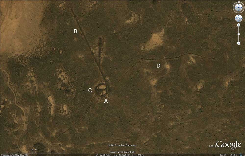
For example, lidar— a term combining light and radar — provides an overview of larger features of an archaeological site that are hard to see from the ground. Lidar systems shine a laser at the ground and detect the reflected light. Google Earth is another useful resource; scientists reported in 2011 they had discovered thousands of tombs in the Saudi desert with Google Earth.
None of these techniques are a substitute for excavation, but they help archaeologists conduct more targeted digs. "We still need to dig, but we can dig much less and know much more," said archaeologist John Steinberg of the University of Massachusetts Boston. Digging less is cheaper and more efficient, but scientists can learn just as much, Steinberg said.
Follow Tanya Lewis on Twitter and Google+. Follow us @livescience, Facebook & Google+. Original article on LiveScience.


