Watch Seismic Waves of 1964 Great Alaska Earthquake Roll Through State (Video)
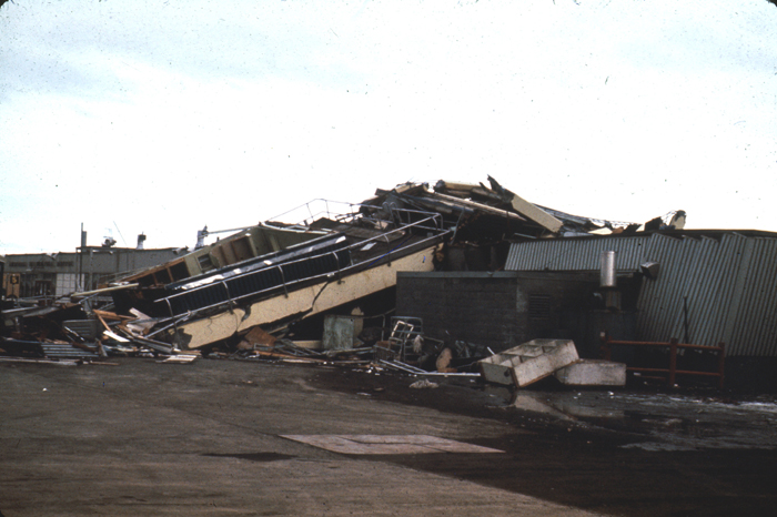
ANCHORAGE, Alaska — For the first time, a new computer model details the path of destruction wrought by the enormous 1964 Alaska earthquake, and could help researchers better predict future quake damage in the state.
The 3D model of the earthquake simulates the powerful seismic waves that rolled through southern Alaska during the massive temblor, and was presented here Wednesday (April 30) at the annual meeting of the Seismological Society of America. Although scientists had thoroughly documented the shocking devastation from the Great Alaska earthquake, the actual spread of the seismic waves throughout the region wasn't well understood. There was only one earthquake monitor (called a seismometer) in Alaska 50 years ago.
"In my mind, this is a picture of the 1964 Alaska earthquake," said study presenter Carl Tape, a geophysicist at the University of Alaska, Fairbanks.
Tape constructed a supercomputer model of the massive Alaska-Aleutian megathrust — the fault that unleashed the 1964 earthquake — as well as the complicated geology closer to the surface. Tape then showed how the seismic energy from the five-minute-long earthquake traveled through different regions, based on 1964 records from distant seismometers as well as data from more recent earthquakes. The results show the great earthquake waves sped through the region in a complex pattern.
For example, the Cook Inlet basin, which is west of Anchorage and filled 5 miles (8 kilometers) high with sediment, jiggled more violently than the rock in the surrounding mountains. Sedimentary basins often shake differently than rock, because earthquake waves move more slowly in their softer sediments. The amount of shaking also increases as the layers of sand, mud and other sediments thicken.
Constructing the new 3D model of southern Alaska is the first step in predicting the damage from future earthquakes, Tape said. Gauging the impact of simulated earthquakes can help predict which area will suffer the most severe shaking, he said.
"This is a useful and exciting starting point," Tape told Live Science's Our Amazing Planet.
Sign up for the Live Science daily newsletter now
Get the world’s most fascinating discoveries delivered straight to your inbox.
A separate study presented yesterday (May 1) also confirmed that the 50-year-old quake was one of the world's most powerful earthquakes. [See Photos of the Great Alaska Earthquake]
"Alaska is still the second-largest earthquake ever recorded," said lead study author Meredith Nettles, a seismologist at the Lamont-Doherty Earth Observatory in New York.
Nettles re-analyzed the Alaska earthquake's seismic records, digitized for easier computer scrutiny, and found that earlier estimates of the size still hold up. In fact, she gave it a boost. The mathematical models that today's seismologists use to represent movement on faults produce a size estimate of magnitude-9.4 for the 1964 Alaska Earthquake and magnitude-9.3 for 2004 Sumatra earthquake, Nettles said.
Email Becky Oskin or follow her @beckyoskin. Follow us @OAPlanet, Facebook and Google+. Original article at Live Science's Our Amazing Planet.

