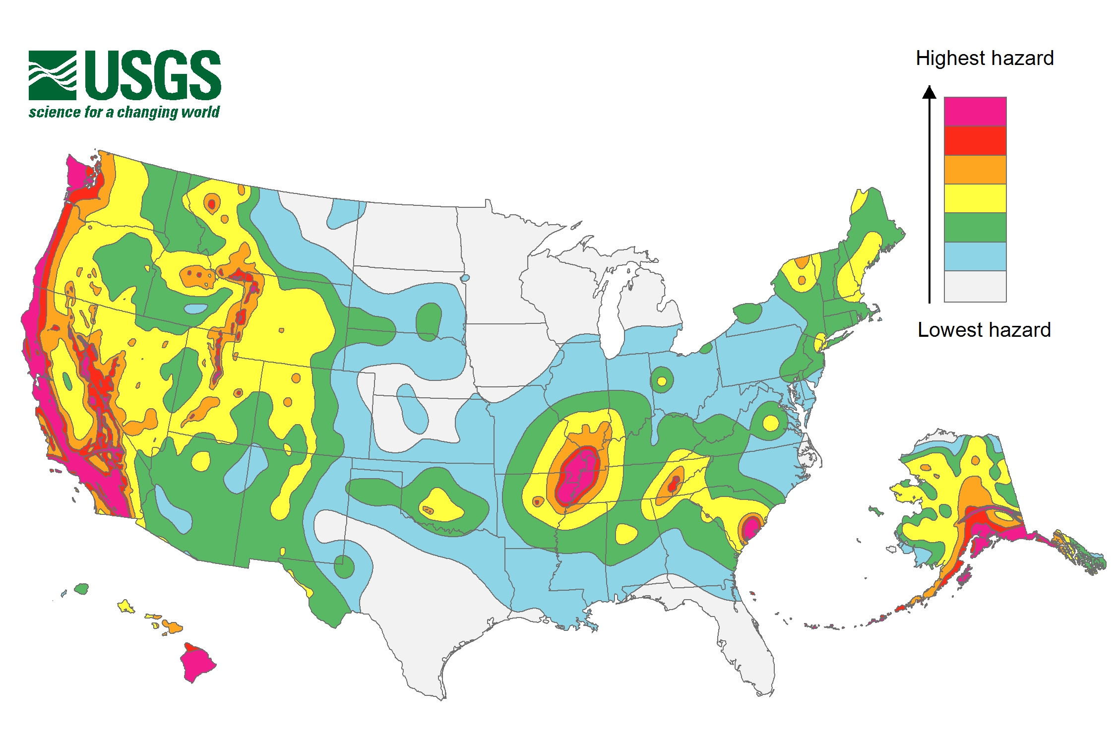
Half the US Faces Earthquake Risk

PASADENA, Calif. — Earthquakes threaten roughly half the U.S. population, a new study finds.
More than 143 million Americans live in earthquake-prone regions in the Lower 48 states, according to research presented here Wednesday (April 22) at the annual meeting of the Seismological Society of America. If you include Alaska, Hawaii and Puerto Rico, that number rises to about 150 million U.S. citizens, said lead researcher Kishor Jaiswal, a U.S. Geological Survey (USGS) contractor.
In a previous estimate prepared in 1991, officials with the Federal Emergency Management Agency (FEMA) said 75 million people in 35 states were at risk of earthquakes.
Now, more people are living in quake-prone areas than a quarter-century ago, Jaiswal said. The USGS has also learned more about earthquake hazards. The nation's most recent national seismic hazard maps are much more detailed than the 1996 version, Jaiswal said. [Image Gallery: This Millennium's Destructive Earthquakes]
As many as 28 million people in the 48 contiguous states could feel strong shaking in their lifetimes, he added. The Modified Mercalli Intensity Scale defines "strong shaking" as being frightening to many people, with some heavy furniture moved across the floor and a few instances of fallen plaster.
Jaiswal and colleagues from the USGS, FEMA and the California Geological Survey analyzed the nation's earthquake risks by combining the 2014 National Seismic Hazard Maps with LandScan, a global population database. The 2014 map only covers the 48 contiguous states; Alaska, Hawaii and Puerto Rico will be updated in coming years.
The research team also calculated the potential financial losses from earthquakes, using 2010 Census data and the 2012 replacement-cost values for buildings. The average economic hit from building damage in the contiguous states was $4.5 billion, with 80 percent of the losses concentrated in California, Oregon and Washington. However, the study researchers also found areas susceptible to building losses on the East Coast.
Sign up for the Live Science daily newsletter now
Get the world’s most fascinating discoveries delivered straight to your inbox.
"The bottom line is that there are a significant number of structures located amongst higher-hazard levels," Jaiswal said.
The study revealed more than 6,000 fire stations, more than 800 hospitals, and nearly 20,000 public and private schools that are built on shaky ground.
The study does not account for the spate of induced earthquakes, which are man-made quakes linked to wastewater injection wells and hydraulic fracturing, Jaiswal said. "There are 140 million people exposed to earth-shaking hazards, but that number could be even higher if you include induced seismicity," he said.
The U.S. Geological Survey has since issued new hazard maps that focus on man-made earthquakes and that will help people evaluate their risk of shaking from these quakes.
Follow Becky Oskin @beckyoskin. Follow Live Science @livescience, Facebook & Google+. Originally published on Live Science.


