Hurricane Matthew Photos: See How the Monster Storm Evolved
A storm is born
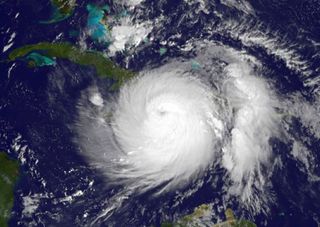
Hurricane Matthew became the fifth hurricane of the 2016 Atlantic hurricane season on Sept. 29. The storm first made landfall in southwestern Haiti as, with a Category 4 hurricane, with wind speeds of 145 mph (233 km/h).
This is a visible-light image of Hurricane Matthew taken at 7:45 a.m. EDT on Oct. 4, 2016. The storm made landfall on Haiti at about 7:00 a.m. EDT.
Temperature check
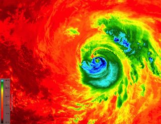
The Copernicus Sentinel-3A satellite captured this image of Hurricane Matthew at 11:13 p.m. ET on Oct. 6 (03:15 GMT on Oct. 7) as it approached Florida. The thermal infrared image shows the temperature at the top of the hurricane.
Waves of destruction
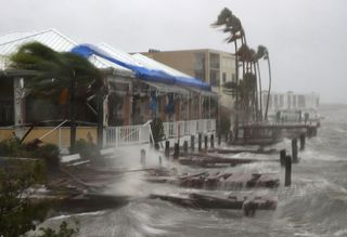
Heavy waves caused by Hurricane Matthew battered boat docks in Cocoa Beach, Florida, on Oct. 7, 2016.
Flooding in St. Augustine
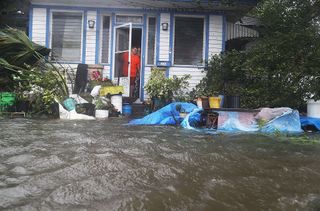
People in a neighborhood in St. Augustine, Florida, look out at the flooded street in front of their home as Hurricane Matthew passes through on Oct. 7, 2016.
Double eyewall
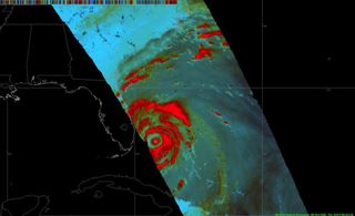
A double eyewall structure captured of Hurricane #Matthew at 3 p.m. EDT (1900 GMT) on Oct. 6, 2016 by the Global Precipitation Measurement mission core satellite.
Car trouble

In St. Augustine, Florida, a man checks on his car after it floated out of his driveway on Oct. 7, 2016.
Cocoa Beach
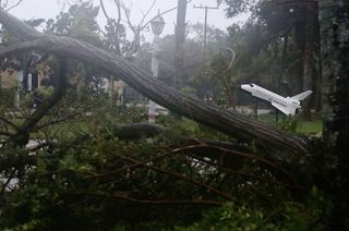
Hurricane Matthew passed through Cocoa Beach, Florida, as a Category 3 hurricane. Here, on Oct. 7, 2016, a space shuttle model sits near trees downed by the hurricane, which brought high winds and some flooding to the area.
Sign up for the Live Science daily newsletter now
Get the world’s most fascinating discoveries delivered straight to your inbox.
Crash ashore
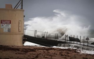
Waves crash on the shore in Singer Island, Florida, as Hurricane Matthew approaches the area on Oct. 6, 2016.
Infrared view
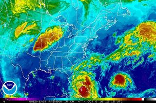
An infrared map of Hurricane Matthew as it nears Florida. Tropical Storm Nicole, located farther east in the Atlantic Ocean, is seen to the right.
Western Haitian cities
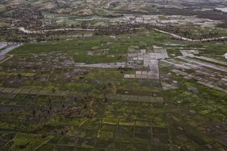
Haiti's capital Port au Prince was mostly spared from the full strength of Matthew, which was a Category 4 storm when it passed through the Caribbean nation on Oct. 4, 2016. However, the western cities of Les Cayes and Jeremie took the brunt of the storm.
Over the Bahamas
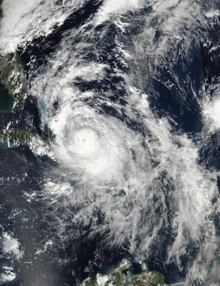
The NASA-NOAA Suomi NPP satellite monitored Hurricane Matthew as it moved through the Bahamas on Oct. 5 at 2:30 p.m. EDT (1830 GMT).
When this image was captured, Hurricane Matthew was a Category 3 storm, with sustained winds of about 115 mph (185 km/h).
