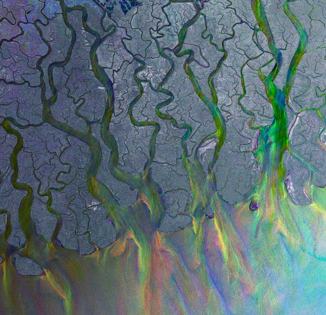
Ganges Delta: Gorgeous, Wild and Deadly

Satellites have captured a snapshot of the Ganges delta, the world’s largest river delta and one of the most geographically turbulent spots in the world.
The interweaving network of streams that make up the Ganges Delta in South Asia is formed by the joining of three rivers – the Padma, Jamuna, and Meghna rivers. More than 100 million people (mostly Bangladeshi) call the delta home, relying mostly on rice, tea and other crops for subsistence. The region is also inhabited by around 1,000 endangered Bengal tigers.
Since the turn of the century, the delta has become ground zero for a host of devastating natural disasters. In 1970, the region was ravaged by the Bhola cyclone — one of the deadliest on record, with a death toll estimated at between 500,000 and 1 million people. In 1991, the Bangladesh cyclone killed an estimated 138,000 people. Just seven years later, the Ganges flooded the delta, leaving more than 30 million people homeless and wiping out rice crops and threatening the entire nation’s food supply.
The Ganges delta is also particularly vulnerable to climate change, since further melting of glaciers and snow from the Himilayan mountains can lead to more severe floods.
- The 10 Worst U.S Natural Disasters
- Video: Goldilocks and the Greenhouse
- Image Gallery: Earth As Art
Get the world’s most fascinating discoveries delivered straight to your inbox.


