Rumbles in 2004: Mount St. Helens Wakes Up
The Calm Before The Storm
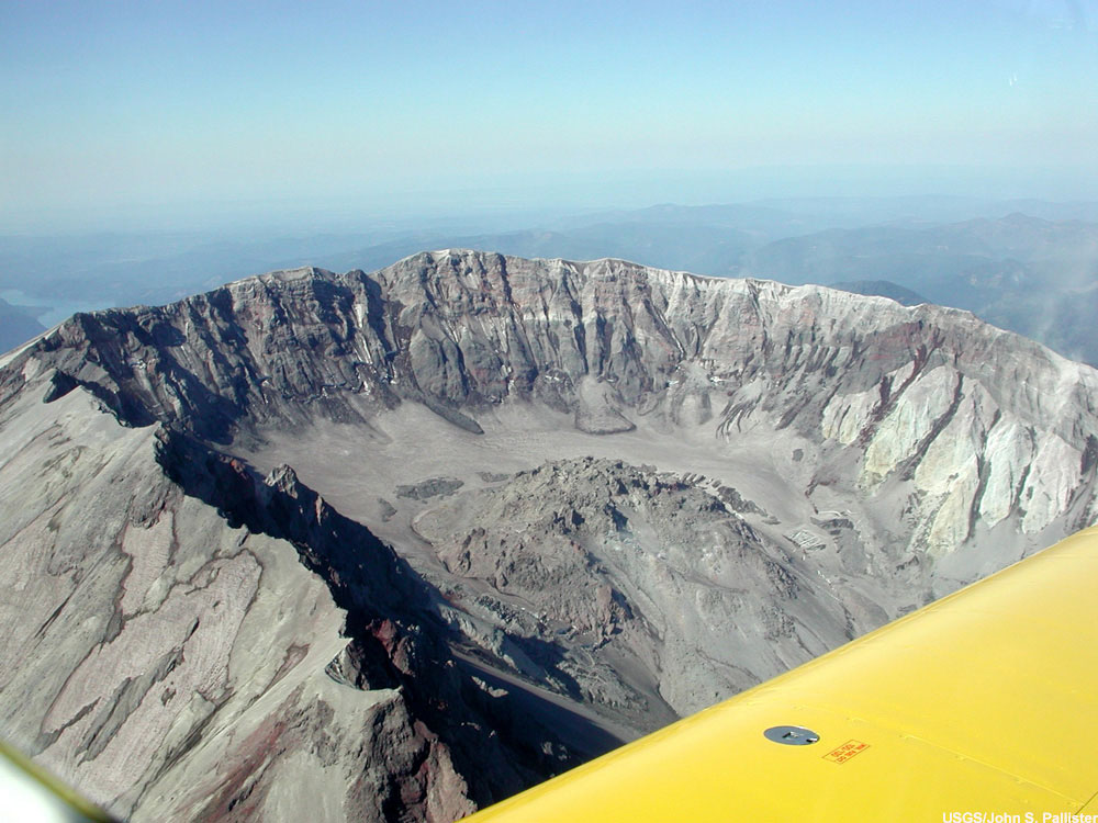
This Image Gallery highlights some of the notable activity, which has occurred at Mount St. Helens this year, since it has “roared back to life”. This picture was taken in the summer, on June 23, 2004, before there was any significant activity in the lava dome on Mount St. Helens. This is an oblique aerial photograph of north flank, crater, lava dome and new glacier (behind dome), Mount St. Helens, Washington state, USA.
Early Warning Sign
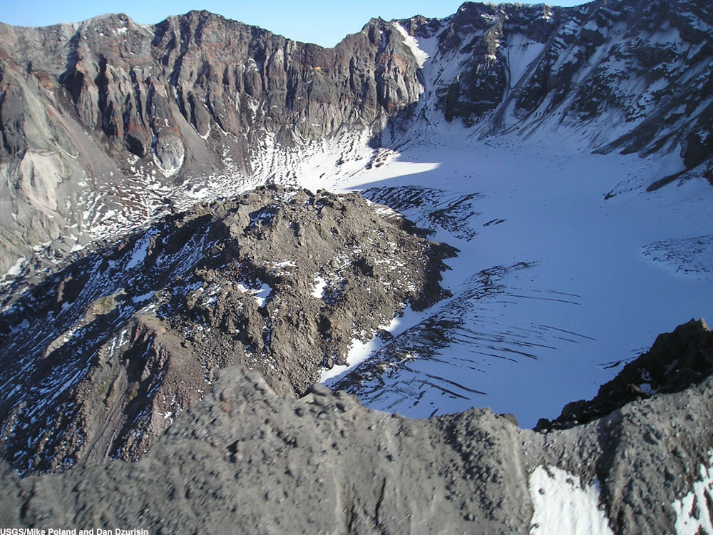
A swarm of small, shallow earthquakes (smaller than magnitude 1) began on morning of September 23, peaked in midday on September 24, then declined through the afternoon of September 25. There was a significant amount of seismic activity during this week. The image above, taken as deformation of the crater floor was recognized on September 29, shows the western side of Mount St. Helens crater and dome. Notice the glacier forming at the base of the dome. The area of deformation encompassed 20,000-40,000 square meters (5-10 acres). Amount of uplift totaled several meters. New fissures had cut across ice and talus lying upon glacial ice.
Mount St. Helens Awakens
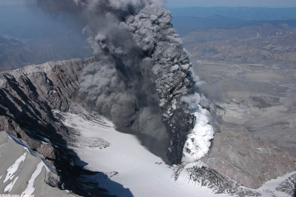
The picture above, taken on October 1, shows the Crater/Plume on Mount St. Helens. On October 1, the first emission of steam and ash occurred. Beginning at 11:57 a.m. and lasting about 25 minutes, a small steam eruption, with minor ash, issued from a vent just south of the 1980-86 lava dome, the culmination of a week of increasingly energetic seismicity. This vent lay within that part of the crater-floor glacier that had become increasingly crevassed and uplifted over the past few days. The plume rose to 3,700 m altitude (12,000 ft), dropped to 3,000 m (10,000 ft), and drifted southwest with minor ashfall close to the volcano. Seismic activity dropped to a low level for several hours after the eruption, then gradually increased.
View from Above
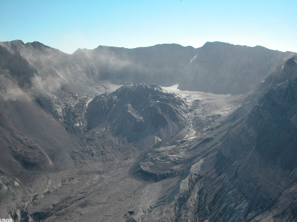
The picture above, taken on October 4, is an aerial view of Mount St. Helens crater and dome, with the glacier on the right. On October 4, large-scale uplift, on the order of tens of meters, was verified on the basis of visual observations and photogrammetric analysis from the previous day. Deformation affected part of the crater-floor glacier and adjacent area of the 1980-86 dome. Also, at approximately 9:43 a.m., a small steam and ash eruption occurred, lasting 40 minutes. Associated seismic activity was trifling. The steam plume reached to about 3,700 m (12,000 ft) altitude, and its ashy fallout dusted roads southeast of the volcano. Ash thickness at 8 km (5 mi) from the volcano was 0.2 cm (less than one-eighth inch).
Strong Activity in the Crater
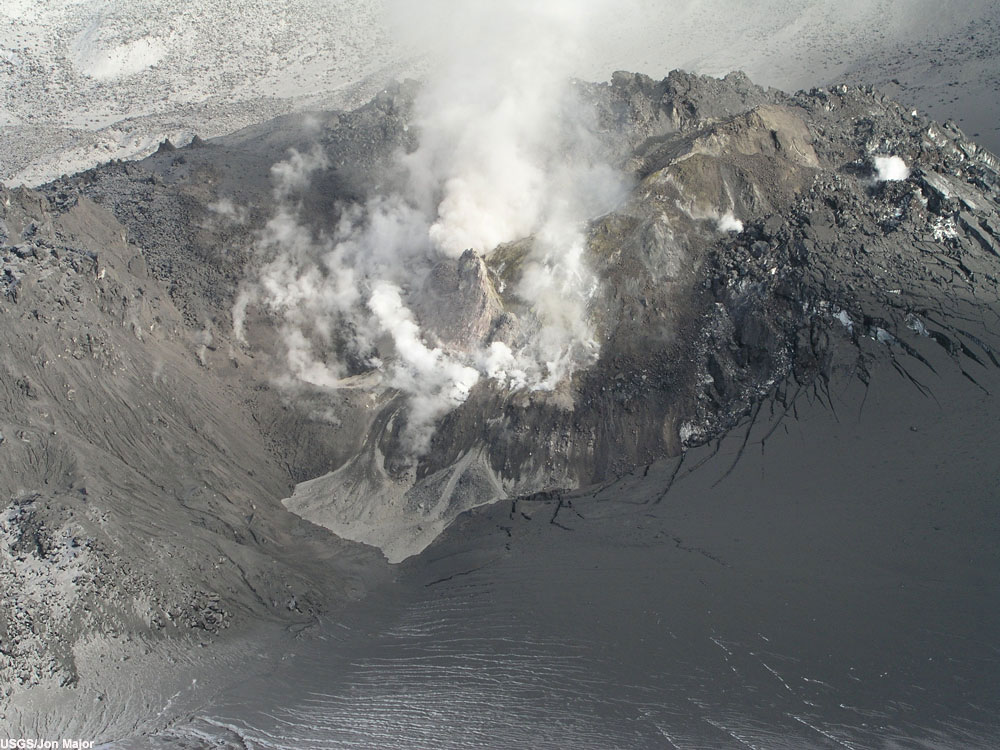
The image, taken on October 11, shows the Mount St. Helens dome and uplift from the west. On October 11, new dome breached the surface, recognized when freshly extruded rock formed a "fin" abreast the uplifted crater floor. It marked the first appearance of extruded magmatic material in the crater. Seismic activity continued at low level (1 event per 5-10 min; M1 or smaller). Also, steam plume from deforming area continued to rise to just above crater.
New Growth
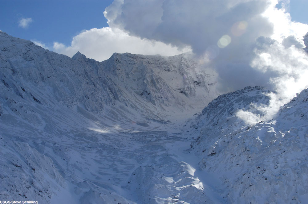
The image, taken on October 21, shows the Mount St. Helens crater floor, developing glacier (lower left), dome, and uplift with new growth, as seen from the northeast. On October 21, geological and thermal-imaging observations confirmed that both the area of uplift and the new lava extrusion had increased in size noticeably since last seen on October 14. About 1 foot of new snow with a light dusting of ash covered much of the uplift, except for the new lava extrusion, which steamed heavily. A gas-sensing flight detected low levels of the volcanic gases carbon dioxide, sulfur dioxide, and hydrogen sulfide, which is consistent with magma continuing to rise from depth.
Mount St. Helens Exposed
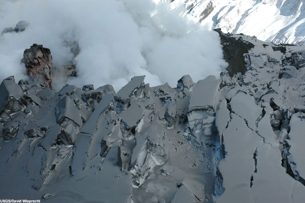
The image, taken on October 27, shows the top of Mount St. Helens new growth, vent area, and broken glacier ice, as seen from the west. On this date, a new GPS station on the southern part of the new dome showed motion downward and to the southeast; a station near the summit of the old dome had moved northward about 7 cm (3 in.) since October 20. Thermal imaging showed an elongate band of elevated surface temperature, locally as great as 775 degrees Celsius (1,420 deg F), along the west face of the new dome coincident with the area of exposed newly extruded lava. Samples of dome rock similar in appearance to the rock of the older dome were collected from two localities in the vicinity of the exposed new lava.
Sign up for the Live Science daily newsletter now
Get the world’s most fascinating discoveries delivered straight to your inbox.
Meeting with the Sun
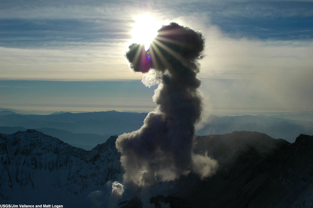
The image, taken on November 4, shows Mount St. Helens' plume, looking into the sun. On this date, the elongate new dome, which extends southward from the 1980-1986 dome, had undergone substantial vertical growth since October 27, extruding upward by as much as 100 m (330 ft). Exposed rock faces had temperatures in the range 400-500 degrees Celsius (750-930 deg F), creating the incandescence that could be seen from the north on clear nights. The steep new faces on the dome generated small hot rock falls and avalanches within the crater. The finer particulate from these deposits, which roiled upward within the steam plume, rose to about 3,360 m (11,000 ft) altitude, or about 800 m (2,640 ft) above the crater rim.
Up close (and personal): Lava Dome
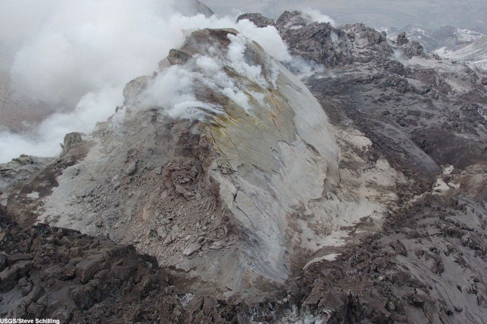
This image, taken on November 10, shows Mount St. Helens' new growth as seen from the south. Good viewing conditions revealed continued growth of the lava dome. Estimated dimensions for the "welt"--the broad area of deformation--were about 600 m (about 1970 feet) in diameter. The new lava dome, in the central and western parts of the welt, was about 400 by 180 m (1310 by 590 ft). The highest point on the new lava dome was about 250 m (820 ft) above the former surface of the glacier that occupied that point in mid-September. Maximum surface temperatures on the new dome remained at about 700 degrees Celsius (1,300 deg F).
Football Field VS The New Dome
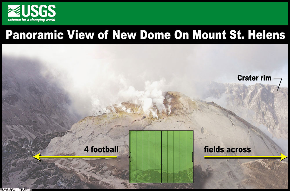
The image, taken on November 18, shows Mount St. Helens' new growth as seen from the east, with a football field for comparison. During the week of November 12 – November 18, there wasn’t any significant activity at Mount St. Helens. Seismicity remained at a low level. Slow extrusion of new dome continued, with broadening of the surrounding uplifted area. GPS measurements continued to indicate no deformation of the volcano's outer flanks. Suitable weather for the scheduling of fieldwork proved elusive.
On a Slope
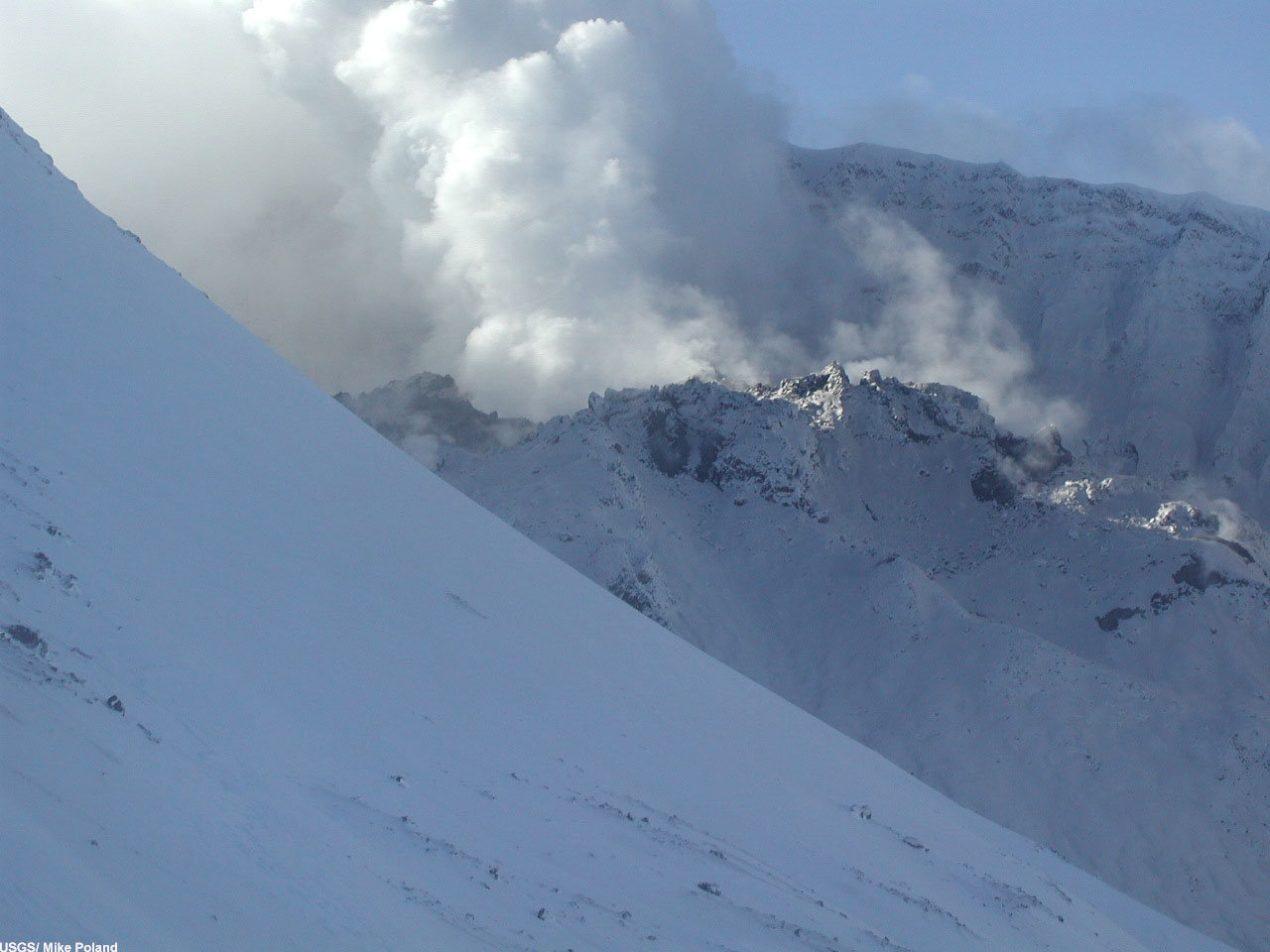
The image above, taken November 20, shows Mount St. Helens dome as seen from Sugar Bowl, on the northeast flank. Here are some notable results from November 20: The welt of deformed crater-floor material and glacial ice was pushed to the south crater wall by the growing lava extrusion. During this week, the "Elevator" GPS receiver, which sat atop the new dome, traveled south-southeast 46 cm per hour and upward about 6 cm hour, as it was carried along the advancing whaleback-like new lava extrusion.


