La Niña Is Over: So What's Next?
After hanging on for several months, the powerful climate system behind this year's historic floods and terrible tornado season is finally gone, according to government climate scientists.
If you've been following the weather, this climate pattern is a household name by now. It's called La Niña (Spanish for the little girl) and it's a cyclical system of trade winds that cools the waters of the equatorial Pacific (El Niño is La Niña's warm-water counterpart.). La Niña can muck with global weather patterns, recurring every few years and lingering for as long as two years. [Weirdo Weather: 7 Rare Weather Events]
The recent La Niña is one of the strongest since climatologists began recording the phenomenon 50 years ago. But now that it’s gone, neutral conditions have developed and are expected to continue at least through the 2011 Northern Hemisphere summer, according to a forecast from the Climate Prediction Center in Camp Spring, Md.
So what's next for the weather?
"More of the same," said climatologist Jake Crouch with the National Climatic Data Center in Asheville, N.C. That's because there is a delay between what's happening in the tropical Pacific and what's happening in the atmosphere, Crouch said.
For people in the United States, much of the damage is already done.
La Niña leftovers
Sign up for the Live Science daily newsletter now
Get the world’s most fascinating discoveries delivered straight to your inbox.
Remember all that snow this past winter? That was La Niña at work. For most people battling the recent heat wave, that snow is a distant memory. But folks along the flooded Missouri River can't shake this past winter's huge snowpack.
"TheLa Niña weather pattern did set up the regime that set up the unusual amounts of snow and rain so far," said Lynn Maximuk, deputy director of the National Weather Service's Central Region in Kansas City, Mo.
All that water has run into the Missouri River, and the U.S. Army Corps of Engineers has been forced to release record amounts of water from the river's reservoirs to cope with the flooding. They could be releasing water well into August, according to Kevin Grode of the corps.
Terrible tornadoes
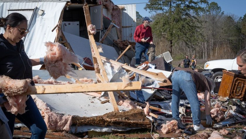
La Niña has been blamed for this year's terrible tornado season as well. But this blame comes more for what it didn't do than what it did.
La Niña began its exit around three months ago, which allowed the jet stream to go rogue, driving winds into the heart of the U.S., where it violently mixed cool and warm air masses, creating the thunderstorms that spawned killer tornadoes.
Had La Niña stayed strong, the jet stream would have been farther north during the first few months of tornado season. There is no official forecast for tornadoes, so how the neutral conditions in the Pacific will affect the remainder of tornado season is "a little more of a gray area," Crouch told OurAmazingPlanet.
Summer and beyond
La Niña is also linked to increased hurricane activity in the Atlantic basin. And while this year's La Niña has mostly wrapped up, its impacts — including reduced wind shear, which can cut off a developing storm — are expected to continue into the hurricane season, Crouch said.
The 2011 Atlantic hurricane season is forecast to be above average, according to the U.S. National Oceanic and Atmospheric Administration (NOAA). It may see 12 to 18 named storms (which include tropical storms and hurricanes) and six to 10 hurricanes, with up to six of those as major hurricanes. Hurricane season runs from June 1 to Nov. 30. The forecast for the equatorial Pacific after the Northern Hemisphere summer and into the end of hurricane seasonis not as reliable, and the Climate Prediction Center will issue another forecast in July.
- A History of Destruction: 8 Great Hurricanes
- Natural Disasters: Top 10 U.S. Threats
- The World's Weirdest Weather
Reach OurAmazingPlanet staff writer Brett Israel at bisrael@techmedianetwork.com. Follow him on Twitter @btisrael.
