In Photos: Hurricane Irene
Hurricane Irene
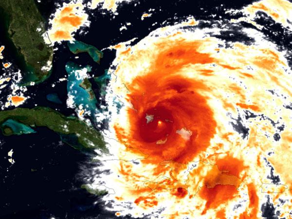
After the hitting Bahamas, Hurricane Irene is making its way toward the U.S. Northeast, forecasters predict. Here are the latest images of the hurricane. Above, Hurricane Irene on Aug. 24.
Irene Snapped from the International Space Station
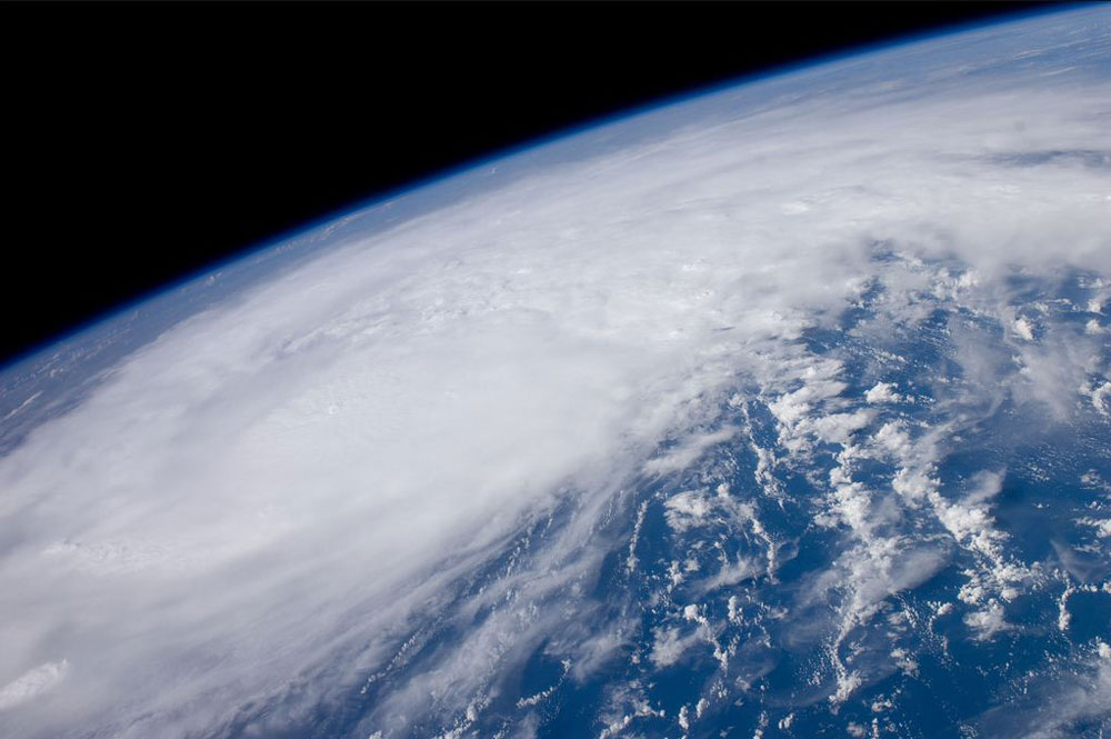
A panoramic view of Hurricane Irene, photographed by the crew of the International Space Station on Aug. 22 from a point over the coastal waters of Venezuela. At the time, the newly-formed hurricane had 80 mph winds and was just north of the Mona Passage between Hispaniola and Puerto Rico, preparing to trek west-northwestward toward the southern Bahamas.
Steadily Strengthening
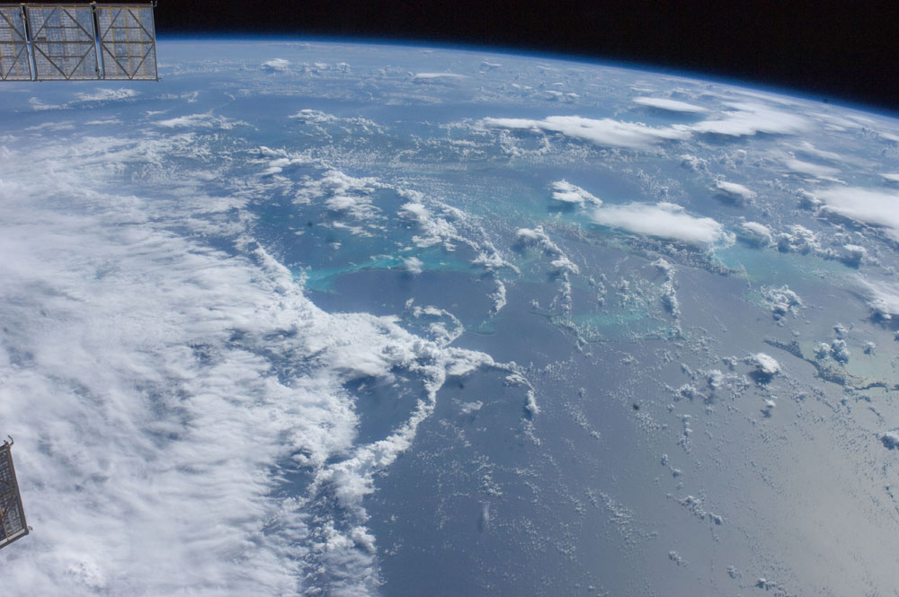
Above is another photo of the growing hurricane taken from the International Space Station on Aug. 23. This view looks toward the southwest at part of Hurricane Irene as it brews near the northern Bahamas, including Great Abaco Island on the photo's lower right and Andros Island under a thunderstorm on the center right. Irene was probably centered over Acklins Island when the photo was snapped, according to meteorologists.
Bahamas Bull's-Eye
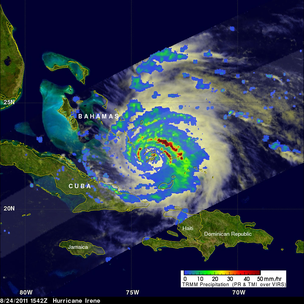
Hurricane Irene hit the southeast Bahamas on Wednesday (Aug. 24), passing directly over Crooked Island. In the above satellite image, the hurricane's eye is somewhat obscured by the island.
The Rainbow Before the Storm

This breathtaking shot, taken the morning of Aug. 24 in Boynton Beach, Fla., shows a rainstorm's looming clouds over a rainbow, with a faint double rainbow overhead. While Hurricane Irene was hitting the Bahamas at the time, the storm was gathering strength, with gusty winds and rain affecting Florida's beaches.
Heavy Rainfall
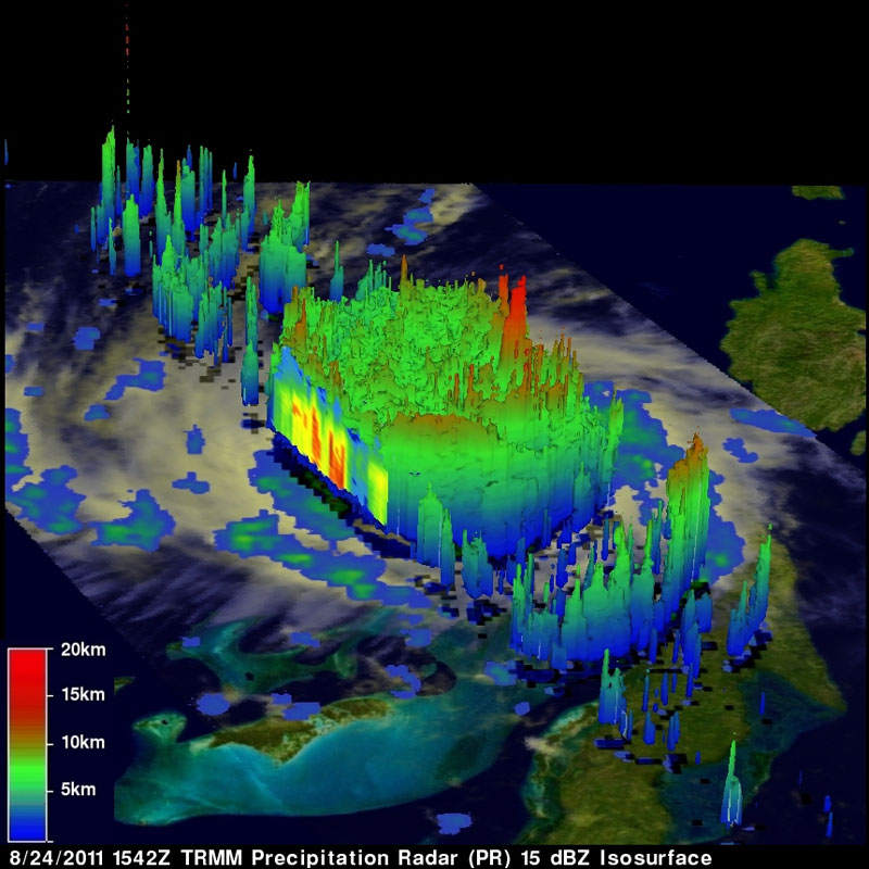
This 3-D view of Hurricane Irene was captured on August 24 by a NASA satellite. The red areas indicate rainfall of about 2 inches or more per hour, while the yellow and green areas show moderate rainfall of between .78 to 1.57 inches per hour.
Looming Storm Clouds
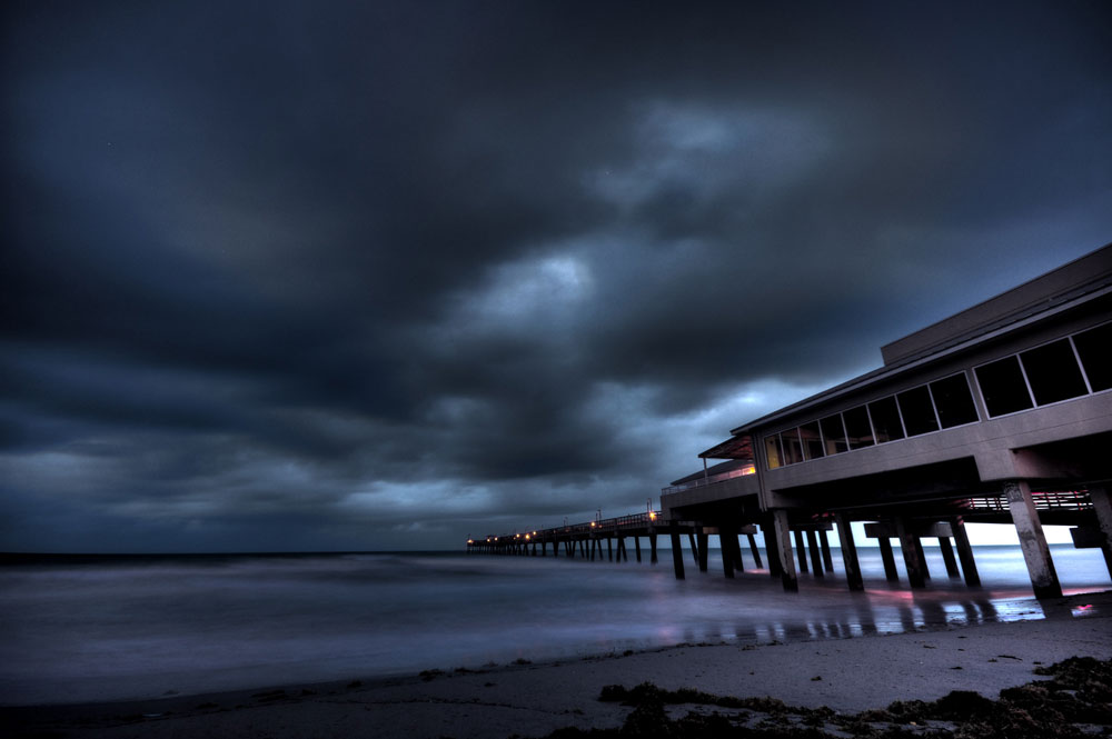
Dania Beach, a city in Broward County, Fla., also saw fearsome thunderstorm clouds approaching on the morning of Aug. 25.
Sign up for the Live Science daily newsletter now
Get the world’s most fascinating discoveries delivered straight to your inbox.
Whipping Winds
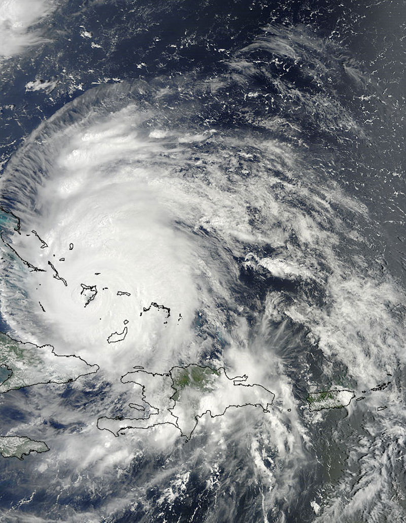
This satellite image shows Hurricane Irene directly over the southern Bahamas on Aug. 24. The category 3 hurricane's winds increased to speeds of 120 mph (195 kmh) as it passed over the area.
Projected Path
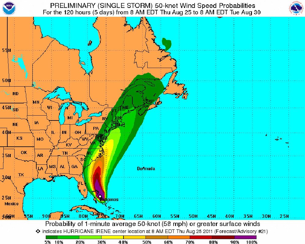
This National Weather Service graphic, based on National Hurricane Center data, predicts Hurricane Irene's path from Aug. 25 to Aug. 30 along the U.S. East Coast. With surface wind speeds equal or exceeding 58 mph (93 kph), state and National Weather Service officials have begun urging New Jersey and North Carolina residents to prepare for Hurricane Irene now. Even New York City Mayor Michael Bloomberg is taking the hurricane's threat seriously, advising New Yorkers to stay alert, as the storm could come near New York City on Aug. 28.
Likely Landfall?
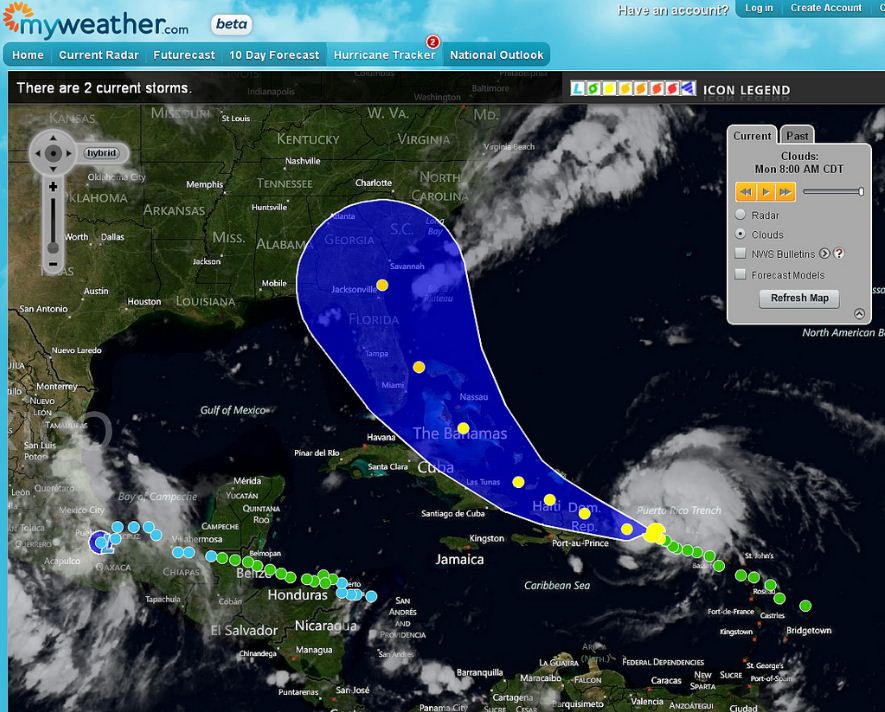
Another graphic depicting the hurricane's projected path. If Irene makes landfall in the U.S., it will become the first hurricane to do so since destructive and costly Hurricane Ike pummeled the Texas coast in 2008.
Harvest Rush
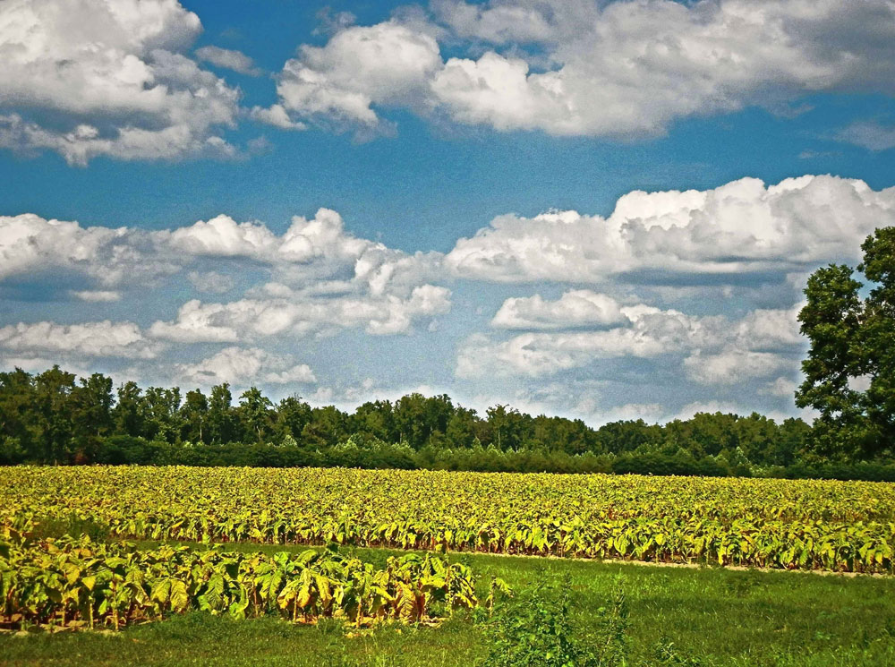
In preparation for Irene's arrival, workers on Faith Baptist Church Road in Edgecombe County, N.C., are harvesting ripe tobacco as quickly as possible in a preventative effort to limit the amount of damage the storm's whipping winds may unleash upon this summer's crop.


