In Photos: Hurricane Irene
Monster Irene and Smaller Tropical Depression
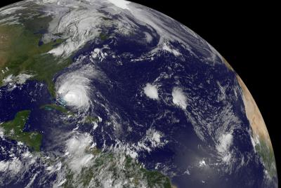
This satellite image captured Hurricane Irene moving through the Bahamas on the morning of Aug. 25. To the east was the newly formed Tropical Depression 10, which is on the far right of the image. Irene is much larger than the tropical depression 10, as the hurricane is estimated to be about 1/3 the size of the entire U.S. East coast.
No Eye?
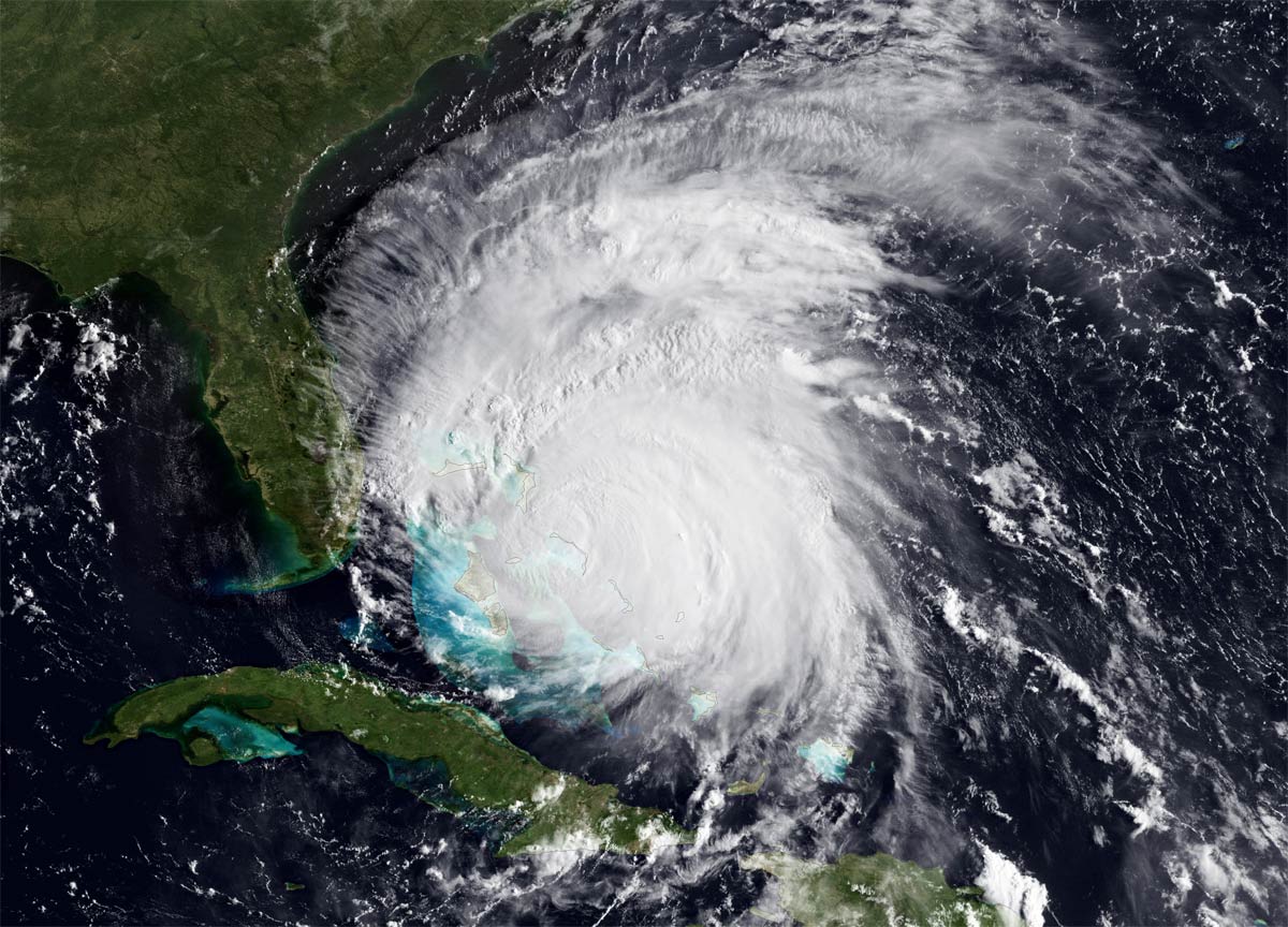
At the time this NASA satellite image was taken on Aug. 25 at 8:15 a.m. ET (1215 UTC), Hurricane Irene was still packing a punch with 115 mph winds. Although the eye has disappeared from this NOAA GOES-East satellite imagery, the storm is not weakening and appears to be going through an eyewall replacement cycle. The National Hurricane Center is still predicting Irene to reach category 4 status within the next day. Hurricane and tropical storm watches are in effect for much of the Carolina coastline.
Irene from Space
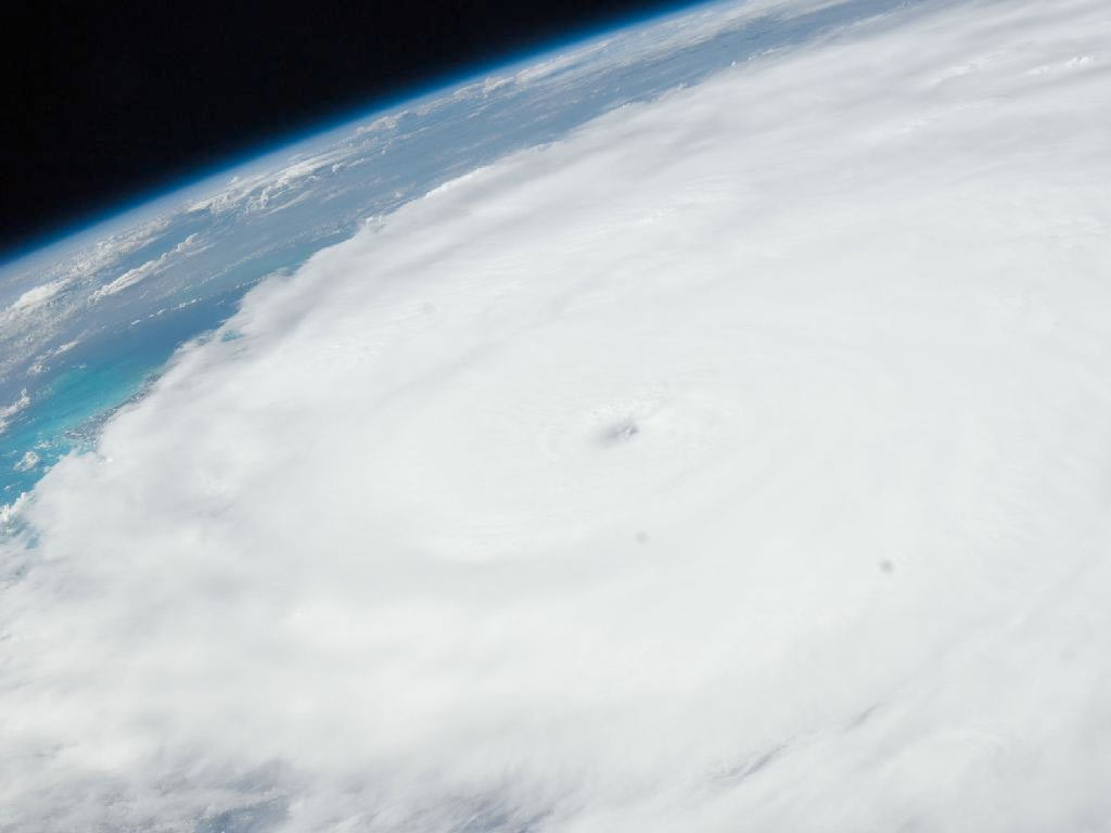
This photo of Hurricane Irene was photographed from onboard the International Space station at 19:14:09 GMT (3:14 p.m. ET) on Aug. 24, 2011. The image, captured with a 38-mm lens, reveals the eye at center frame.
Ominous Clouds

Vilano Beach, Fla., also got a taste of Hurricane Irene's still far-off fury on the morning of Aug. 26.
Irene Close-Up
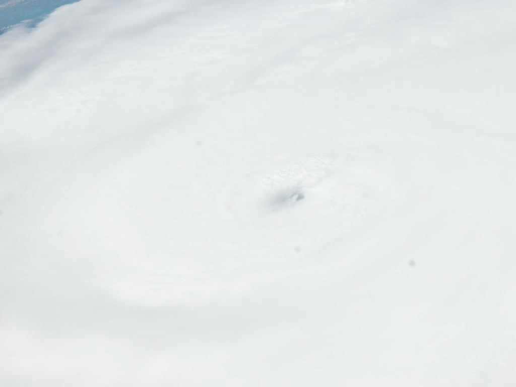
Another photo taken from onboard the space station on Aug. 24 reveals the eye of Hurricane Irene.
Storm Progression
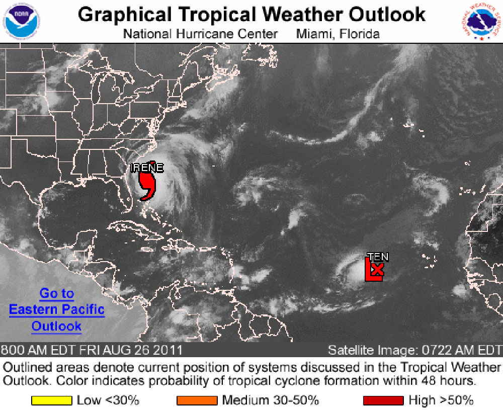
The above NOAA image shows the position of Hurricane Irene and Tropical Storm 10 on the morning of Aug. 26, with Irene about 375 miles south-southwest of Cape Hatteras, N.C., according to the National Hurricane Center.
Threatening Thunderhead

Above is another shot of Dania Beach in Broward County, Fla., as threatening storm clouds raced overhead before the rain began to fall during the early morning hours of Aug. 25.
Sign up for the Live Science daily newsletter now
Get the world’s most fascinating discoveries delivered straight to your inbox.
Getting Closer
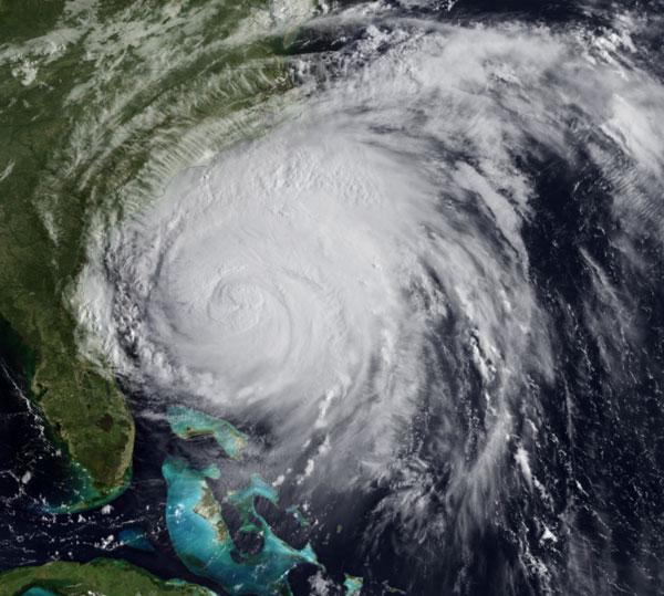
This image was taken by NOAA's GOES-EAST satellite on Aug. 26 as Hurricane Irene moved between the Bahamas toward the U.S. East Coast.
Aquamarine Sky

This amazing photo of approaching storm clouds was taken on Aug. 25, while workers and officials in Washington, D.C., scrambled to prepare for Hurricane Irene to make landfall on Saturday in North Carolina. The area has received a tropical storm warning, leading to train service cancelations and Mayor Vincent Gray urging residents to study emergency evacuation routes from Washington.
Flying By

This photo captured the west edge of Hurrican Irene as it passed by northern Florida. It was taken the morning of Aug. 26, about 20 miles west of Jacksonville, Fla.
