Portable Radar Peers Inside Western Winter Storms
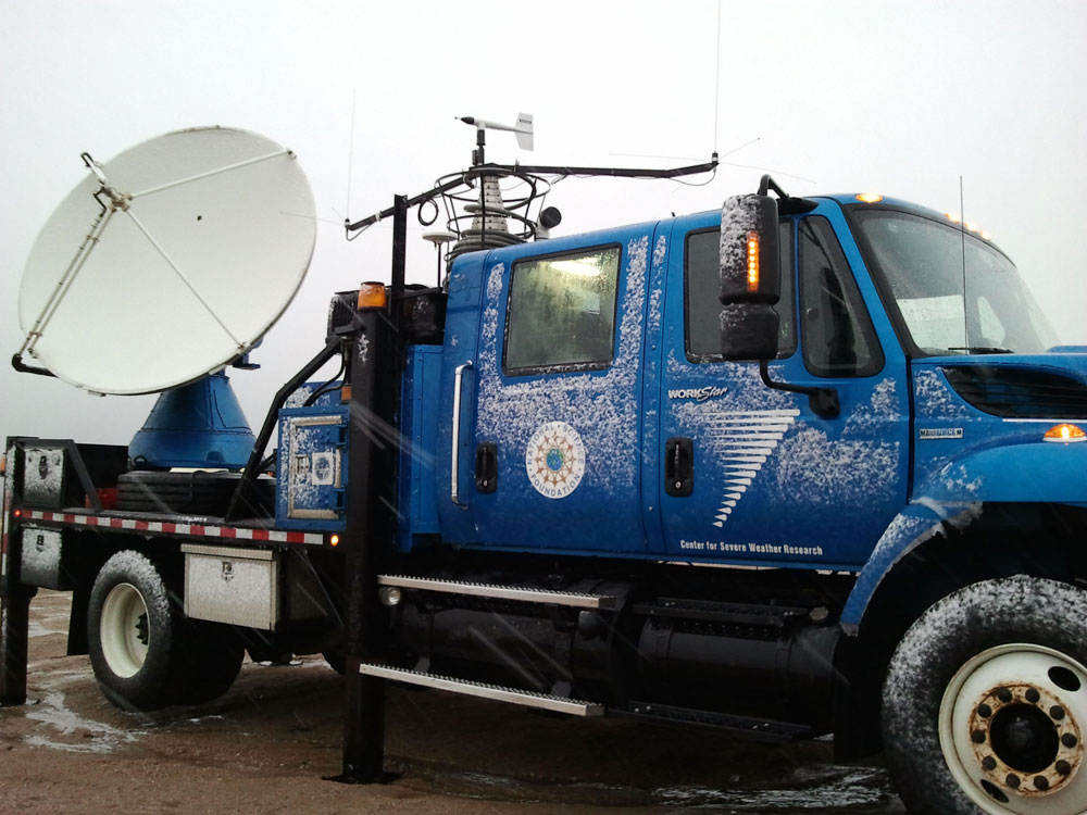
Tornadoes aren't the only storms that meteorologists can chase: A group of researchers in Utah is showing through its use of portable, truck-mounted radars to peek inside winter storms.
"For students who love snow, it's every bit as thrilling as chasing tornadoes," said atmospheric scientist and avid skier Jim Steenburgh, of the University of Utah. "That's why we call it storm chasing, Utah style."
The Storm Chasing Utah Style Study, or SCHUSS (the term for a straight, downhill ski run), makes use of a Doppler on Wheels (DOW) radar truck operated by the Center for Severe Weather Research in Boulder, Colo., for the National Science Foundation. The radar truck gives the team unprecedented views into the heart of winter storms in the area.
"We have never been able to examine the 'guts' of Wasatch winter storms like we can with the Doppler on Wheels radar that is presently here in Salt Lake City," Steenburgh wrote recently in his Wasatch Weather Weenies blog. "In particular, we can take a meteorological CAT scan of winter storms to see their inner workings."
What Doppler can do
The portable "X-band polarimetric Doppler radar" system was developed originally for studying tornadoes, and Steenburgh said it "measured the strongest wind ever recorded during the Moore, Okla., tornado" in 1999, which clocked in at 318 mph (512 kph).
The truck's radar emits and receives radio waves horizontally and vertically. This provides more information than radars used by the National Weather Service, which plans to upgrade to the new radars in the next few years.
Sign up for the Live Science daily newsletter now
Get the world’s most fascinating discoveries delivered straight to your inbox.
Steenburgh said the DOW radar can distinguish the size and shape of snowflakes and raindrops in a storm, can collect data on lower-elevation valley locations and can park closer to storms and thus get more detail. This kind of information could improve forecasts of winter storms in the area.
"Despite improvements in weather forecasting over the past few decades, winter storms in Utah remain a challenge to predict," Steenburgh said in a statement. "Unlike radars used for weather forecasting, the Doppler on Wheels can be placed anywhere during a storm, enabling us to peer into storms and uncover their secrets. The information we collect can be used to better understand lake-effect, mountain and other Utah storms, and improve computer models used for weather prediction."
Storm success
Steenburgh hopes the truck's radar can be used to study eight to 10 storms during its time in Utah (it leaves on Nov. 21), although there haven't been many so far. As of Nov. 10, the radar truck has been deployed for five weather events including a dry cold front that moved across the Great Salt Lake Oct. 24- 25, breezes blowing southward off the Great Salt Lake and into Rush Valley Oct. 30, and a couple of snowstorms.
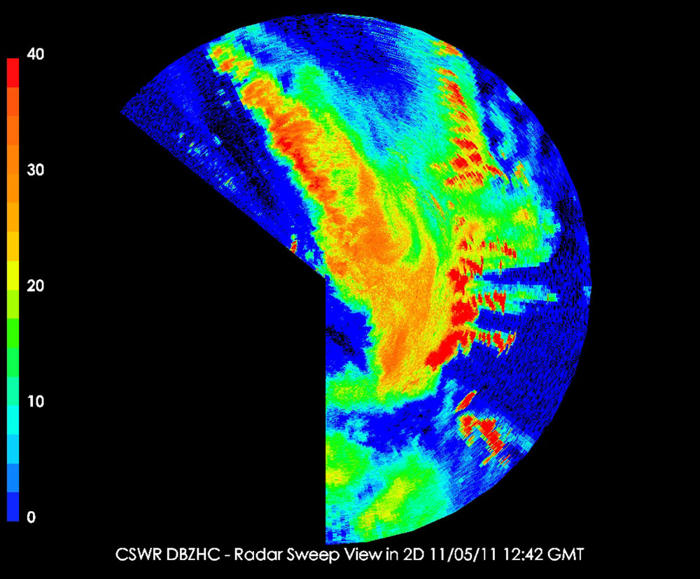
One of those snowstorms, which occurred Nov. 1, featured a cold front with rain and snow that moved over Salt Lake Valley. The radar captured a burst of heavy snow over Twin Peaks in the Wasatch Range, and got unprecedented images of the "transition zone," where falling snowflakes turn to raindrops. The exact elevation of the transition zone is critical to forecasting if a city like Salt Lake will experience weather of 32 degrees Fahrenheit (0 degrees Celsius) with heavy snow or 35 F (1.7 C) with rain. [Snowflake Images: No Two Alike]
"The truck is teaching our students with a new kind of radar to better determine where the snow level is and where precipitation is transitioning from rain to snow, which is a big piece of figuring out how much snow is going to fall at any particular location," Steenburgh said.
A big snowstorm, with some snow enhanced by the Great Salt Lake's "lake effect," was captured by the radar truck Nov. 4-5 as it dumped several inches of snow on Salt Lake City and other Wasatch Front cities.
"We got an unprecedented data set on the lake effect snow that fell Saturday morning," Steenburgh said. "It was phenomenal."
This story was provided by OurAmazingPlanet, a sister site to LiveScience.

