No Snow, No Cold: Where Is Winter?
WASHINGTON, D.C. — Just how pitiful has winter been this year? Amtrak passengers from New York City — a notoriously blasé bunch — were positively delighted to see snow flurries falling at Union Station yesterday (Jan. 9).
And barely any snow fell. Washington's Dulles International Airport saw 0.5 inches (1.27 centimeters) yesterday, pushing its total since the summer to just over 1 inch.
Things are uncharacteristically balmy in Chicago too, where people are walking around in flip-flops, according to one news report.
People across the country are wondering: Where is winter? As OurAmazingPlanet previously reported, the nation has been snow poor this winter. Last year at this time, the Deep South was still a-buzz after an unusually big snowfall, and the Northeast was still reeling from the big post-Christmas blizzard. But this year, climate patterns have conspired to make winter a snow strikeout for much of the nation.
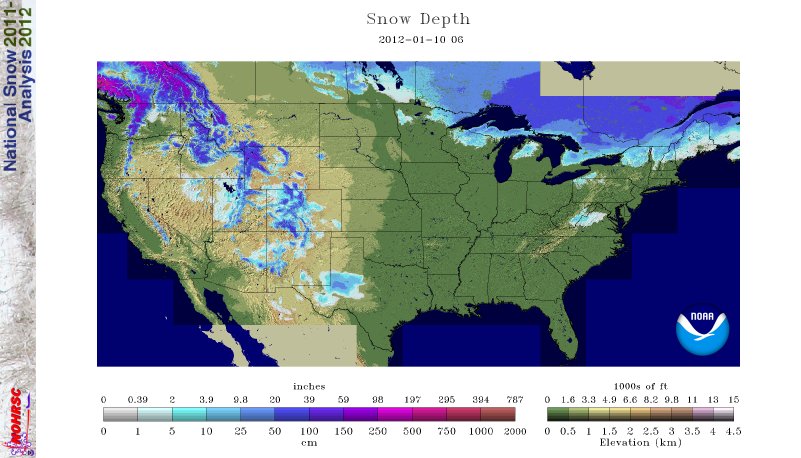
Today (Jan. 10), just 14.4 percent of the United States is covered by snow. On this day in 2011, 61.7 percent of the country had snow on the ground, according to the U.S. National Operational Hydrologic Remote Sensing Center in Minnesota.
Hardly anyone got the gift of a White Christmas, and on New Year's Day just 19.8 percent of the country had snow on the ground. The paucity of snow hasn't been for a lack of storms, as a series of them have rolled across the country — the air has simply not been cold enough to turn precipitation to snow.
Parts of the West and — oddly — Texas are among the few places that have seen snow this winter.
Sign up for the Live Science daily newsletter now
Get the world’s most fascinating discoveries delivered straight to your inbox.
Year to year
Typically snowy cities in the Midwest and Northeast aren't snowy this year because they aren't cold.
A January heat wave set at least 1,500 daily record high temperatures from January 2-8, reported Climate Central. On Jan. 5, Rapid City, S.D., had a high of 73 degrees Fahrenheit (23 degrees Celsius). That was warmer than Miami, which hit 69 F (20.5 C) on the same day. Mitchell, S.D., hit 68 F (20 C), a record high for the month of January.
Temperatures this time of year in the East Coast are partially driven by a climate pattern of opposing atmospheric pressures in the middle and high latitudes of the Northern Hemisphere, called the Arctic Oscillation, Jake Crouch, a climatologist at the National Climatic Data Center in Asheville, N.C., told OurAmazingPlanet. The past two winters, the Arctic Oscillation, or AO, was mostly in a record-strength negative phase. This year, the AO has been in a positive phase.
"When the AO is positive, the Eastern Seaboard, Midwest and Southeast tend to have warmer-than-average temperatures," Crouch said.
In the Great Lakes, so far this year, not much cold air has been blowing over the big bodies of water, so the region has seen little of its infamous lake-effect snow.
Lake-effect snow is created when bitter Arctic air spills south over the warmer Great Lakes. The cold air warms, moistens and forms into snow clouds, which drop the white stuff in whichever direction the strongest wind is blowing. Lake-effect snow is heaviest downwind, or leeward, of a water body.
Snow should finally show up this week. An inch of snow is expected across the Midwest, and heavy lake-effect snow could hit some cities as a blast of cold air moves east, the Weather Channel has forecast. That same cold air could create wintry conditions in New England by the week's end.
A light snow is also expected across the Rocky Mountains, and Glacier National Park in Montana is under a winter storm warning, with up to 7 inches (17.8 cm) of snow forecast.
Snowy surprises
Even though much of the nation is missing snow, the 2011 winter has given a few fleeting surprises.
A surprisingly early snowstorm smacked the East Coast on Halloween, knocking out power to thousands in Connecticut. New York’s Central Park recorded 2.9 inches of snow (7.6 cm), the first time since record-keeping began in 1869 that an inch or more of snow has been recorded there during the month of October, according to the National Weather Service.
A week before, that same weather system created wild weather in Denver. The Colorado capital saw temperatures of 80 degrees F (27 degrees C) Oct. 24, a record for the day in Denver. Snow and freezing temperatures came in with the winter system the next day.
It wasn't much, but Nov. 28, Alabama saw a November snowfall for the first time in 35 years. The southern snow was caused by a "cold bubble" that settled over the region.
Perhaps the biggest surprise this winter has been Midland, Tex. The west Texas town saw its biggest snowfall ever yesterday with 10.5 inches (26.7 cm). Midland could surpass its snowiest season on record, the winter of 1946-47, which saw 13.9 inches (35 cm) of snow.
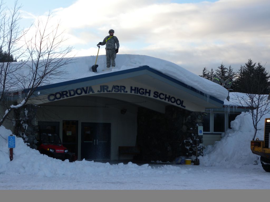
Alaska hasn't wanted for snow either. From Dec. 17 to Jan. 6, 14.5 feet (4.4 meters) of snow has fallen in Cordova, Alaska. Cordova could see another 10 to 15 inches (25 to 38 cm) of snow over the next 36 hours.
You can follow OurAmazingPlanet staff writer Brett Israel on Twitter: @btisrael. Follow OurAmazingPlanet for the latest in Earth science and exploration news on Twitter @OAPlanet and on Facebook.


