'Spring Break' From Floods Is Forecast

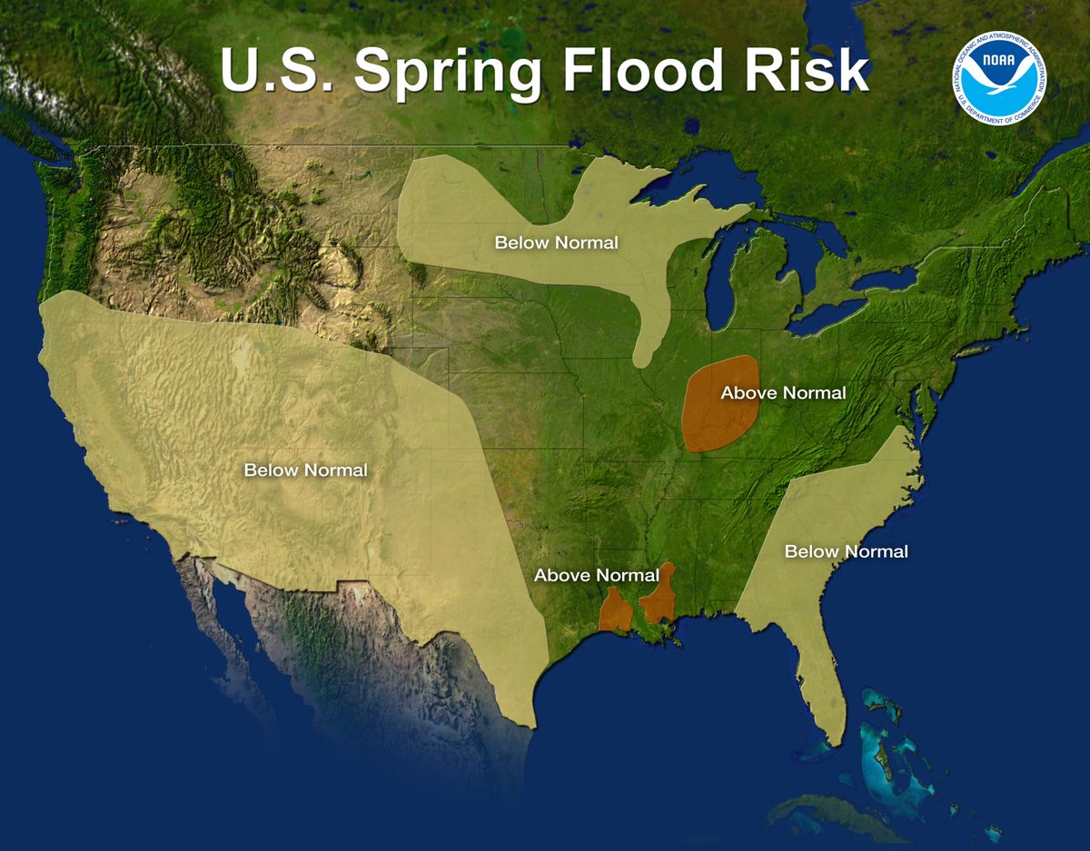
For the first time in four years, no region in the United States is at risk of major flooding heading into spring, according to the U.S. National Oceanic and Atmospheric Administration's spring flooding outlook released today (March 15).
That's a stark break from last year, when record-breaking flooding on the Mississippi, Missouri and Red rivers made headlines all spring and summer. Last year a huge snowpack overwhelmed rivers as it melted. That's not a concern this year. A mild winter and warm start to spring has led to the third smallest snow cover in nearly 40 years of data, and rivers and streams are running well under capacity so they can handle any snowmelt, said Laura Furgione, deputy director of the National Weather Service.
"The United States is getting a much needed spring break this year from flooding," Furgione said.
Last year, almost half the country had an above-average risk of flooding. This year only the Ohio River Valley and the Gulf Coast have an above-average risk of flooding due to heavy soil moisture and high river levels.
Any major flooding this year will be driven by rainfall, Furgione said. Even though this year's flood forecast is not severe, heavy rainfall can lead to flooding at anytime, Furgione said. Flooding claims more than 100 lives every year, mostly people in cars. Just 6 inches (15 centimeters) of water can cause drivers to lose control of their car.
Atmospheric players
Last year, a strong La Niña climate pattern dominated the weather and was blamed, at least in part, for the widespread flooding. La Niña is a naturally occurring climate phenomenon that results from interactions between the ocean surface and the atmosphere over the tropical Pacific Ocean. During La Niña, cooler-than-average Pacific Ocean temperatures influence global weather patterns
Sign up for the Live Science daily newsletter now
Get the world’s most fascinating discoveries delivered straight to your inbox.
This year, La Niña is still around, but it's weak and on the way out, and another climate pattern, called the Arctic Oscillation, or AO, has been keeping the country dry. The AO is now in a high-pressure phase, which brings warmer and drier conditions over the United States.
"The AO appears to have dominated over the La Niña," said Ed O'Lenic of NOAA's Climate Prediction Center.

Deepening Drought
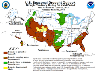
The flip side to the good news about flooding is that the country is now experiencing a more widespread — but less extreme — drought, said David Brown of the Southern Region Climate Services.
2011 was the worst one-year drought in Texas history, and two-thirds of the state is still in the top three worst-drought classifications.
A drought has also emerged in the Southeast. Over three-quarters of the state of Georgia is in the three most intense drought classifications.
Brown said forecasts show the drought will persist this spring in the Southeast and Southwest, but Texas may be wetter than in recent years.
You can follow OurAmazingPlanet staff writer Brett Israel on Twitter: @btisrael. Follow OurAmazingPlanet for the latest in Earth science and exploration news on Twitter @OAPlanet and on Facebook.


