Faults Show Lake Tahoe's Shaky Past — and Future

As a cross-country skier trekked through the wilderness near Lake Tahoe 15 years ago, he noticed something odd about the trail he'd taken. The hill crest that had been beneath his skis abruptly dropped off, then picked up again about 20 feet away.
As luck would have it, the skier was a geologist, and the oddities of that trail — including the offset moraines, or ancient glacial deposits, he noticed that day — helped him piece together the seismic hazards underlying the Lake Tahoe region.
"As you walk along these very prominent geologic features, all of the sudden, that same feature is now over there," said James Howle, a geologist with the U.S. Geological Survey in Carnelian Bay, Calif. "These long, linear moraines are very abruptly offset, and I couldn't help but ask, 'what caused that?'"
Howle has been studying the region ever since. He's now identified five active seismic faults, which point to important landslide and earthquake hazards — potentially up to magnitude-6.9 temblors — for those living near Lake Tahoe.
Finding faults
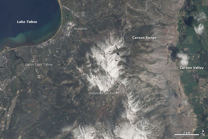
Together, the five faults make up the Tahoe-Sierra Frontal Fault Zone, which lies between the Sierra Nevada and the west side of Lake Tahoe. Geologists had known about several of these faults before Howle's latest findings, which were detailed online May 18 in the journal Geological Society of America Bulletin, but heavy tree and brush cover made the area difficult to survey.
Using LiDAR, a type of laser radar that can "see" through dense vegetation, Howle's team precisely traced the five faults and measured their offsets, or the distances seismic activity had moved land on each side of the faults. They also found, from radioisotope data, that the glacial moraines in the region were 21,000 and 70,000 years old — an important piece of the puzzle that scientists hadn't known before, Howle said.
Sign up for the Live Science daily newsletter now
Get the world’s most fascinating discoveries delivered straight to your inbox.
The data allowed Howle's team to calculate how fast the land along the faults is moving. The rates they calculated are two to three times greater than had been estimated, he said. [13 Crazy Earthquake Facts]
Those slip rates boil down to significant seismic risks. A rupture along any of the five faults could generate a magnitude-6.3 to 6.6 quake, the team calculated. If two or more adjacent faults ruptured together, they could produce a magnitude-6.9 or greater quake.
"The seismic hazard itself hasn't increased," Howle told OurAmazingPlanet. "The faults have always been there, the hazard has always been there, we just didn't have the data to quantify it until now."
Quakes and slides
What do the findings mean for those who call Lake Tahoe home? Be prepared, advised Howle, who lives in the area and has no plans to relocate.
The faults have not produced any major quakes since people have been living in the region, but that doesn't mean they won't, he said. The team doesn't have enough evidence to determine exactly how often earthquakes recur along these faults, but Howle estimates it's on the timescale of thousands of years. Since they don't know when the last quake occurred, the next could hit at any time.
What's more, earthquakes aren't the only danger. The team's LiDAR images show evidence of massive ancient land and rockslides associated with the quakes.
"It's kind of a latent hazard, and people don't take it seriously because there hasn't been much seismic activity here in historical times," Howle said. "But these new data clearly show the faults are active. They haven't ruptured while we've been around here, but they have been active in recent geologic time."
This story was provided by OurAmazingPlanet, a sister site to LiveScience. Follow OurAmazingPlanet for the latest in Earth science and exploration news on Twitter @OAPlanet and on Facebook.


