Seriously, When Will the Heat End?
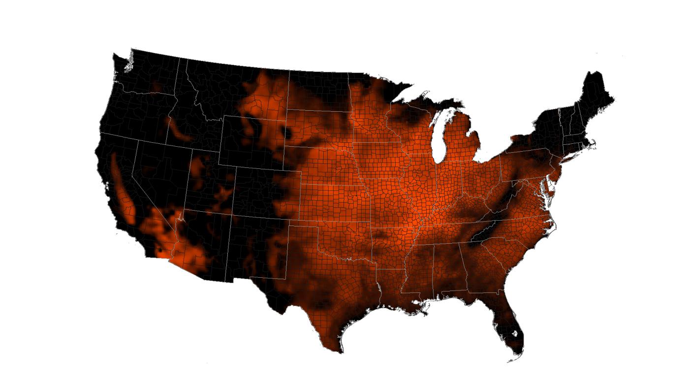
After an unusually oven-like June, the beginning of July has been sweltering, too. The heat didn't even take time off for Independence Day, with 262 daily high records tied or broken nationwide, mostly in the Midwest and the South, according to government records. In comparison, only 60 records were set on July 4, 2011, and a mere 15 were set on that date in 2010.
In addition to extreme heat during the day, it's not cooling off very much at night; in the first four days of July, 432 daily minimum high temperatures have been set (minimum high temperatures generally reflect nighttime conditions).
But there's a small amount of good news for those who are cooking in Chicago or withering in Washington, D.C. (both of which nearly broke all-time highs yesterday): a "cold" front will be sliding east across the country, said National Weather Service meteorologist Greg Carbin. That should bring slightly cooler weather and possibly precipitation to the Midwest and surrounding areas by the beginning or middle of next week, Carbin told OurAmazingPlanet.
In addition to the front, the North American monsoon has arrived and is expected to lower temperatures by about 20 degrees Fahrenheit (11 degrees Celsius) in Colorado this weekend, and bring some much-needed precipitation to the area that will hopefully help fight Colorado's raging wildfires, said Jeff Weber, a scientist with the University Corporation for Atmospheric Research in Boulder, Colo. This same system should bring lower temperatures and rain to North and South Dakota, Iowa and northern Illinois next week, he said.
Still, most areas east of the Rockies should expect average summertime temperatures at best next week; and then it will probably get worse in a few days. Weber said he expects a basic pattern to repeat itself throughout the summer: rising heat will generate in the Southwest and slowly roll across the country, causing uncomfortably high temperatures in any given area for about 10 days. Then a lower pressure system will move through, providing some mild relief for about three to four days. Then, another heat wave will come again, he said. And so on. [Harshest Environments on Earth]
Stuck in place
The heat burning up the country right now is due in part to a persistent high-pressure system, also called a heat ridge or dome, which parked itself over the mountain West, and has now shifted east into the Midwest and Southeast. The system is stuck in place, Weber said, because of a slowdown of the North Atlantic Oscillation, a climate pattern that pulls weather patterns eastward across the country.
Sign up for the Live Science daily newsletter now
Get the world’s most fascinating discoveries delivered straight to your inbox.
This "blocking" of the Atlantic has caused the jet stream, which normally ferries air from west to east across the United States, to buckle and trap heat in the Midwest and Southeast, Weber said.
It looks like the epicenter for heat this year will be the state of Missouri and its surroundings, he said. And the heat dome doesn't look likely to completely dislodge itself for the remainder of the summer. Above-average temperatures are expected throughout the central and eastern parts of the country (excluding the northeastern states of Vermont, New Hampshire and Maine), Carbin said.
The high nighttime temperatures that this system has brought are dangerous for those sensitive to extreme heat. They are made worse by the urban heat island effect, wherein buildings and man-made materials absorb more heat during the day and emit it at night, Carbin said. It's also exacerbated by air pollution, which prevents heat from dissipating into the upper atmosphere.
High and dry
The warm summer follows an unusually warm winter, which was the hottest and driest that the western United States has ever recorded.
The first five months of 2012 have also been the hottest on record in the contiguous United States. And that's not including June, when 164 all-time high temperature records were tied or broken around the country, according to government records.
The early heat records are unusual, since July and August tend to be the hottest summer months in most areas of the country, said Jake Crouch, a climate scientist with the National Climatic Data Center.
Dry soils, in part a product of the dry winter, exacerbate the heat. "If the soils were wetter, more energy would be absorbed by the water and the daily high temperatures wouldn't be as warm," Crouch told OurAmazingPlanet. For example, southern Georgia and Florida, drenched by Tropical Storm Debby, haven't been as hot as areas to the north in the last week or so.
More areas of the United States are now in moderate drought or worse than ever before in the 12-year history of the U.S. Drought Monitor, a national measure of drought conditions.
Climate change?
The early heat waves of summer — following higher temperatures in spring and winter — could be part of a pattern of climate change.
"It's consistent with what we'd expect in a warming climate," Crouch said. [Video: Earth's Warming Since 1880]
Carbin went further, saying that this persistent high heat — stretching back through the winter —and extended drought nationwide are the exact features predicted to occur in a warming world. "An increasing frequency of heat waves, that's one aspect of climate change you can point to," Carbin said.
Reach Douglas Main at dmain@techmedianetwork.com. Follow him on Twitter @Douglas_Main. Follow OurAmazingPlanet on Twitter @OAPlanet. We're also on Facebook and Google+.


