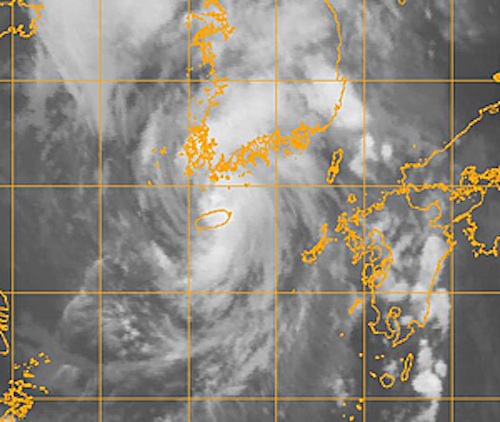
Tropical Storm Khanun Targeting Korea

This article was provided by AccuWeather.com.
Torrential rain and flooding will pose a significant threat as Tropical Storm Khanun intersects the Korean Peninsula Wednesday and Thursday.
Wednesday, Eastern Time, the center of Khanun was located near the island of Cheju, South Korea, based upon satellite imagery accessed by AccuWeather.com.
Highest sustained winds at the time were about 50 mph, with storm movement toward the north at nearly 20 mph, according to the Joint Typhoon Warning Center (JTWC).
Tracking northward, Khanun is forecast by the JTWC to follow the western shore of South Korea through Wednesday night before angling inland south of the North Korea border early on Thursday. Once inland, Khanun should weaken quickly, losing tropical storm status.
AccuWeather.com meteorologists foresee a similar path by Khanun, as the tropical cyclone is forecast to be steered by high pressure near Japan.
Near the track of Khanun, South Korea could see locally damaging winds. The primary threat to life and property, however, will be that of localized torrential rain and flash flooding on the Korean Peninsula, AccuWeather.com forecasters believe.
Get the world’s most fascinating discoveries delivered straight to your inbox.
While Khanun will not directly affect Japan, it could help to trigger localized torrential rain in parts of Kyushu flooded by record rainfall late last week.
© AccuWeather.com. All rights reserved. More from AccuWeather.com.
