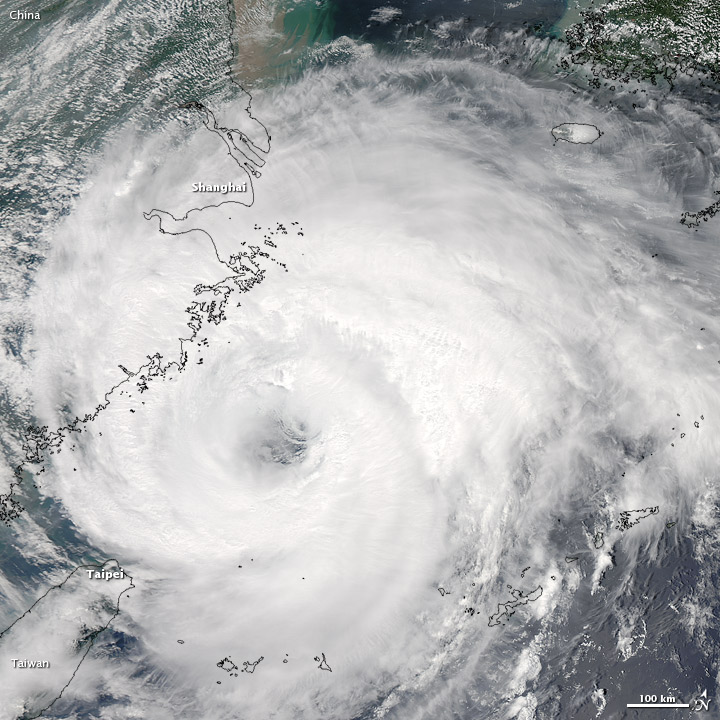
Third Typhoon in 5 Days to Hit China

Just days after two typhoons, Saola and Damrey, came ashore in China one right after the other, Typhoon Haikui is set to make landfall later today (Aug. 7) or early tomorrow.
The state-run Xinhua news agency has reported that schools have been closed, flights grounded and passenger trains stopped in coastal regions of China's Zhejiang Province, where the storm is expected to make landfall south of the city of Shanghai, according to a NASA statement.
The Moderate Resolution Imaging Spectroradiometer (MODIS) on NASA's Aqua satellite snapped an image of Haikui at 12:35 p.m. local time on Aug. 7 that showed the storm had a well-defined eye and spiral arms that extended far over the Chinese mainland.
The latest update from the Joint Typhoon Warning Center (run by the U.S. Navy and Air Force) had Haikui's maximum sustained winds clocking in at 69 mph (111 kph), which would make it a strong tropical storm in the Atlantic basin. (Typhoons are the same phenomenon as tropical storms and hurricanes, all collectively known as tropical cyclones.)
Haikui is currently about 225 nautical miles south-southeast of Shanghai and is moving to the northwest. They cyclone's strength will diminish as it move over land.
This story was provided by OurAmazingPlanet, a sister site to LiveScience.
Sign up for the Live Science daily newsletter now
Get the world’s most fascinating discoveries delivered straight to your inbox.


