Nadine Rain, Squalls to Reach Azores

This article was provided by AccuWeather.com.
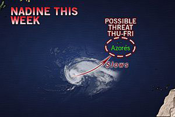
Nadine, once the eighth hurricane of a busy 2012 season, will fling rain and squalls toward the Azores later this week.
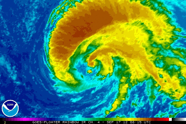
A hurricane for a brief time late Saturday and Sunday, the storm was downgraded to a tropical storm Sunday evening.
Despite the downgrade, heavy rain and gusty winds from Nadine could impact the Azores later this week, potentially marking the second time this season a tropical system has affected the islands.
Last month, Gordon paid the islands a visit.
Early this week, Nadine will continue on a course east and eventually northeastward. Though being impacted by wind shear, the system is expected to maintain its strong tropical storm status through midweek.
"The strong upper-level winds were pushing the top of Nadine east of the low-level center of circulation," said AccuWeather.com Meteorologist Brian Edwards.
Sign up for the Live Science daily newsletter now
Get the world’s most fascinating discoveries delivered straight to your inbox.
It is possible that by the time Nadine reaches the Azores, towards the end of the week or maybe not even until next weekend, it could begin to lose its tropical characteristics. Nonetheless, residents and visitors can expect heavy rain, strong winds and rough surf at the very least.
At first glance Monday, Nadine appears to be more of a wave of low pressure along a front.

Elsewhere in the Tropics
For the first time in weeks, the remainder of the Atlantic basin remains fairly quiet.
A potent tropical wave will move across the central Lesser Antilles with thunderstorms and gusty winds expected.
While conditions do not appear favorable for much tropical development with this wave over the next couple of days, that could change later this week as it pushes farther west across the eastern Caribbean Sea.
Because of this, interests in Puerto Rico, Cuba, Jamaica, Hispaniola and Cuba should monitor the progress of this system.
© AccuWeather.com. All rights reserved. More from AccuWeather.com.


