Satellite Sees Typhoon Sanba Wallop Japan, Korea

Get the world’s most fascinating discoveries delivered straight to your inbox.
You are now subscribed
Your newsletter sign-up was successful
Want to add more newsletters?
Join the club
Get full access to premium articles, exclusive features and a growing list of member rewards.
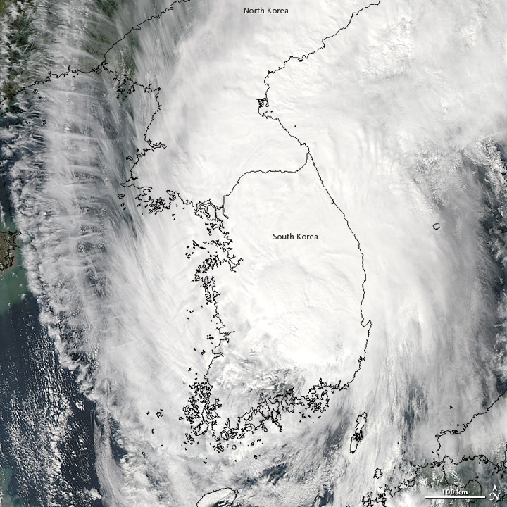
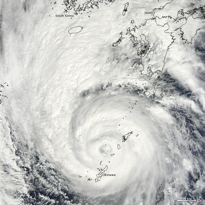
NASA's Terra satellite captured images of Typhoon Sanba as it engulfed the Korean peninsula earlier today (Sept. 17) and Okinawa, Japan, yesterday.
The storm caused torrential rains throughout South Korea, resulting in landslides and at least one death, according to the Associated Press.
When it struck Japan yesterday, Typhoon Sanba boasted winds of up to 127 mph (205 kph) and also dropped massive amounts of rain in that country, leaving thousands without power and canceling hundreds of flights.
Article continues belowIt has since weakened dramatically, and today, shortly after the first image was taken, Sanba was downgraded to a tropical storm. It currently has maximum sustained winds of 52 mph (83 kph), with gusts up to 63 mph (102 kph), according to the Joint Typhoon Warning Center (run by the U.S. Navy and Air Force).
At its strongest, Sanba was a super typhoon with winds equivalent to those in a Category 5 hurricane.
It is currently centered over the Taebaek Mountain Range and is producing large amounts of rain over the high, rugged terrain. The storm is moving to the north at 23 mph (37 kph) and is expected to continue weakening before reaching the Sea of Japan, and bringing rain to China, according to NASA.
Sanba is the third major typhoon to hit the Korean peninsula in two months’ time, AFP reported.
Get the world’s most fascinating discoveries delivered straight to your inbox.
Reach Douglas Main at dmain@techmedianetwork.com. Follow him on Twitter @Douglas_Main. Follow OurAmazingPlanet on Twitter @OAPlanet. We're also on Facebook and Google+.
 Live Science Plus


