Arctic Sea Ice Hits a Record Minimum (Infographic)

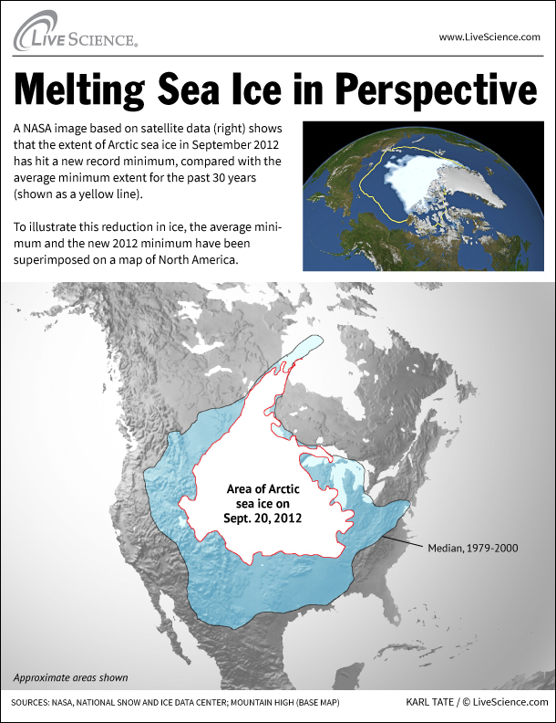
A new NASA image based on satellite data shows that the extent of Arctic sea ice, as of September 2012, has hit a new record minimum, compared with the average minimum extent for the past 30 years.
The new minimum, set on Sept. 16, is almost 300,000 square miles (777,000 square kilometers) less than the previous record minimum set in September 2007 (1.61 million square miles or 4.17 million square kilometers).
By comparison, the state of Texas measures around 268,600 square miles (696,000 square km).
The minimum coverage of Arctic sea ice has been decreasing over the past 30 years as ocean and air temperatures have increased. The 2012 minimum is about half the size of the average extent of ice coverage from the period of 1979 to 2000.
Follow LiveScience on Twitter @livescience. We're also on Facebook & Google+.
- On Ice: Stunning Images of Canadian Arctic
- Image Gallery: One-of-a-Kind Places on Earth
- The Reality of Climate Change: 10 Myths Busted
Get the world’s most fascinating discoveries delivered straight to your inbox.


