Devastating Pakistan Flooding Seen From Space

Torrential rains in Pakistan have drenched the country in the past month, causing massive flooding that has affected hundreds of thousands of people, causing deaths and injuries.
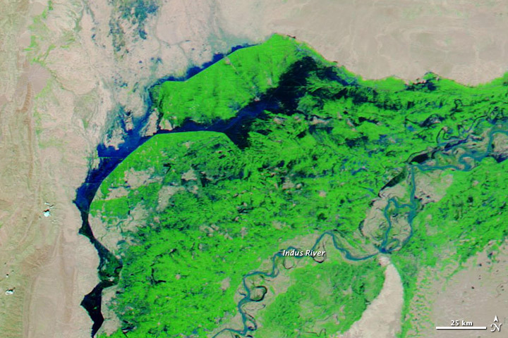
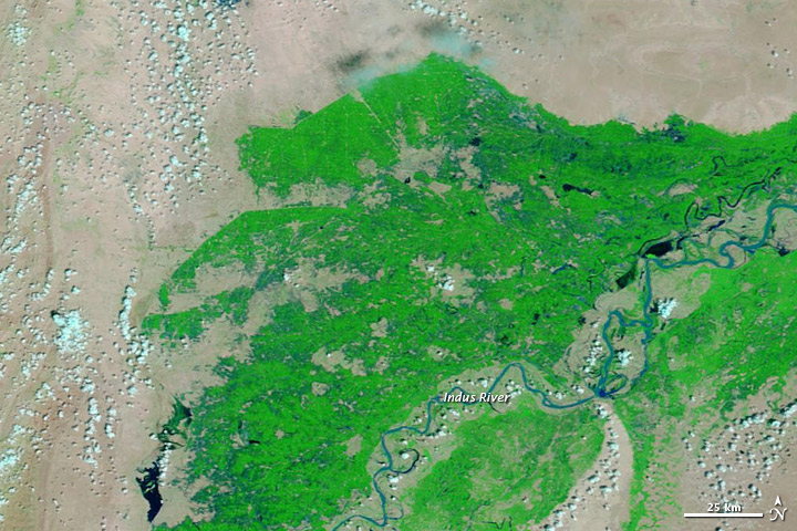
NASA's Aqua satellite acquired these images of the flooding from space; they show floodwaters advancing beyond the banks of the Indus River and the bounds of the irrigation system that waters a large amount of crops in southern Pakistan.
The images were taken on Sept. 1 and on Sept. 21. Both images incorporate a combination of visible and infrared light to distinguish water (which varies in color from electric blue to navy) from vegetation (which appears green). Bare ground shows up as pink-beige. Darker shades of blue indicate deeper water.
The relatively pale blue color of the water in the Indus River shows that it's carrying heavy loads of sediment, which is common during floods. In the upper left of the image, the pale blue suggests shallow water on a floodplain. Deep water appears to cover large stretches of land, much of it along the edge of the network of irrigation ditches.
At least 51 people have died across the Baluchistan province in southwest Pakistan, where torrential monsoon rains broke a 30-year record, according to Agence France-Presse (AFP).
The rains have affected 700,000 people and destroyed crops across 600 square miles (1,540 square kilometers) of land, an area roughly twice the size of New York City.
Still, monsoon rains this year haven't been as bad as they were in 2010, when a rogue storm system caused severe flooding that killed more than 2,000 people.
Sign up for the Live Science daily newsletter now
Get the world’s most fascinating discoveries delivered straight to your inbox.


Reach Douglas Main at dmain@techmedianetwork.com. Follow him on Twitter @Douglas_Main. Follow OurAmazingPlanet on Twitter @OAPlanet. We're also on Facebook and Google+.


