Almost Cold Enough for Snow This Weekend
This article was provided by AccuWeather.com.
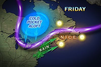
A pocket of chilly air will rotate southward over the Great Lakes and central Appalachians this weekend, leading to atmospheric chaos.
The air originating from central Canada will reach across southern Ontario, Michigan, northern Indiana, northern Ohio, northwestern Pennsylvania and western and central upstate New York.
According to Expert Senior Meteorologist John Gresiak, "The air will not be quite cold enough aloft for snow, but it will be almost cold enough."
As the cold air passes over the waters of the Great Lakes the atmosphere, it will pick up a little warmth but will also become very unstable.
"The result will be angry clouds, cold showers of rain and hail, as well as brief, gusty thunderstorms," Gresiak stated, "If the air were about 5 to 10 degrees colder, we would be looking at snow showers all over the place."
Sign up for the Live Science daily newsletter now
Get the world’s most fascinating discoveries delivered straight to your inbox.
The activity will begin over Michigan Saturday afternoon and will spread eastward and southward into Sunday toward the central and northern Appalachians.
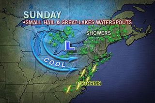
Cities impacted the most by the unsettled, crazy weather conditions include Detroit, Cleveland, Akron, Erie, Pittsburgh, Buffalo, Rochester, Toronto, London and Ottawa.
Even though temperatures will peak in the 60s over much of the region, as these showers move over and drag cold air down from aloft, the temperature can drop 20 degrees, into the 40s, in a matter of minutes.
It is possible that the hail may sort of look like snow and may be softer in consistency than what we typically experience during severe thunderstorms. Meteorologists call this soft hail graupel.
Only if the air were to get colder on the spot would snowflakes mix in, and that is a little more likely away from the lakeshore areas, like the plateau region of northwestern Pennsylvania and the mountains of western New York and perhaps the interior Lower Peninsula of Michigan.
Another phenomenon that is likely to occur is waterspouts. As the cold air moves in over the warm lakes, it picks up moisture and swirls upward over the water, forming funnels with the equivalent of an EF0 to EF1 tornado strength.
Boaters and fisherman are advised to keep a look out for these relatively short-lived, but potentially dangerous storms.
Areas along the immediate East Coast will not be greatly impacted by the chilly air holding up west of the Appalachians this weekend.
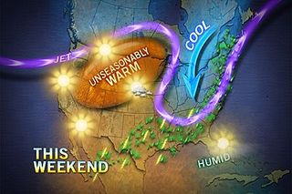
However, a swath of moisture over the Atlantic Ocean will graze some cities from Norfolk to Washington, D.C., Philadelphia, New York City, Providence and Boston with rain at times.
© AccuWeather.com. All rights reserved. More from AccuWeather.com.
The weather is getting stranger, right? Well, for the most part no, scientists say, but humans often think so when a strange event does occur. So here’s your chance to prove how much you known about weather oddities.
Weird Weather: One Strange Quiz
