This Week's Snow Potential From Midwest to New England
This article was provided by AccuWeather.com.
There are additional opportunities for snow this week and they include the Upper Midwest, northern New England and neighboring Canada.
Last week snow fell on parts of the northern Plains, Denver and Cheyenne and barely reached the highest elevations of the Northeast late this past weekend.
This week, cold air will continue to nose southward from the polar regions and will try to hook up with weak storm systems along the Canada/United States border in two separate events. The pattern will extend the chance of the first snowflakes of the season to some northern tier locations.
While temperatures will be marginal in both cases, a few degrees can make the difference between all rain and wet snow mixing in for a time.
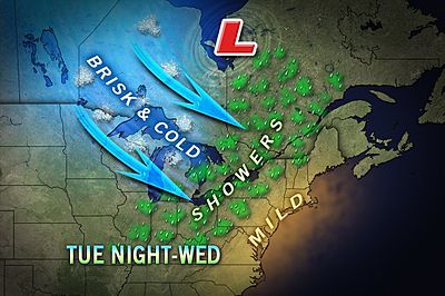
As a disturbance and surface cold front swing across the Great Lakes, there is the chance for cold rain and wet snow showers in portions of Wisconsin, upper and northern lower Michigan and central Ontario later Tuesday into Wednesday. A second disturbance could bring another opportunity Wednesday night into Thursday. Cities that may get a little snow include Duluth, Minn., Marquette and Traverse City, Mich., and Thunder Bay, Ont. A few snowflakes could reach as far south as Green Bay, Wis., and Traverse City, Mich.
The first of the two systems are then forecast to move on to northern upstate New York, Vermont, northern New Hampshire, northern and western Maine, and portions of Quebec Wednesday night. There is a chance of rain mixing with or changing to a little wet snow before ending. The second disturbance would swing through Thursday night with the chance of a rain/snow mix or a period of snow. Cities that have a chance at getting a little snow from one or both systems include Ottawa, Montreal and Quebec City. Snowflakes could reach as far south as Massena, N.Y, Burlington, Vt., and Caribou Maine.
Sign up for the Live Science daily newsletter now
Get the world’s most fascinating discoveries delivered straight to your inbox.
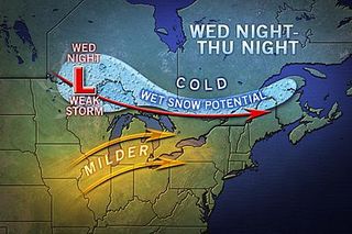
According to Expert Senior Meteorologist Brett Anderson, "In both cases in both areas, the second of the two disturbances may have a little more cold air established to work with. So the second system has a slightly greater chance at allowing snow to reach the ground in more places."
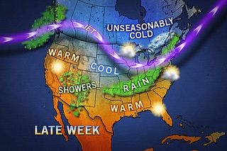
In the wake of the potential for a touch of snow for northern areas, the coldest air of the season so far will spread a killing frost and freeze farther east than any such air mass so far this autumn. The upcoming frost and freeze can reach the I-95 corridor of the Northeast.
Elsewhere, there will be a couple more opportunities for a little more snow for the foothills and Rockies in western Alberta Tuesday and Wednesday.
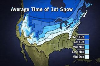
A storm rolling into California this week may, by this weekend, could bring heavy high country snow to portions of Colorado, northern New Mexico and Utah's Wasatch Mountains.
© AccuWeather.com. All rights reserved. More from AccuWeather.com.
