Expedition Aims to Map Deep Magma-Plume

Long ago, a giant pillar of hot, molten rock from deep within the Earth may have played a role in the extinction of the dinosaurs by triggering massive volcanic explosions. That deep jet of magma may still be around, and researchers are now deploying a vast array of electronics on the seafloor to try to learn more about it and the effects it can have on Earth's surface.
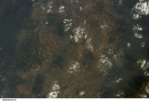
A French-German expeditionis currently exploring the source of volcanism at Réunion Islandin the Indian Ocean. Unlike most volcanoes, the earthshaking activity here doesn't occur at the border of colliding tectonic plates, but instead arises within a tectonic plate.
"Réunion is one of the most suitable places on Earth to investigate the problem of intra-plate volcanism in the oceans," said researcher Karin Sigloch, a seismologistat Ludwig Maximilian University of Munich.
The source of this volcanic violence is a so-called hot spot that apparently has roots at great depths — a titanic jet of magma known as a mantle plume that pumps colossal amounts of heat upward, burning through the overlying material like a blowtorch.
As the millennia have passed andEarth's surface has drifted over this mantle plume, it has seared a track of volcanic activity that stretches about 3,400 miles (5,500 kilometers) northward from Réunion to the Deccan Plateau region of what is now India. At the end of the Age of Dinosaurs about 65 million years ago, massive volcanism in the Deccan area spewed lava across 580,000 square miles(1.5 million square km), radically altering Earth's climate and potentially hastening the giant reptiles’ demise.
Investigators suspect that mantle plumes originate near the Earth's core at depths of more than 1,550 miles (2,500 km). Still, geoscientists debate the plumes’ exact origin. [50 Amazing Volcano Facts]
Deeper than ever before
Sign up for the Live Science daily newsletter now
Get the world’s most fascinating discoveries delivered straight to your inbox.
To help resolve the controversy, the expedition is deploying nearly 60 seismometers on the floor of the Indian Ocean over a vast area of about 1.5 million square miles (4 million square km). They will install more instruments on land at Réunion,Mauritius, Madagascar and the Seychelles, while other observatories around the Indian Ocean coastline will contribute data, making this project the largest campaign ever to map a mantle plume.
"In all, there will be about 180 broadband seismometers running in our area of interest during this coming year," Sigloch told OurAmazingPlanet. "We want to look deeper into the Earth's interior than any previous expedition, down to the bottom of the mantle at a depth of about 2,900 kilometers [1,800 miles] — earlier efforts reached half that depth, at most."
The seismometers deployed on Réunion may also help protect the island's residents. "We do expect to learn more about currently active and dangerous volcanism there, and perhaps also the potential for gigantic landslides and tsunamis when half of the volcano slides into the sea, which can happen, though it's very unlikely," Sigloch wrote via email from aboard the French research vessel Marion Dufresne.

The seismometers the researchers are dispersing in the ocean are each about 3 by 4 by 2 feet (1 by 1.2 by 0.6 meters) in size and weigh about 570 pounds (260 kilograms). Powered by lithium batteries, they will record seismic data for 13 months.
Fishing for seismometers
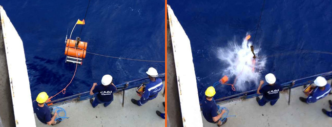
To gather data, the researchers lower the seismometers to the seabed — which can vary from 7,500 feet (2,300 m) to 18,000 feet (5,500 m) deep in the study area — by dropping them off the side of the boat with a crane. [Infographic: Tallest Mountain to Deepest Ocean Trench]
"Then [the seismometers] sink to the ocean bottom within an hour or two … hopefully onto a not-too-rugged spot," Sigloch said. A heavy, iron anchor then ensures the devices sit solidly on the ground.
In a year, the scientists will return to collect each seismometer with the German research vessel Meteor. They will bounce acoustic pings off the seismometers, prompting the buoyant part of the seismometer to detach from the anchor and rise, with all its data, back to the surface. The acoustic pings will help the team locate the devices.
"It becomes a fishing expedition. You need to spot it — not always easy, but easier at night, because it has a flashing device," Sigloch said.
"When everything goes well, a recovery takes two to three hours. When the weather is very bad and the waves are high, it may not be possible to recover at all."
The research cruise began Sept. 27, five days later than planned due to a port worker strike, and is scheduled to finish at the end of October. Once the seafloor seismometers are recovered in 2013, the scientists hope to create 3-D pictures of the mantle plume from the crust to the core.
It remains uncertain whether even a project this large will completely image the mantle plume. "We don't know exactly how large, strong, deep [or] where it is," Sigloch said.
This story was provided by OurAmazingPlanet, a sister site to LiveScience. Follow OurAmazingPlanet on Twitter @OAPlanet. We're also on Facebook and Google+.


