NASA's IceBridge Mission Spies on Antarctic Ice

The rumble of a 40-year-old plane packed with scientists has returned to the Antarctic skies.
NASA's Operation IceBridge recently kicked off its fourth year with a survey of land and sea ice in West Antarctica, near the bay where a massive iceberg may soon break off Pine Island Glacier.
"We could witness the birth of an iceberg with our own eyes," IceBridge project scientist Michael Studinger told OurAmazingPlanet in an email interview. "How cool is that?"
South Pole skies
The program's DC-8 research plane, loaded with remote-sensing equipment, is on a six-year mission to study ice at the South Pole during the Southern Hemisphere's spring and summer. IceBridge fills the gap between the defunct ICESat satellite and the planned ICESat-2, scheduled to launch in 2016. (A P-3B plane patrols the Greenland Ice Sheet and Arctic sea ice for IceBridge in Northern Hemisphere summers.)
The first science flight took off Oct.12 from the research plane's home base in Punta Arenas, Chile.
"A typical science flight is 11 hours long, and we routinely travel a distance that is longer that the trip from Los Angeles to New York and back," Studinger wrote on the IceBridge blog. "The long legs of the DC-8 allow us to reach scientific targets in Antarctica that have been, and still are, a challenge to survey."
Sign up for the Live Science daily newsletter now
Get the world’s most fascinating discoveries delivered straight to your inbox.
During the first few weeks of a campaign, IceBridge typically concentrates on sea ice before it begins to melt as spring temperatures rise. However, the weather had other ideas this year.
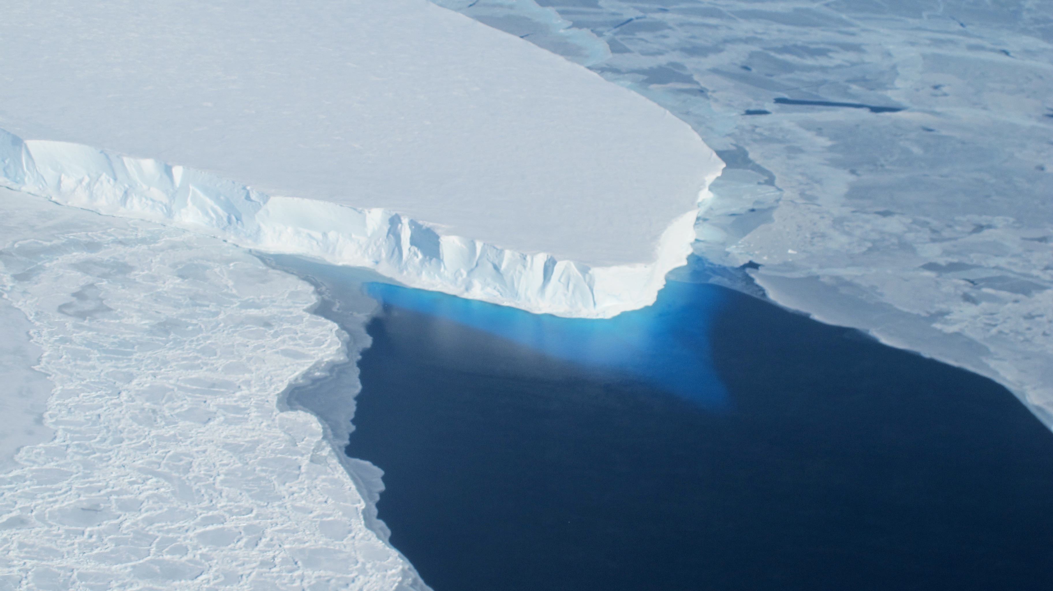
"The forecast for all sea ice science targets was hopeless," Studinger said in a NASA statement. "We decided to take advantage of the unusually good conditions over the Thwaites Glacier area."
Antarctic climate change
Thwaites Glacier is one of the largest glaciers in West Antarctica and has been the subject of repeated missions over several years. Computer models have a hard time pinpointing what the Antarctic ice sheet and surrounding sea ice might do as the climate changes. Having more data to work with would make these models more useful.
"IceBridge collects critical data used to predict the response of Earth's polar ice to climate change and resulting sea-level rise," Studinger said in the email interview.
The Antarctic sea ice reached a record maximum extent in September. Warming temperatures and stronger winds likely helped push more ice out to sea.
This year IceBridge will survey previously unmeasured areas of land and sea ice and gather further data on Pine Island Glacier. Last year IceBridge scientists discovered a large crack in Pine Island Glacier's floating ice shelf. The ice shelf now threatens to calve, or break off, a large iceberg into Pine Island Bay in the Amundsen Sea.
Reach Becky Oskin at boskin@techmedianetwork.com. Follow her on Twitter @beckyoskin. Follow OurAmazingPlanet on Twitter @OAPlanet. We're also on Facebook and Google+.


