Hurricane Sandy: Photos of a Frankenstorm
News
By
Live Science Staff
published
East Coast Lights Out
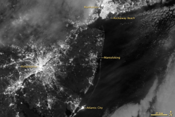
This image was captured on Nov. 1, 2012, after Hurricane Sandy.
GOES satellite image, Oct. 30, 2012
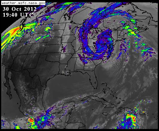
An image from NASA's GOES East satellite shows superstorm Sandy hovering over the eastern U.S. GOES is one of several satellites nearing the ends of their expected lifetimes.
Satellite of Sandy on Halloween
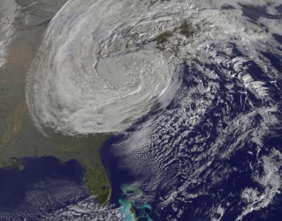
This GOES-13 satellite image was captured on Oct. 31 at 1240 UTC as Sandy's circulation was winding down over Pennsylvania. Sandy had been downgraded a remnant low pressure area.
Sign up for the Live Science daily newsletter now
Get the world’s most fascinating discoveries delivered straight to your inbox.
For the science geek in everyone, Live Science offers a fascinating window into the natural and technological world, delivering comprehensive and compelling news and analysis on everything from dinosaur discoveries, archaeological finds and amazing animals to health, innovation and wearable technology. We aim to empower and inspire our readers with the tools needed to understand the world and appreciate its everyday awe.
Most Popular
LATEST ARTICLES


