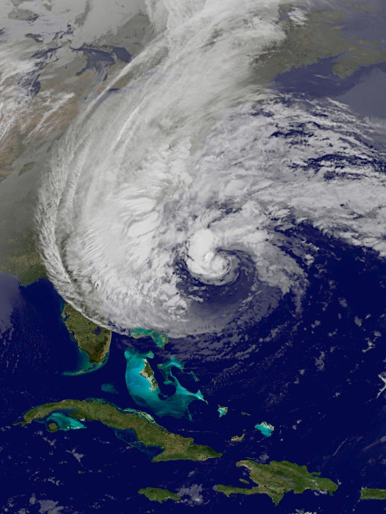
As Hurricane Sandy heads toward the East Coast, storm crews are placing hundreds of sensors to predict the toll of flooding in the region.
"The combination of an extremely dangerous storm surge and the tide will cause normally dry areas near the coast to be flooded by rising waters," according to a National Hurricane Center advisory.
New York City may see its biggest storm surges in history.
"With the high tide occurring tomorrow night, we are looking at many locations approaching record levels of storm surge," said National Weather Service spokesperson Sean Potter.
Hurricane Irene, for instance, caused surging tides that reached only 4 feet (1.2 meters). In contrast, Sandy is expected to cause life-threatening flooding in New York Harbor and tides of 6 feet to 11 feet (1.8 to 3.3 meters) in areas of Long Island Sound, according to the National Weather Service. For instance, the Battery in lower Manhattan is expected to see 11.7-foot storm surges, surpassing the 10-foot surges recorded in 1960 with Hurricane Donna, Potter told LiveScience.

A full moon Monday may intensify storm surges, as the moon's tug will make high tides along the Eastern Seaboard about 20 percent higher than normal, Joe Rao, a meteorologist for News 12 in Westchester, N.Y., told LiveScience sister site OurAmazingPlanet.
The storm's projected duration may also worsen flooding. "We'll still see tropical storm-force winds occurring for 24-36 hours starting into tomorrow morning going into Tuesday afternoon," Potter told LiveScience. "That's one thing that really sets this storm apart compared to Hurricane Irene."
Sign up for the Live Science daily newsletter now
Get the world’s most fascinating discoveries delivered straight to your inbox.
As of 11 a.m. ET on Sunday, Oct. 28, the center of Hurricane Sandy was located 250 miles (400 kilometers) southeast of Cape Hatteras, N.C., and 575 miles (930 km) south of New York City. The storm is moving toward the northeast near 14 miles per hour (23 kilometers per hour). The current forecast track puts the center of Sandy near the coast Monday night, according to the National Hurricane Center.
The winds will likely be near hurricane force at landfall, according to the National Hurricane Center advisory.
The U.S. Geological Survey (USGS), along with other federal agencies, are latching 150 storm surge sensors to poles on piers from Massachusetts to Chesapeake Bay. The gauges track wind gusts, rainfall and water levels at the coast, and eight of the sensors track the storm-tide in real-time as it reaches land.
Tracking the toll of Hurricane Sandy will help predict flooding in future storms, according to the USGS.
"With Sandy wehave the opportunity to test and improve predictive models of coastal zone impact based on what we previously learned," said USGS director Marcia Hutt in a press release.
Follow LiveScience on Twitter @livescience. We're also on Facebook & Google+.

Tia is the managing editor and was previously a senior writer for Live Science. Her work has appeared in Scientific American, Wired.com and other outlets. She holds a master's degree in bioengineering from the University of Washington, a graduate certificate in science writing from UC Santa Cruz and a bachelor's degree in mechanical engineering from the University of Texas at Austin. Tia was part of a team at the Milwaukee Journal Sentinel that published the Empty Cradles series on preterm births, which won multiple awards, including the 2012 Casey Medal for Meritorious Journalism.

