A Stunning Map of Hurricane Sandy's Winds


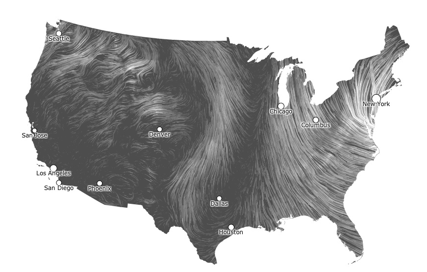
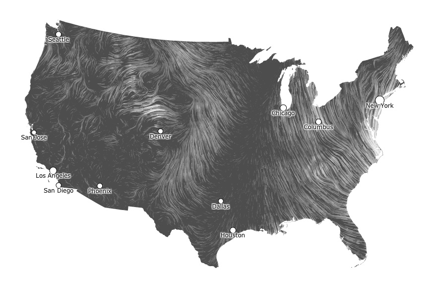
A beautiful animation just out shows Hurricane's Sandy's wind gusts as the Frankenstorm moves up the East Coast.
Screenshots taken from the map animation capture Sandy's winds advancing north last night and this morning (Oct. 29).
The map was created by Fernanda Viégas and Martin Wattenberg, artists/technologists who lead Google's "Big Picture" visualization research group in Cambridge, Mass., according to their website.
The map highlights just how big and powerful the storm is. As of 11 a.m. ET, it has strengthened and boasts maximum sustained winds of 90 mph (150 kph), according to the National Hurricane Center (NHC). It's currently transitioning into an extra-tropical storm, similar in some respects to the Perfect Storm of 1991, and could strengthen further. Its winds have piled up water and are expected to create a life-threatening storm surge that could exceed 11 feet (3.4 meters) in some areas. [4 Things You Need to Know About Hurricane Sandy]
Sandy currently has hurricane-force winds extending up to 175 miles (280 kilometers) from its center, and tropical storm-force winds out to 485 miles (780 km), according to the NHC. That's second only to 2001's Olga in terms of the size of wind field of a storm. (Olga's winds extended out 600 miles (965 km).
Faster winds are shown as thicker white lines, and the speed of the wind can be determined by zooming in and clicking on individual gusts. The map was created by taking surface wind speeds from the National Digital Forecast Database, which is updated every hour.
"So what you're seeing is a living portrait," the duo writes on their site.
Get the world’s most fascinating discoveries delivered straight to your inbox.
Follow OurAmazingPlanet on Twitter @OAPlanet. We're also on Facebook and Google+.


