Hurricane Sandy Profiled in New Side-View Image

There have been plenty of images of Hurricane Sandy from above, but there's a new image that gives a side profile, or cross section, of the storm.
NASA's CloudSat satellite captured an image of Hurricane Sandy at 2:30 p.m. ET on Saturday (Oct. 27), as the storm began dropping large amounts of rain on North Carolina.
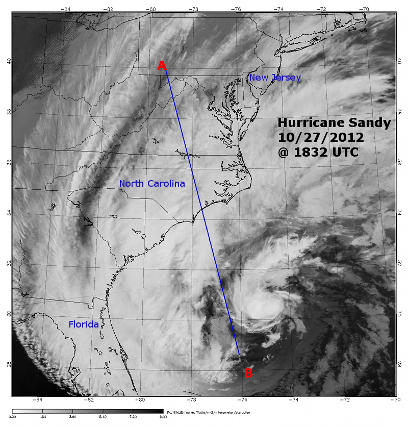
A second image shows the path CloudSat travelled to take this image, starting near southwestern Pennsylvania and moving south over the Atlantic, off the coast of Florida.
On the very bottom of the image, the brown stripe shows the point at which the satellite was over land; the blue shows the ocean surface, said Natalie Tourville, a scientist at Colorado State University who works on CloudSat.
The blue-hued areas toward the top of the image show ice particles at the top of Sandy's clouds, and water droplets appear green to pink, with green being the smallest and pink being the largest droplets. Pink areas designate large quantities of water. The red colors toward the bottom show areas of intense rainfall, Tourville told OurAmazingPlanet.
On the left, you can see an isolated area of rain churned up by Sandy's vast wind fields, Tourville said.
Toward the right of the image, where there is a gap in the colors, there is a mass of dry air sucked into Hurricane Sandy, she said.
Sign up for the Live Science daily newsletter now
Get the world’s most fascinating discoveries delivered straight to your inbox.

Reach Douglas Main at dmain@techmedianetwork.com. Follow him on Twitter @Douglas_Main. Follow OurAmazingPlanet on Twitter @OAPlanet. We're also on Facebook and Google+.


