Images Show How Hurricane Sandy Rocked Jersey

Hurricane Sandy hit the Jersey Shore especially hard and new images show how the superstorm dramatically altered the landscape up and down the coast.
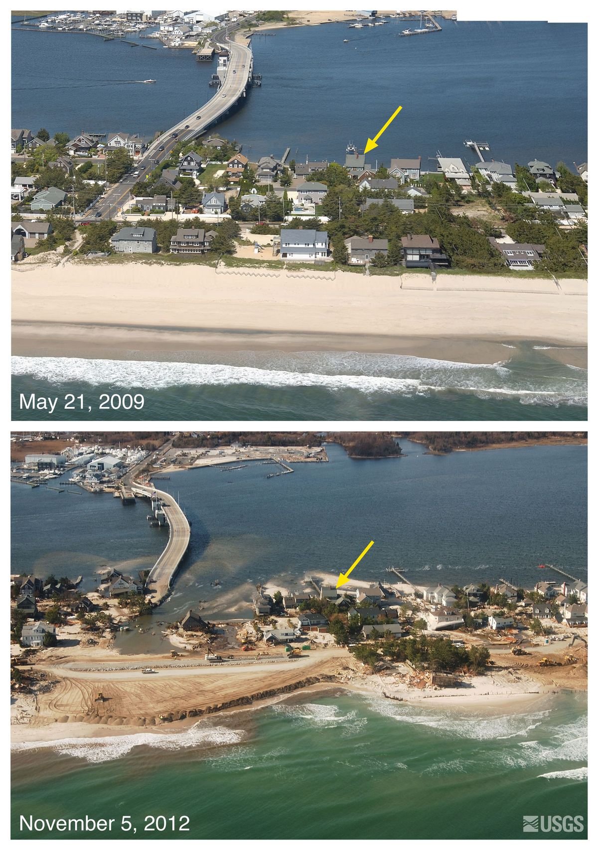
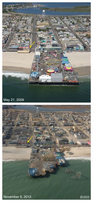
The photos from the U.S. Geological Survey (USGS) feature different points along New Jersey's coastline on May 21, 2009 in contrast with the same locations on Nov. 4-6, 2012, days after Sandy made landfall near Atlantic City.
The pictures show how Sandy's pounding waves and powerful surge pushed around the earth. The storm flattened dunes, tore down rock shore-protection structures and washed huge deposits of sand over barrier beaches and into bays. Besides the vast beach erosion, the post-Sandy photos also show how the storm wrecked houses, even sweeping some of them off their foundation in towns like Seaside Heights. [See the Before and After Photos]

The East Coast has been facing steady erosion for 150 years, according to a USGS report released in February 2011, which found that beaches in New England and the Mid-Atlantic are losing an average of about 1.6 feet (0.5 meters) per year. Storms like Sandy, as well as Hurricanes Ida (2009) and Irene (2011), exacerbate the problem when they eat away at protective seawalls and dunes.
Follow LiveScience on Twitter @livescience. We're also on Facebook & Google+.
Sign up for the Live Science daily newsletter now
Get the world’s most fascinating discoveries delivered straight to your inbox.


