2012 One of the Most Active Hurricane Seasons
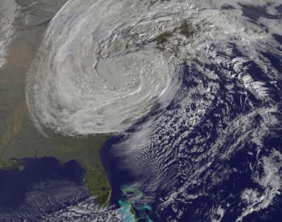
This year's hurricane season officially ends today (Nov. 30) and will be remembered primarily for Hurricane Sandy, for obvious reasons. But Sandy was only the last hurricane in a very active — and unusual — season.
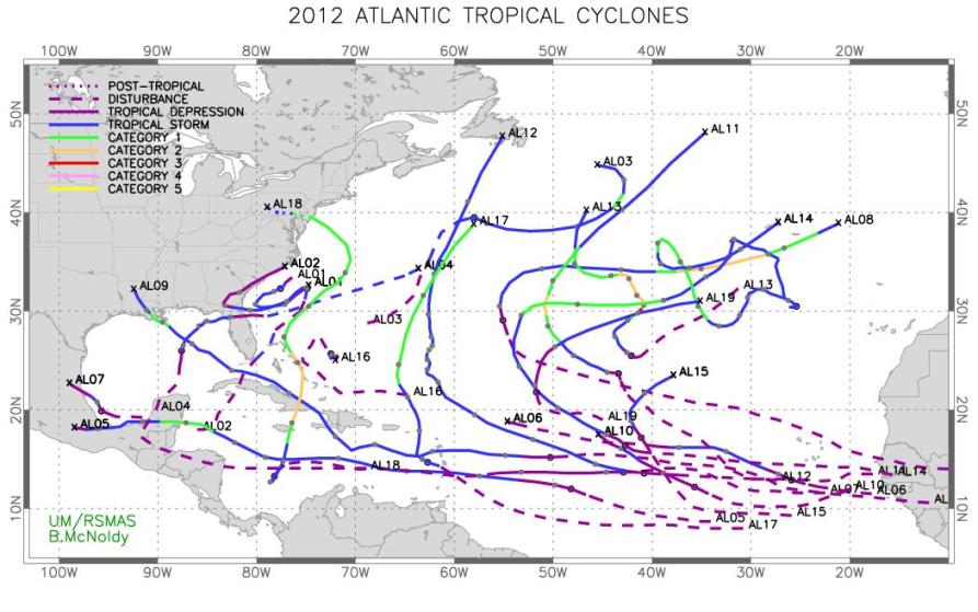
One of the busiest on record, the 2012 season also saw weaker-than-average cyclones and began earlier than usual, said Brian McNoldy, a researcher at the University of Miami.
There were 19 named tropical storms this year in the Atlantic Ocean basin tying 2012 at third for most named-storms in recorded history, McNoldy told OurAmazingPlanet. The top spot goes to the 2005 season, which saw 28 named storms. A storm is named once it attains tropical storm status, defined as a rotating, organized storm with maximum sustained winds of at least 39 mph (63 kph). [In Images: Hurricane Season 2012]
Early rise
Two storms, Alberto and Beryl, spun up this spring before the official hurricane season start date of June 1, an unusual occurrence, McNoldy said. These resulted from warmer-than-average surface temperatures throughout the Atlantic. Beryl was the earliest second-named storm of any season since record keeping began in 1950, according to government records. (The official start date is a human-imposed one based on statistical averages of hurricane season starts. Likewise, another hurricane could arise after today's season end, although it isn't likely.)
Over the last 30 years, an average of 12.1 named storms, 6.4 hurricanes and 2.7 major hurricanes have occurred per year, McNoldy said. This year, 10 hurricanes appeared, but only one of them, Hurricane Michael, grew intense enough to rank as major (defined as Category 3 or stronger on theSaffir-Simpson scale). And Hurricane Michael only maintained this level of intensity for six hours, McNoldy said.
In fact, the United States has not been hit with a major hurricane since 2005, by far the longest respite on record, according to McNoldy.
Sign up for the Live Science daily newsletter now
Get the world’s most fascinating discoveries delivered straight to your inbox.
While major hurricanes were scarce this year, storms still caused major damage, particularly Hurricane Sandy. That storm killed 125 people in the United States, and another 71 people in the Caribbean, including 54 in Haiti, according to the Associated Press. Hurricane Isaac also walloped the South in late August, causing a storm surge of up to 11 feet (3 meters) in some areas. Mainly, though, it poured down rain, dropping some 23 inches (58 centimeters) near Gretna, La., for example, according to the National Hurricane Center.
Blame it on the heat
The large number of hurricanes seen this season resulted, in part, from above-average surface temperatures throughout the Atlantic, conditions which help cyclones form, said Jeff Weber, a scientist with the University Corporation for Atmospheric Research in Boulder, Colo. Temperatures reached about 6 degrees Fahrenheit (3 degrees Celsius) above average this summer, he said.
However, air higher up in the atmosphere also got warmer than usual. This helped to cap the storms' strength, McNoldy said; hurricanes intensify the most when the upper atmosphere stays cool. The difference between the warm surface and cool atmosphere provides strength to cyclones, which function like giant heat engines, he said.
Nevertheless, this year's storms still packed a punch. Scientists use Accumulated Cyclone Energy, or ACE, to measure the intensity of a hurricane season; the measure quantifies the amount of energy contained in cyclonic winds, taking into account the number, duration and intensity of storms. The 2012 season finished with an ACE of 126.2, or about 137 percent of an average season. The median value from 1951 to 2010 is 92.4, as McNoldy noted in a piece he wrote for the Capital Weather Gang.
More than predicted
In its first hurricane season forecast, made before the season began, the National Oceanic and Atmospheric Administration predicted nine to 15 named storms. Then, in August, the organization upped its prediction to 12 to 17 named storms, with five to eight of those becoming hurricanes. The revision was based on changes to climate patterns that affect storm formation. A tropical storm becomes a hurricane once its top winds hit at least 74 mph (119 kph).
The 19 named storms this season beat even the revised prediction.
It's relatively unusual to have more storms than forecast. The underestimate can be blamed on El Niño, or rather, the lack of El Niño, Gerry Bell, the lead hurricane season forecaster at NOAA's Climate Prediction Center, told OurAmazingPlanet in October, when Hurricane Sandy formed. Forecasters predicted that this weather pattern, characterized by cool surface temperatures in the Pacific Ocean, would have developed by the fall. But it didn't.
Therefore, cyclone activity continued longer than expected in the Atlantic, unperturbed by El Niño, which spawns high level winds that stream eastward and can disrupt the swirling motion that gives a developing storm its power, McNoldy said.
This year contributes to a recent trend of increased hurricane numbers. It is one of only seven years on record with 19 or more cyclones. Three of those seven years are 2010, 2011 and 2012.
One main reason for the recent abundance of cyclones is that, since 1995, the Atlantic Ocean basin has been in the warm phase of a cyclical weather pattern called the Atlantic Multidecadal Oscillation, with hotter than average surface temperatures throughout the tropics and sub-tropics, Bell said. This pattern lasts for about 25-40 years, and comes with more hurricanes than its "cool" phase, he said. Warm water helps hurricanes form and gives them strength. [Infographic: How, When & Where Hurricanes Form]
In addition, the past few years have also seen a strong West African monsoon, which creates disturbances in the eastern Atlantic that can turn into cyclones, Bell said. There's also been relatively weak wind shear in the tropical Atlantic, where cyclones form. Wind shear is a difference in wind speed or direction between the low and high atmosphere, which tears apart developing storms. El Niño tends to hamper cyclone formation via wind shear.
The season's end
Global warming likely isn't to blame for the increase in hurricanes, McNoldy said. Many climate models suggest that increased temperatures could lead to fewer, but stronger hurricanes worldwide, he said, essentially the opposite of what we saw this year.
Better technology also allows us to detect more hurricanes than in the past, Weber, of UCAR, said. In the past few decades, satellites have significantly increased the detection of short-lived tropical storms, i.e. ones that last fewer than 36 hours.
This year's season ended with Hurricane Sandy, which caused widespread devastation thanks to a tremendous storm surge throughout New Jersey and New York. Sandy will go down as the second costliest storm in U.S. history. This storm was unusual, as the first storm to retain hurricane strength north of the jet stream, the wind pattern that moves air from west to east across North America and into the Atlantic, Weber said. Sandy also registered the lowest barometric pressure in the history of the Northeast, he said. Once it moved north of the Gulf Stream, Sandy interacted with a mass of cold air moving east across the continent, causing it to transition to an extratropical storm and wreak so much devastation, he said.
Scientists are still studying Sandy to understand how it formed, and whether or not climate change might have contributed. "It could be a freak thing, or we could be going into a new climate regime where we're likely to see more impacts like this in the future," Weber said.
Reach Douglas Main at dmain@techmedianetwork.com. Follow him on Twitter @Douglas_Main. Follow OurAmazingPlanet on Twitter @OAPlanet. We're also on Facebook and Google+.

