3D Imaging Sizes Up Volcanic Island Landslides
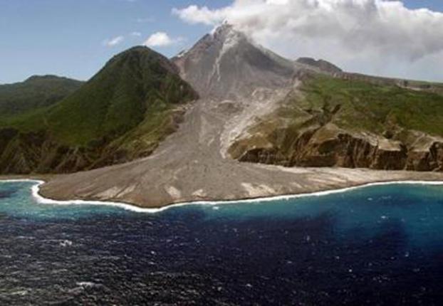
In the summer of 1995, the sleepy Soufrière Hills volcano on the Caribbean island of Montserrat awoke. The volcano has been erupting ever since, and its lava flows and ash falls have destroyed the capital city of Plymouth and what was, at the time, Montserrat's only airport.
As lava flows like these move toward the ocean, they can build up and cause massive landslides. Those landslides are, of course, dangerous to the communities and structures in their paths, but they also pose other, less direct dangers.
"Understanding how volcanic island landslides are triggered and emplaced is important because of the hazard they pose directly, and because they can generate potentially very destructive tsunamis," writes a team of researchers led by Gareth Crutchley of the Helmholtz Centre for Ocean Research in Kiel, Germany.
The team used 3D seismic imaging to map underwater landslide deposits from the Soufrière Hills volcano in hopes of sizing up tsunami risks and understanding the mechanisms that trigger volcanic island landslides across the globe.
Imaging the debris in 3D
Volcanic islands like Montserrat are home to some of the planet's largest landslides. Thousands of cubic miles of rock and hardened lava can slough off in a single event, causing widespread damage as the material makes its way to the ocean. Landslides like this have played a major role in shaping Montserrat throughout its history, the researchers say, but scientists have never been able to observe one in action.
"Better constraining how landslides are emplaced is challenging because we are yet to monitor directly a large-volume volcanic landslide that enters the sea," Crutchley wrote. "Much of our understanding must be based on the rock record of previous landslide deposits and advanced through experiments and modeling strategies."
Sign up for the Live Science daily newsletter now
Get the world’s most fascinating discoveries delivered straight to your inbox.
To begin to get a handle on the consequences of large landslides, the team used seismic imaging to map a section of the seafloor with two major landslide deposits. Like the seismic data scientists gather during an earthquake, seismic images allowed the team to look at the internal structure of the rubble.
What's more, they gathered the first-ever 3D seismic images of this type of landslide, allowing them a much deeper glimpse of the deposits' subtle details.
Three ways to slide
Crutchley's team found a series of landslide events preserved in the seafloor deposits.
The oldest material seems to come from a volcanic flank collapse — an event triggered when an entire side of a volcano catastrophically fails. That debris reached the ocean and flowed eastward along the seafloor until it likely reached a subtle incline and began to flow south, the team found.
The younger deposit is likely from a single, rapid debris avalanche, the researchers say. This type of event happens when rocky material from the steep slope of the volcano fails, begins to slide and shears off additional debris. [50 Amazing Volcano Facts]
The team examined another set of rubble lying between these two deposits. Seismic imaging suggests this layer comes from a series of particle-laden mass flows — a type of underwater debris current that happens when hot volcanic gases, lava and ash reach the sea. Since the current eruption started in 1995, most volcanic material has been deposited this way, the researchers say.
Based on the team's success in mapping the Montserrat deposits, Crutchley says high-resolution 3D seismic imaging looks to be a very promising technique for understanding volcanic island landslides.
The findings were published in the Jan. 1 issue of the journal Marine Geology.
This story was provided by OurAmazingPlanet, a sister site to Live Science.


