Stalled Cold Front Spotted from Space

Get the world’s most fascinating discoveries delivered straight to your inbox.
You are now subscribed
Your newsletter sign-up was successful
Want to add more newsletters?
Join the club
Get full access to premium articles, exclusive features and a growing list of member rewards.
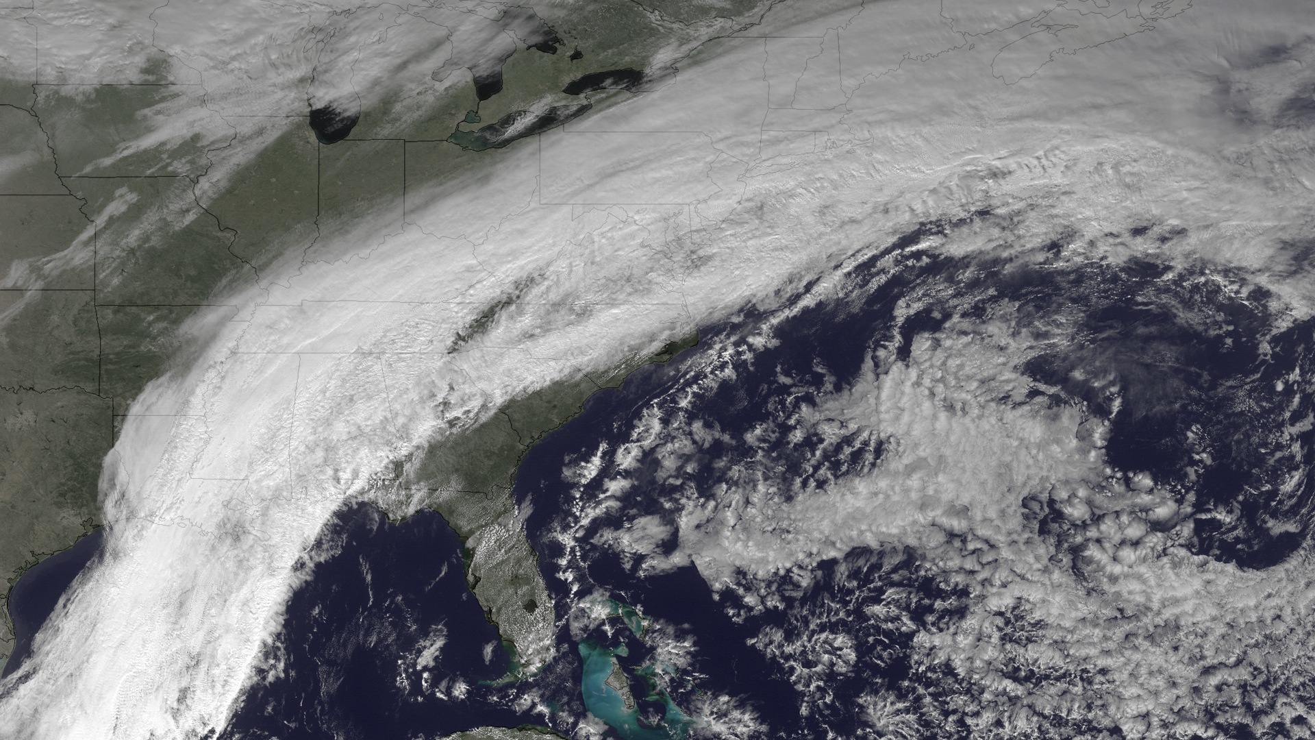
A cold front sweeping across the United States stalled out over the East Coast today (Jan. 17), causing flash floods in the Southeast and bringing heavy snows to the North.
The GOES satellite snapped the stagnant system yesterday as it draped across the eastern states.
The mass of cold air is dropping snow across the southern Appalachians and into parts of Washington, D.C., and Baltimore, Accuweather.com reported. Flash floods are hitting parts of eastern Tennessee and the Carolinas.
Article continues belowThe heavy rains and snow result from the brutal trough interacting with a ridge of high pressure centered over Bermuda, climatologist Jeff Weber told OurAmazingPlanet in an email interview.
The stalled front finally will be pushed farther east by a new blast of Arctic air expected early next week, said Weber, a scientist with the University Corporation for Atmospheric Research, in Boulder, Colo. This could bring freezing temperatures to areas as far south as northern Georgia by Jan. 22.
The system sitting over the East Coast was produced by an extreme southward dip in the jet stream, which allowed cold air to travel south into California earlier this week. After setting a record daily low in Los Angeles on Jan. 14, the air mass marched across the country, settling in for a predicted week of havoc in the East.
Reach Becky Oskin at boskin@techmedianetwork.com. Follow her on Twitter @beckyoskin. Follow OurAmazingPlanet on Twitter @OAPlanet. We're also on Facebook and Google+.
Get the world’s most fascinating discoveries delivered straight to your inbox.

 Live Science Plus


