Second Arctic Outbreak on the Way
This article was provided by AccuWeather.com.
Another blast of arctic air will sweep from the northern Plains to the mid-Atlantic and New England as the week progresses.
The cold wave will follow a brief warmup that will lead to severe weather in some locations.
According to Meteorologist Mark Paquette, "A second pulse of stratospheric warming occurred during the middle of January is now sending another blast of arctic air southward."
For information on how stratospheric warming yielded the nasty cold wave from last week, consult "Evolution of the Arctic Outbreak." In short, sudden warming in the stratosphere is often a sign that arctic air will build and drive southward into the mid-latitudes two to three weeks later.
The new wave of arctic air will be almost as cold as the first blast that hit during the latter part of week three and the first part of week four of January.
"The latest indications are this frigid blast will not be quite as long-lasting as the first, probably lasting three to five days instead of the week-long barrage just experienced," Paquette said.
Sign up for the Live Science daily newsletter now
Get the world’s most fascinating discoveries delivered straight to your inbox.
However, this time the arctic blast will be following very closely behind a couple of days of warm weather shifting from west to east over the Plains, Midwest and the East. As a result, it will pack just as much, if not more, shock than the first.
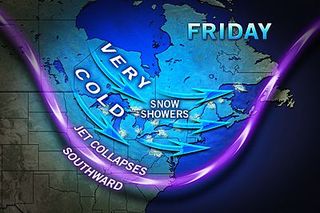
Minneapolis may have another day where temperatures fail to get above zero.
In Chicago, two to perhaps three days of temperatures no higher than the teens are likely.
Around New York City and the I-95 mid-Atlantic, it is possible there are a few days where temperatures do not get above the freezing mark.
How cold it gets at night from region to region will depend on where the core of the arctic air settles, as well as sky and wind conditions. Clear and calm conditions with fresh snow cover are ideal for allowing temperatures to plummet to bitterly cold levels at night.
Beyond the several-day stretch of dead-of-winter cold from the northern Plains to the mid-Atlantic and New England, the pattern will turn a bit more progressive. This means that shifting bouts of cold air and mild conditions will occur through much of the rest of the month over the same areas.
According to Long Range Weather Expert Joe Lundberg, "It appears the stratosphere is now entering a cooling phase, so we should not see prolonged cold lasting into March.
"The only thing that would derail the progressive pattern beyond early February would be if there was another stratospheric warming event and there is no way to reliably forecast that," Lundberg added.
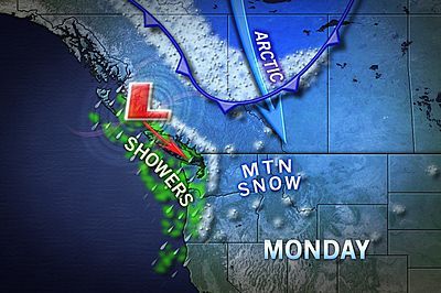
While some chilly air and snow has settled into parts of the West, it will not pack the cold punch of earlier in the month, where a frost reached the coast of Southern California and freezing air dipped into southern Arizona. The second arctic outbreak is not aiming for the Deep South.
In terms of snow, February is typically a stormy and unsettled month.
While face-value looks of the pattern and a lack of blocking high pressure over Greenland may not yield blockbuster blizzards, there is still the potential for rounds of moderate snowstorms during the changing of the guard.
While the period from the second half of February into March is not likely to bring steady arctic cold in the Northeast, temperatures will end up averaging near to slightly below normal for the period, which would be a switch from much of the winter thus far.
AccuWeather.com plans to release its spring 2013 forecast on Wednesday, Jan. 30, 2013.
AccuWeather.com. All rights reserved. More from AccuWeather.com.
The weather is getting stranger, right? Well, for the most part no, scientists say, but humans often think so when a strange event does occur. So here’s your chance to prove how much you known about weather oddities.
Weird Weather: One Strange Quiz
