Recap of the Dramatic Jan. 27-31, 2013, Storm
This article was provided by AccuWeather.com.
From snow to flooding, temperatures extremes, damaging winds and deadly tornadoes, this storm system had it all. This story recaps the dramatic events of the storm this week.
Areas of heavy snow developed over the interior West during the past weekend. One of the components of the storm produced close to 10 inches of snow in Salt Lake City and a few inches of snow around Denver on Monday, Jan. 28, 2013.
As the storm and its snow emerged over the Plains, surging warmth combined with increasing winds aloft began to produce a few thunderstorms with hail from portions of Oklahoma to near Lake Michigan. A handful of damaging wind incidents were also reported in portions of Oklahoma.
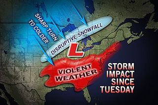
However, the storm was not going to stop with snow over the West and a few minor severe weather incidents. Violent weather associated with the storm would go on to reach nearly 2,000 miles from Oklahoma to New Brunswick in the days ahead.
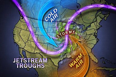
Steering winds high in the atmosphere, known as the jet stream, were developing a huge buckle, not only the middle of the United States, but much of North America.
This is an example of a large buckle in the jet stream setting up a large southward dip, known as a trough and a large northward bulge, known as a ridge.
Sign up for the Live Science daily newsletter now
Get the world’s most fascinating discoveries delivered straight to your inbox.
According to Chief Meteorologist Elliot Abrams, "At peak in this particular situation, the hairpin curve to the jet would be able to send a particle from the Arctic Circle, southward to Mexico over the Plains, then northeastward to nearly Greenland."
This huge buckle was driving below-zero air southward over the Canada Prairies and into the northern Plains by Tuesday, Jan. 29 and 60 and 70 degree air into the Ohio Valley and parts of the mid-Atlantic.
The temperature contrast, combined with the tremendous jet stream energy would begin to set off a much more substantial severe weather outbreak Tuesday from Oklahoma and Texas to the Tennessee and Ohio valleys. On this day, over 420 reports of severe weather occurred including nearly 400 incidents of damaging wind gusts and nearly two dozen reports of tornadoes.
Fortunately, the tornadoes were on the low-end of the Fujita Scale, and were short-lived. There were no reports of fatalities or serious injuries from the storms this day. And, there was beneficial rainfall over part of the Missouri, Arkansas, Illinois, Ohio and upper Mississippi basins. Enough rain fell to bring Mississippi River levels up at St. Louis.
During Tuesday night, the charging cold air was producing a swath of snow over lower elevations on the Central Plains and the snow was spreading northeastward into the Upper Midwest. The snowfall will translate to more future moisture for agriculture in part of the region and runoff into part of the Mississippi waterway.
By Wednesday, snow was piling up to a half of a foot or more in portions of Iowa and Wisconsin and snow was covering the ground around Kansas City.
At the same time Wednesday morning, temperatures were below zero over much of North Dakota, but were surging to record highs (66 degrees in Buffalo, N.Y., and 74 degrees in Morgantown, W.Va.) over parts of the eastern Ohio Valley and eastern Great Lakes ahead of zone of heavy rain and gusty winds, known as a squall line.
The squall line, over 1,000 miles long, stretched from the Gulf of Mexico to the eastern Great Lakes Wednesday morning and continued to produce incidents of flash flooding and damaging wind gusts.
Unfortunately, the severe weather was just getting warmed up along with the temperature.
Rain was falling on much less needy areas from the eastern Ohio Valley to the central and southern Appalachians. There were multiple incidents of flash and urban flooding, including in Chattanooga, Tenn. Roads were flooded or washed out as far north as Muskegon and Ottawa counties in Michigan.
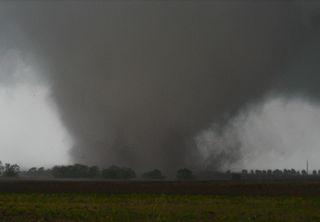
The severe weather would take on more damaging and deadly consequences in northwestern Georgia during the midday hours Wednesday. A large and strong tornado touched down in Adairsville, claiming the life on one person and injuring 14 others. The storm overturned 100 vehicles on nearby I-75.
Additional violent storms would cause multiple injuries during the midday Wednesday in northwestern Georgia.
An additional 300 incidents of severe weather would occur on Wednesday, Jan. 30, 2013. reaching from northern Florida to Pennsylvania resulting in extensive property damage and downed scores of trees, which took power lines with them in some cases.
Gusts between 50 and 70 mph occurred as far north as southwestern Pennsylvania during the midday hours Wednesday. The carnage continued during the afternoon and evening east of the Appalachians in the South, where temperatures in some locations surged past 80 degrees.
The violent weather was not done yet.
During the morning and midday hours of Thursday, Jan. 31, 2013, intense rainfall and high winds swung through the coastal areas of the mid-Atlantic, New England and into portions of New Brunswick.
Powerful gusts knocked out power to tens of thousands in Connecticut alone early Thursday. Gusts reached hurricane force at Langley Air Force Base in Virginia and at Blue Hill Observatory in Massachusetts.
Rainfall ranging from 1 to 4 inches over a several-hour period continued from the Mississippi basin Tuesday and the Appalachians and South Wednesday to the Northeast early Thursday as well. The wall of rain and flash flooding that quickly followed caught motorists by surprise in northern Virginia and in the Washington, D.C., area.
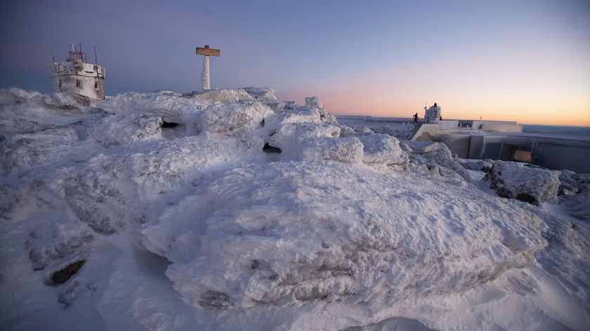
The huge buckle in the jet stream was shifting eastward. The charge of cold air that began over the northern Plains days earlier was sweeping across the Midwest, setting off bands of flurries, snow squalls and heavy lake-effect snow. The squalls were bringing local whiteouts and were combining with the plunging temperatures to bring a rapid freeze-up as far east as the central Appalachians. Powerful gusts of cold wind were bringing down trees and power lines in upstate New York.
Temperatures in Chicago were nearly 50 degrees lower Thursday morning, when compared to 48 hours earlier. In Pittsburgh, the temperature at 10:00 a.m. Thursday was 25 degrees or 43 degrees lower than at the same time the day before, when a record high of 68 degrees was achieved. AccuWeather.com RealFeel® temperatures were 4 below zero and 8 above zero degrees at Chicago and Pittsburgh, respectively, at 10 a.m. Thursday. RealFeel temperatures were 60 degrees below zero in parts of North Dakota at the same time Thursday.
While actual numbers on the cold on the East Coast were not expected to be as extreme as the arctic outbreak a week earlier, the sudden rush of cold air will be a shock to some people and will cause areas of runoff to freeze in some cases for a couple of days.
AccuWeather.com. All rights reserved. More from AccuWeather.com.
The only sure thing about weather forecasts is that they’re wildly different all over the planet. Test your knowledge on the wild ranges in temperature, precipitation and more.
Extreme Weather Facts: Quiz Yourself
