'Earth from Space': See the Planet Like Never Before
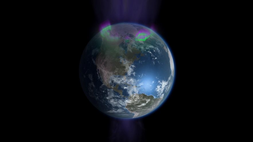
You may have seen pictures of our planet from space, but never quite like this. A new NOVA show on PBS, "Earth from Space," features amazing images captured by satellites used to observe the planet, and these pictures have given scientists a better view and understanding of the Earth than ever before. The NOVA program features photos, videos, computer models and other data that the show's creators have combined to create a comprehensive image of Earth's interconnected ecosystems.
OurAmazingPlanet caught up with NOVA senior executive producer Paula Apsell to hear more aboutthe new program, which debuts Wednesday, Feb. 13, at 9 p.m. ET (8 p.m. Central) on PBS (check local listings).
OurAmazingPlanet: Tell us about the show.
Paula Apsell: There are more than 120 satellites used to capture images of the Earth. I think most people know that satellite technology exists and that satellites have improved weather predictions … But I don't think most people know how much satellite technology has helped us to understand our planet.
Satellites don't just see how we see, with optical light, but can [also] see in infrared and microwave light. Because they see in so many waves in the electromagnetic spectrum, they can get more info about the earth than our eyes can give us.
The question becomes, with all these satellites in space, what have we learned? The answer is fascinating and unpredictable. The big take-home lesson is that everything is interconnected — the air, the land, the water and light itself are all part of one big system that works together and [they all] feed into each other. It's really given us, and scientists, a whole new view of the planet. [Watch a Preview of the Documentary]
OAP: How have satellites given scientists a new understanding of the Earth?
Sign up for the Live Science daily newsletter now
Get the world’s most fascinating discoveries delivered straight to your inbox.
PA: Well, for one, satellite imagery has shown us that studying any one thing in isolation isn't going to help you. You have to look at the planet as a system and see where these connections are.
OAP: Do you have any examples from the show of these connections?
PA: There are a bunch of examples of how different processes from different parts of the Earth are connected. We show how, for example, hurricanes that end up in Florida and the Gulf Coast often start near the Cape Verde islands off the coast of northwest Africa.
We also show how a massive, underwater waterfall in the Antarctic affects ocean currents as far away as Peru, nourishing plankton and an enormous stock of fish there, which helps feed everybody on Earth.
OAP: Are there any other ways that physical processes ultimately affect humans?
PA: The sun gives us energy for life to be sustained, and for electricity. There's a satellite called the Solar Dynamics Observatory that can look at forces from the sun and help scientists understand them. It can also help predict solar storms, which can completely disrupt all of our electronics. It's a satellite that's directly helping us protect and preserve civilization.
Other satellites have shown us how dust that blows off from deserts in Africa helps nourish plant life in the Amazon rainforest, which functions as the lungs of the Earth. It takes in carbon dioxide we breathe out and provides us with oxygen. Also, these plants provide us with many products like medicines.
Would anybody suspect that dust particles from African deserts go all the way to South America, fertilizing the rain forest? Without satellite imagery, I think that would be completely counterintuitive. [Earth Pictures From Space: Landsat Satellite Legacy]
OAP: Why have this show now?
PA: A lot of these satellites have been there for a long time. Some have gone past the number of years they were supposed to last. I think understanding the importance of satellites is key to people, because satellites don't last forever, and you have to replenish them.
We're at a point in time where, first of all, we're all profoundly affected by weather and climate change, and understanding scientific instruments that will let us know better what the future holds, that's important.
In some ways, it's a timeless show, but on the other hand, it's only now that scientists have enough satellites up there and enough computer power to have payoff in understanding these systems. The study of this is really reaching a certain mature level where you can actually say things about [the Earth]. That's the point at which NOVA feels it can tell stories.
OAP: What challenges did you face in making this program?
PA: The challenge was visualizing it. Satellites record all parts of the electromagnetic spectrum, only a small part of which is visible. I think the great achievement is how beautiful it is.
Also constructing a narrative, that's always a challenge. Where do you start? We decided we'd start with hurricanes, because that's such an immediate threat. How do satellites visualize the formation of hurricanes? We show that in a lot of detail.
OAP: What do you want people to take away from this program?
PA: I hope people take away from it how important these satellites are and how important these instruments are that enable scientists to get a better idea of how the planet works. I hope it will help people understand the Earth's complexity and appreciate it more, see how fragile it is, and learn more about what we need to do to keep our planet healthy.
Reach Douglas Main at dmain@techmedianetwork.com. Follow him on Twitter @Douglas_Main. Follow OurAmazingPlanet on Twitter @OAPlanet. We're also on Facebook and Google+.


