Satellite Spies Unusual Antarctic Sea Ice
Strong winds make for strange sea ice patterns in the Southern Hemisphere.
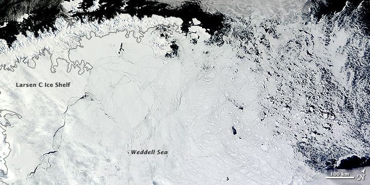
In the Weddell Sea along the coast of Antarctica, the sea ice stretched 124 to 186 miles (200 to 300 kilometers) north of its typical extent in January and February, according to the National Snow and Ice Data Center (NSIDC).
A satellite image snapped Feb. 22 by the Moderate Resolution Imaging Spectroradiometer (MODIS) on NASA's Terra satellite shows Antarctic sea ice tightly packed in the Weddell Sea, next to the Larsen C Ice Shelf. Ice to the north appears thin, diffuse and broken up, Walt Meier, a scientist at the NSIDC, told NASA's Earth Observatory. Though the ice is thin, the region north of the Weddell Sea typically has little or no ice at all this time of year, the Earth Observatory reported.
Cold winds driven by a persistent region of high pressure west of the Weddell Sea are responsible for the unusual ice pattern, according to the NSIDC. The high pressure means winds blow from east to north, pushing ice to the north. The wind pattern also brings cold air from the continent across the ice, keeping it from melting as it moves northward into warmer latitudes, the Earth Observatory wrote online.
Reach Becky Oskin at boskin@techmedianetwork.com. Follow her on Twitter @beckyoskin. Follow OurAmazingPlanet on Twitter @OAPlanet. We're also on Facebook and Google+.
Sign up for the Live Science daily newsletter now
Get the world’s most fascinating discoveries delivered straight to your inbox.

