How Arctic Ice May Have Influenced Superstorm Sandy
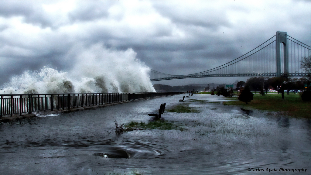
The sea ice covering the Arctic Ocean may not seem to be connected to a hurricane like Superstorm Sandy, but a group of scientists is suggesting the record lack of ice last summer could have set up the atmospheric pattern that sent Sandy barreling into the Northeast.
The potential link is just one of many ways that human activities can, and in some cases already seem to be affecting Earth's weather and driving it toward extremes, be they droughts, megafloods or superstorms like Sandy.
"Extreme weather of all sorts has been increasing around the Northern Hemisphere. When Sandy hit such a high-impact and vulnerable part of the East Coast, many reporters and local people have asked us whether climate change played a role," said Jennifer Francis of Rutgers University in New Jersey, one of the scientists who looked at the link. "It's the question on everyone's mind."
Sandy's start
Sandy began its life as a "classic late-season hurricane" over the Caribbean in mid-October, as the National Hurricane Center put it in its summary of the storm. It tore across Haiti, Jamaica, Cuba and the Bahamas, killing at least 67 people and causing enormous damage.
While Sandy weakened over the Bahamas, it also ballooned in size, giving its wind field an enormous footprint; then, like many storms that form when and where it did, it curved northward, paralleling the U.S. East Coast, driven by the prevailing currents in the atmosphere. As it skirted the coast, moving over the warm waters of the Gulf Stream, it also regained strength. [On the Ground: Hurricane Sandy in Images]
The storm weakened again as it moved farther north over colder waters, but never lost its extreme size. And as it continued on its path, a mass of high-pressure air sitting over Greenland kept it from simply curving out to sea. Not only that, noted Francis and her colleagues in their article, but it also caused the storm to do "something never observed before in records going back to 1851 — it took a sharp turn to the west and toward the most populated area along the eastern seaboard."
Sign up for the Live Science daily newsletter now
Get the world’s most fascinating discoveries delivered straight to your inbox.
That's where the Arctic sea ice comes in.
Sea ice and Sandy
The extent of sea ice covering the Arctic waxes and wanes with the seasons, reaching its high point near the end of the Northern Hemisphere winter, and its low point near the end of summer. But as Earth's average temperature has risen with global warming, the Arctic has been warming at two to three times the rate of the rest of the globe, Francis explained. This accelerated Arctic warming has fueled ice melt beyond normal summertime levels, which reinforces the warming because open ocean waters absorb the sun's rays, while ice reflects it. [8 Ways Global Warming Is Already Changing the World]
As the Arctic warms, the temperature difference between the poles and lower latitudes is reduced, which influences flow patterns in the atmosphere, because "that temperature difference is what drives the jet stream," Francis said.
The jet stream is what moves weather systems from west to east across the midlatitudes. When the temperature difference decreases, the jet stream slows down, and the kinks, or waves, in it hang around longer, as do the weather systems associated with them.
In the case of Superstorm Sandy, a large northward excursion of the jet stream hung around over Greenland, giving Sandy nowhere to go but west. (As it did so, it converged with another low-pressure system, becoming a hybrid extratropical cyclone-nor'easter, which fueled its destructiveness.)
"Our research suggests that these northward swings in the jet stream are happening more frequently now, especially in the North Atlantic, just like the situation that was in place when Sandy came along," Francis told OurAmazingPlanet in an email.
In particular last year, the sea-ice extent (or area covered) in the Arctic reached a record low in September, just over a month before Sandy made its ominous turn toward the coast.
What's expected in a warming world
Right now, as with other individual weather events and climate change, a direct link can't be made between that record sea-ice low and Sandy's path.
"We can't say that the record sea-ice loss last summer definitely created or enhanced the block that affected Sandy, but it's the kind of situation we'd expect to see more of as greenhouse gases continue to build up in the atmosphere and sea ice continues to dwindle," Francis said.
Francis added that it is possible to investigate the statistical likelihood that this record low played a part in Sandy's story.
"Numerical weather prediction computer models can be used to assess this question," she said. "They can be run with and without the various factors related to climate change to see how the storm would have developed in an environment before climate change really got going."
While Francis doesn't have funding ("yet," she said) to study Sandy, she expects many other scientists to delve into the conditions that led to the superstorm.
"I'm sure there will be a flurry of studies coming out over the next couple of years," she said.
Follow Andrea Thompson @AndreaTOAP, Pinterestand Google+. Follow OurAmazingPlanet @OAPlanet, Facebook and Google+.

Andrea Thompson is an associate editor at Scientific American, where she covers sustainability, energy and the environment. Prior to that, she was a senior writer covering climate science at Climate Central and a reporter and editor at Live Science, where she primarily covered Earth science and the environment. She holds a graduate degree in science health and environmental reporting from New York University, as well as a bachelor of science and and masters of science in atmospheric chemistry from the Georgia Institute of Technology.
