Images: Greenland's Gorgeous Glaciers
Life Above The Ice
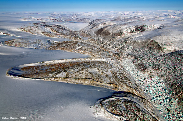
NASA's Operation IceBridge offers scientists a rare view of the ever-changing Arctic ice. From a seat aboard a P-3B plane, researchers soar close above Greenland's glaciers and fjords as they study the ice, part of an ongoing effort to monitor the changing extent of glaciers, sea ice and ice sheets at the poles. The 2013 IceBridge mission to Greenland and the Arctic was the project's fifth year in the far North, and the team is already gearing up for a trip south to Antarctica this fall. Here, IceBridge project scientist Michael Studinger shares some of his stunning photographs from the Greenland trip.
Shrinking glaciers
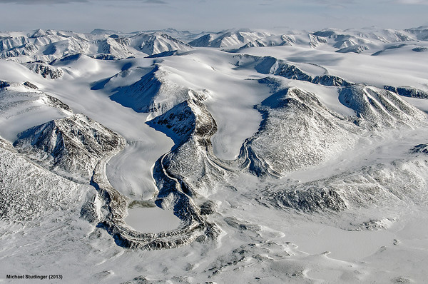
IceBridge project sciencist Michael Studinger calls this photo a textbook example of a receding glacier, one that's shrinking in size. The dark, arc-shaped piles are terminal and lateral moraines, jumbled rock piles left behind as the glacier recedes. A small, frozen lake sits at the left-hand terminus of the glacier. Taken in Thomsen Land, northeast Greenland.
Kee Bird wreck
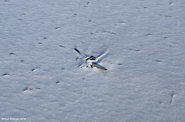
This is the famous Kee Bird plane wreck, a B-29 that crash-landed near the Petermann Glacier in 1947. The plane was repaired in 1995, but while it was taxiing for takeoff, the aircraft caught fire and was destroyed. The tracks surrounding the wreck are from polar bears.
Petermann Glacier
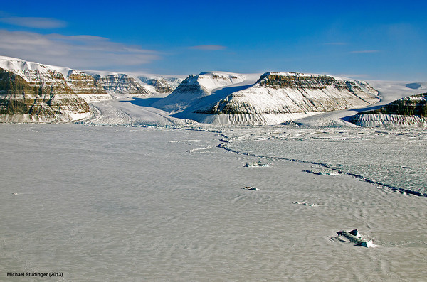
In July 2012, a massive iceberg broke off Greenland's Petermann Glacier, creating a new calving front several miles upstream. The calving front is where new icebergs form. The photo shows several valley glaciers now flowing directly into the fjord, which is covered by sea ice.
Saunders Island
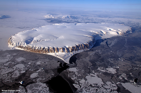
Flat as a pancake, Saunders Island sits in Wolstenholme Fjord, in northwestern Greenland. Kap Atholl is in the background. The sea ice ranges from thick, white ice to thinner grease ice.
Saw tooth shadows
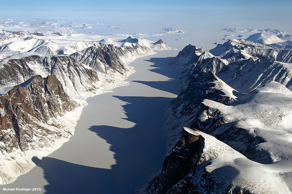
Jagged shadows create a monstrous grin on an ice-covered fjord on Canada's Baffin Island, near the Davis Strait.
Glacial dust
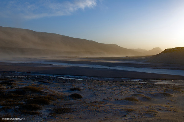
Glaciers drag along everything from pebbles to house-sized boulders as they flow, grinding rock down until it's as fine as flour. This photo shows a dust storm in the early morning sun in Kangerlussuaq, Greenland. The fine sand from the glacial deposits gets easily wind-borne and gets into computers, cameras and a visitor's eyes, said IceBridge project scientist Michael Studinger. The valley that runs from the Greenland ice sheet to Kangerlussuaq is named Sandflugtdalen, which means "valley of flying sand," he said.
Get the world’s most fascinating discoveries delivered straight to your inbox.
Moraines

The horseshoe-shaped rock piles are lateral moraines, piles of rock and debris formed by materials falling from valley walls. They form distinctive ridges when glaciers recede, or shrink. These moraines are next to the Penny Ice Cap on Canada's Baffin Island.
Sled dogs
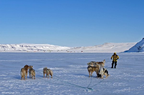
Sled dogs on the sea ice in North Star Bay, Thule. People in Greenland often travel short distances via snowmobile or dogsleds when they need to pick up supplies.
Ice River
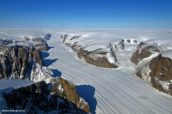
The Penny Ice Cap outlet glacier on Baffin Island, Canada.


