Gallery: Reading the Clouds
Clouds

Let's take a look at the different types of clouds in the sky, broken up into four groups — high clouds, middle clouds, low clouds and vertical clouds — and what they can tell us about the weather, both now and what's about to hit.
High Clouds Cirrus
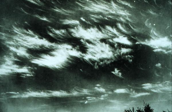
High clouds form at heights of 15,000 to 40,000 feet (4,500 to 12,000 meters). These are clouds that you only encounter on the top of high mountains or at the cruising altitude of a jet aircraft. Because at the altitudes at which they form the air temperature is below freezing, they tend to be comprised primarily of ice crystals. Like Peter Pan, most forms of high clouds lack the ability to cast shadows.
Cirrus clouds are the most abundant of all high level clouds. Cirrus means a "curl of hair." These wispy clouds are composed of ice and consist of long, thin streamers that are also called mare's tails. A few scattered cirrus clouds is a good sign of fair weather. However, a gradually increasing cover of web-like cirrus clouds is a sign that a warm front the leading edge of a warmer and more humid air mass is approaching.
Cirrostratus
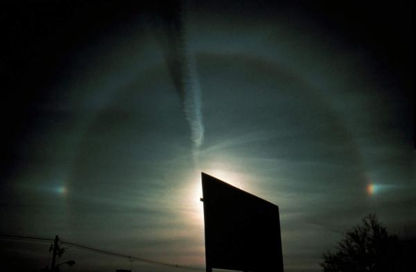
Cirrostratus clouds look like thin sheets that spread themselves across the sky. When the sky is covered by these icy shreds they give the sky a pale, white appearance. These clouds can indicate the approach of precipitation. So thin are they that they are translucent, or maybe even a little transparent, so that the sun and moon can be readily seen through them. Also look for a ring or halo surrounding the moon or sun when these clouds are in the sky, sometimes accompanied during the day by colored swatches of cloud called "sundogs," "mock suns," or parhelions.
Cirrostratus clouds usually come 12 to 24 hours before a period of rain or snow. Remember: "Circle around the moon, rain or snow soon."
Cirrocumulus
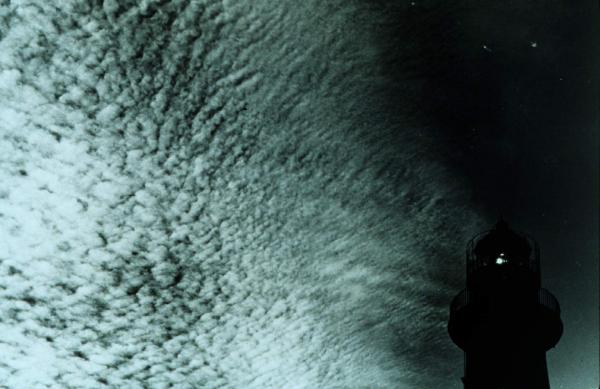
Another form of high cloud is cirrocumulus. These tend to be large groupings of white streaks that are sometimes seemingly neatly aligned. For most climates these clouds mean a spell of fair weather.
However, during the summertime in the tropics, these clouds may indicate an approaching hurricane. The outer fringe of a hurricane, called the outflow boundary, serves as a very important element in hurricane development because the outflow represents all the energy being released by the hurricane. A powerful hurricane always has good outflow and is accompanied by spiral bands of cirrocumulus flowing out from the center.
Middle Clouds Altocumulus
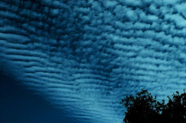
Middle clouds form at 6,500 to 20,000 feet (2,000 to 6,000 m). They are comprised of water, and, if cold enough, ice. Middle clouds frequently are opaque and block sunlight, but not always.
Altocumulus clouds are grayish-white with one part of the cloud darker than the other; there is a lot of contrast between light and dark. They are composed of water droplets and can blanket much of the sky in small, puffy, round layers. They resemble the striped patterns of fish scales on a mackerel hence the name "mackerel sky."
Mackerel skies and mare's tails formations sometimes appear in the same sky. When that happens, precipitation is sure to follow within 36 hours.
The old sailor's mnemonic for these kinds of clouds is "Mares tails and mackerel scales, tall ships carry short sails." Another is "Mackerel sky, storm is nigh," because if you see altocumulus clouds on a warm, humid morning, be prepared to observe thunderstorms late in the afternoon.
Altostratus
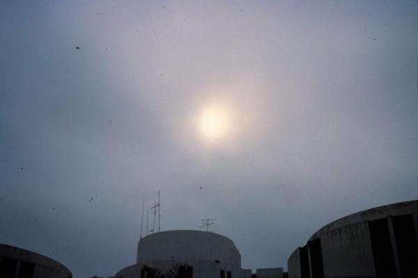
Altostratus clouds are grey and/or blue and cover the entire sky. The sun or moon may shine through an altostratus cloud, but will appear like a hazy and rather diffuse ball. Such clouds usually form ahead of storms that produce steady rain or snow.
Low clouds Stratocumulus
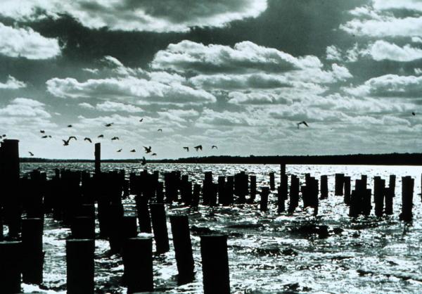
Low clouds form below 6,500 feet (2,000 m). These clouds tend to contain chiefly water, but can also be comprised of ice and snow if the weather gets cold enough. Low clouds block sunlight and usually bring precipitation and wind.
Stratocumulus clouds are low, puffy and gray. They appear as masses of puffy clouds with little or no space in between. A sky full of stratocumulus clouds indicates generally dry weather, though on occasion they can produce a brief light shower or sprinkle.
Sign up for the Live Science daily newsletter now
Get the world’s most fascinating discoveries delivered straight to your inbox.
Nimbostratus
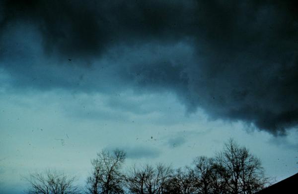
Nimbostratus clouds form a dark gray layer that is so thick that it completely blocks out the moon and sun. Nimbo is derived from nimbus means "rain-bearing" and these clouds will often produce precipitation in the form of a protracted period of rain and/or snow.
Stratus
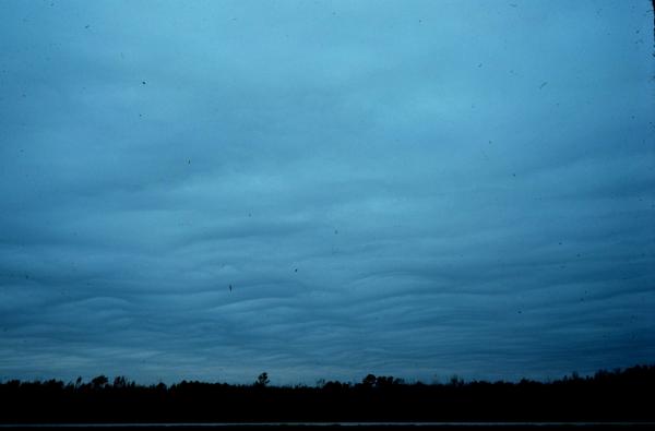
Stratus clouds are dull grayish clouds that often stretch across and block the entire sky; stratus means "a layer" and these clouds form flat, unbroken sheets, like a fog that is not on the ground. Stratus clouds produce only mist, drizzle or very light snow.
Vertical Clouds - Cumulus

Vertically developing clouds are the cumulus variety. Cumulus means "a heap" clouds that are separate, piled-up, fluffy and of different sizes. These puffy clouds are low "fair weather" clouds.
Cumulus Congestus
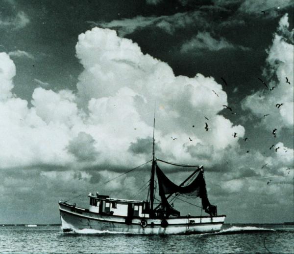
When the top of the cumulus clouds look like the head of a cauliflower, it is called cumulus congestus, or towering cumulus.


