Get the world’s most fascinating discoveries delivered straight to your inbox.
You are now subscribed
Your newsletter sign-up was successful
Want to add more newsletters?
Join the club
Get full access to premium articles, exclusive features and a growing list of member rewards.
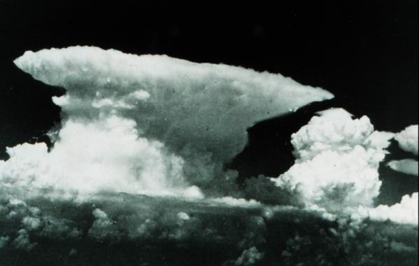
Cumulonimbus

As they develop vertically upward they may go from small, fair weather clouds to large, boiling monsters called cumulonimbus, also called thunderheads.
Such clouds are most often associated with cold fronts: When a mass of cool, dry air pushes into a warm, moist air mass, the heavier cool air acts like an atmospheric plow and pushes the warm air up into violent thunderstorms. High winds aloft can make the cloud's top into a flat anvil-like shape and their bottoms are usually very dark.
These clouds can forecast some of the most severe weather including torrential downpours, vivid lightning, hail and even tornadoes.
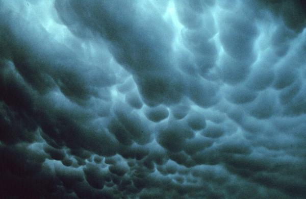
Mammatus Clouds

Clouds that look like hanging bulges from the skies are called mammatus clouds. More often than not, references statr that such clouds are a forbearer of severe weather, but actually, just the opposite is true: These clouds are formed by sinking air and are sometimes seen after a potent thunderstorm; they signal that a storm is retreating, not approaching.
Get the world’s most fascinating discoveries delivered straight to your inbox.

 Live Science Plus


