Alaskan Tundra Thaws as Summer Begins

Green is returning to the ground of Alaska's North Slope, as winter snows melt away, revealing the tundra below it.
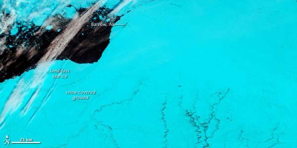
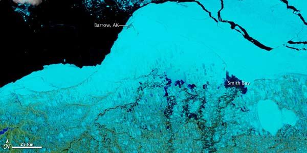
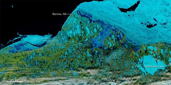
A series of false-color images from NASA's Terra satellite show the progression of the North Slope, near Barrow, Alaska, as the snow melts and the Arctic permafrost and tundra is exposed, along with pools of meltwater.
In the first image, taken on May 30, a field of snow covered the North Slope, and in places, the land merged nearly imperceptibly with the ice-covered sea . The small town of Barrow, a gray smudge, was the only conspicuous feature across the northernmost part of the snowy expanse.
By the time the next image was taken, on June 8, the snow had retreated and the boundary between land and sea was more obvious, especially in Smith Bay.
In the final image, captured on June 15, hundreds of ponds, some round and others stretched into long ovals, were scattered across the tundra.
These ponds form because only the surface of the soil thaws here in the summer; in places, the maximum thaw depth is just 1 to 2 feet (0.3 to 0.6 meters). Below, the ground is permanently frozen year round this soil is dubbed permafrost. The melted snow and ice can't percolate deeply into the frozen ground below, and the flatness of the terrain slows drainage to the sea, causing the water to pool up.
Permafrost in the Arctic is changing as climate warms, but not all areas are responding the same. The maximum thaw depth has increased in some places, but decreased in others.
Get the world’s most fascinating discoveries delivered straight to your inbox.
In some areas, lakes are draining as the permafrost below them thaws and cracks develop.
Soil temperatures are rising, and as the soil warms, it releases increasing concentrations of greenhouses gases, in particular methane, which some scientists worry could further exacerbate the global warming problem.


