Tracking a Retreating Glacier
Columbia Glacier

Scientists set up camp where the Columbia Glacier meets the ocean in this photo from August 2009. The scientists' orange tents are seen on the cliff in the lower left-hand corner of the image.
Glacier Camp
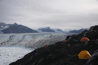
Only accessible by helicopter, three to five scientists will spend up to a month camped out on the wet terrain surrounding the glacier. They deploy instruments to measure the glaciers, take photographs and make observations in the field. The instruments do not transmit their data back to the lab, so twice a year scientists trek to Columbia to retrieve it.
Iceberg are born
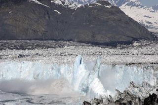
Scientists captured a dramatic submarine iceberg calving at the grounded end of the Columbia Glacier on June 17, 2005. The height of the ice cliff is roughly 230 feet (70 meters).
Service Call
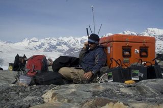
Glaciologist O'Neel of the USGS is pictured here checking up on the seismometer that measured the activity of the Columbia Glacier in May 2009.
"Think of a calving event kind of like a little earthquake," O'Neel told OurAmazingPlanet. "Seismometers tell us when and how long it took to break off, and also gives us ideas about how it was created."
Conveyor Belt of Ice
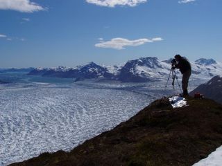
Tad Pfeffer is seen photographing the Columbia Glacier from the western boundary in June 2005. The scientists do more than just take pretty pictures. Try also make quantitative measurements with their images. Pictures taken with this camera help scientists calculate how fast the ice is flowing and also measure the glacier's geometry.
Time-Lapse Photography
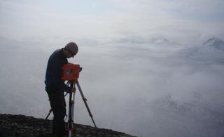
Adam LeWinter is servicing one of the time-lapse cameras at Columbia Glacier. Time-lapse images provide one of the primary sources of data used in this study.
"We use them to identify times when large calving events occur and then look at the seismic data during those periods to study the fracture process," O'Neel said.
In 2004, the time-lapse cameras took four to six pictures per day. Today they snap photographs every 20 minutes.
Sign up for the Live Science daily newsletter now
Get the world’s most fascinating discoveries delivered straight to your inbox.


