Measurement of Mountains' Rise is a First

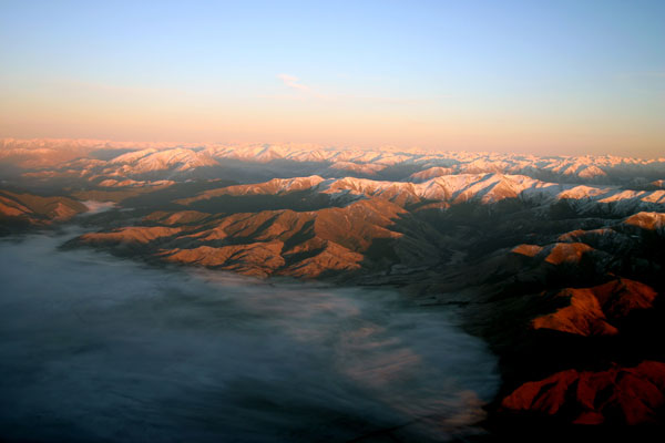
Ten years of GPS data taken from New Zealand's Southern Alps have helped scientists determine how fast this mountain range is rising.
The data are the first to record the vertical movement of a mountain range.
"I don't think anyone has done vertical movement outside of places like Canada, where it is due to the removal of the ice. The reason that we chose to use the Southern Alps is because they are moving very quickly," said Peter Molnar of the University of Colorado-Boulder.
Molnar and his fellow researchers found that the vertical movement was greatest near the crest of the mountains, for reasons Molnar said he couldn't explain. There the rise was determined to be roughly 0.2 inches (5 millimeters) a year on average.
Researchers are still uncertain how much of the rise is due to tectonic plate movement and how much is due to erosion of the valleys between mountains, Molnar told OurAmazingPlanet.
New Zealand straddles the Indo-Australian and Pacific tectonic plates slabs of Earth's crust that slide around the planet's surface, colliding and sliding past one another, placing the country in a particularly active area of seismic activity.
The mountain range is located along the Alpine Fault, a strike-slip fault. The Indo-Australian plate is sliding horizontally toward the northeast at the same time the Pacific plate is pushing up. Over the last 45 million years, the collision has pushed rock up on the Pacific Plate, forming the Southern Alps.
Sign up for the Live Science daily newsletter now
Get the world’s most fascinating discoveries delivered straight to your inbox.
The range runs roughly 280 miles (450 kilometers) north to south, and the tallest peak is Aoraki /Mount Cook, also the highest point in New Zealand at 12,316 feet (3,754 meters).
To measure just how fast these mountains are being pushed up, the researchers placed their equipment along various ridges in the mountain range not an easy task in remote, unforgiving area.
"The key aspect we had to consider when designing the experiment was the relatively harsh environmental conditions and the remoteness: up to 9 meters [30 feet] of rain on the west coast, keas that have the ability to destroy equipment unless it is robustly constructed, sites up to 2,000 meters [6,562 feet] above sea level that are very windy and also receive large quantities of snow each year," said Paul Deny of Otago University in Dunedin, New Zealand. Keas are large native parrots.
The researchers hoped to determine what exactly caused this mountain range to rise as quickly as it did.
"The motivation behind this is finding out to what extent is this vertical movement due to plate movement and to what extent is it other effects such as erosion," Molnar said. "New Zealand is eroding very quickly. When you look at vertical movement you have to wonder which of the various effects is causing this."
As erosion deepens the valleys scattered throughout the Southern Alps, the elevation of the mountains increases. Because of this, it is difficult for research teams to determine how much of each factor contributes to the vertical movement.
"We plan to go back in the near future and do a gravity measurement. This will begin to separate for us how much movement is due to erosion," Molnar said.
The paper appears in the September issue of the journal Geophysical Research Letters.


