Magma in Ethiopia Could Predict Future Eruptions
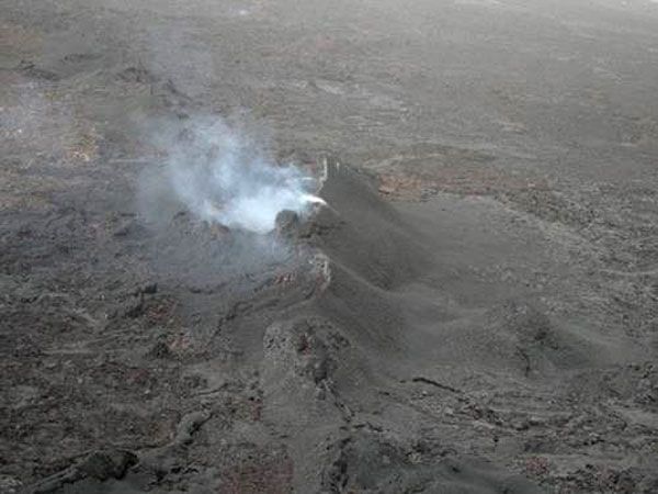
Columns of magma that shove their way into rocks on the surface could help scientists predict where volcanic eruptions may occur, new research suggests.
When magma molten rock that will be known as lava after it reaches the surface travels through underground chambers, the ground changes, with some surface areas deflating as the magma moves away and other areas inflating as the magma moves upward, creating intrusions of magma called dykes . This deflation and inflation creates stress on the ground surface.
Scientists have long wondered whether this stress was linked to later volcanic events and whether they could be used to predict those eruptions. To test that out, a study team investigated the rifting of Earth's surface that is occurring in Ethiopia.
"The idea that the stress change, caused by a magmatic intrusion, may affect the location of future events is not new. However, it has never been systematically demonstrated," said study team member Ian Hamling of the University of the International Center for Theoretical Physics, in Italy. "The ongoing rifting episode in Ethiopia provided a unique opportunity to test whether a link exists."
The episode drawing the team's attention began in September 2005, when a volcanic event in Ethiopia's Afar Desert forced magma up through rocks in a crack, resulting in a tear in Earth's crust 37 miles long (60 km). Over the next four years, 12 more dykes were created in the same region near the Red Sea.
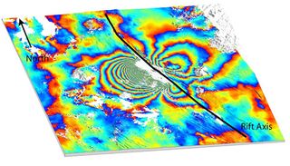
The researchers found that the sequential positioning of dykes was not random. Instead, the stress events created by a new dyke's intrusion were a factor in the location of the next magma intrusions. In the cases of nine of the 12 dykes created after the initial intrusion, at least half the opening was in a region that had been jacked apart by the preceding dyke.
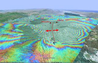
To monitor the surface changes around each dyke throughout the event, the scientists used Synthetic Aperture Radar Interferometry (InSAR) on satellite data taken from the initial dyke between 2005 and 2009, and they produced interferogram images.
Sign up for the Live Science daily newsletter now
Get the world’s most fascinating discoveries delivered straight to your inbox.
InSAR involves combining two or more radar images of the same ground location in such a way that very precise measurements (within a few millimeters) can be made of any ground movements between images.
Combining them with GPS data, scientists discovered that the later eruptions were connected.
While this discovery will enable researchers to get a better idea of where the next event will happen, it doesn't answer every question.
"These findings are unique and will help us better predict the location of future eruptions and help authorities issue timely evacuation warnings," said co-author Tim Wright of the University of Leeds.
The researchers plan to continue tracking stress events.
"A team of international scientists are continuing to monitor the rifting episode using a variety of geophysical methods. As new intrusions occur we will track the evolving stress field to allow us to predict the location of further magmatism," Hamling said.
