Mission to Trace Antarctic Ice Set to Take Off
The state of the world's polar icecaps is an important, but contentious, topic when it comes to evaluating the state and future of the world's climate.
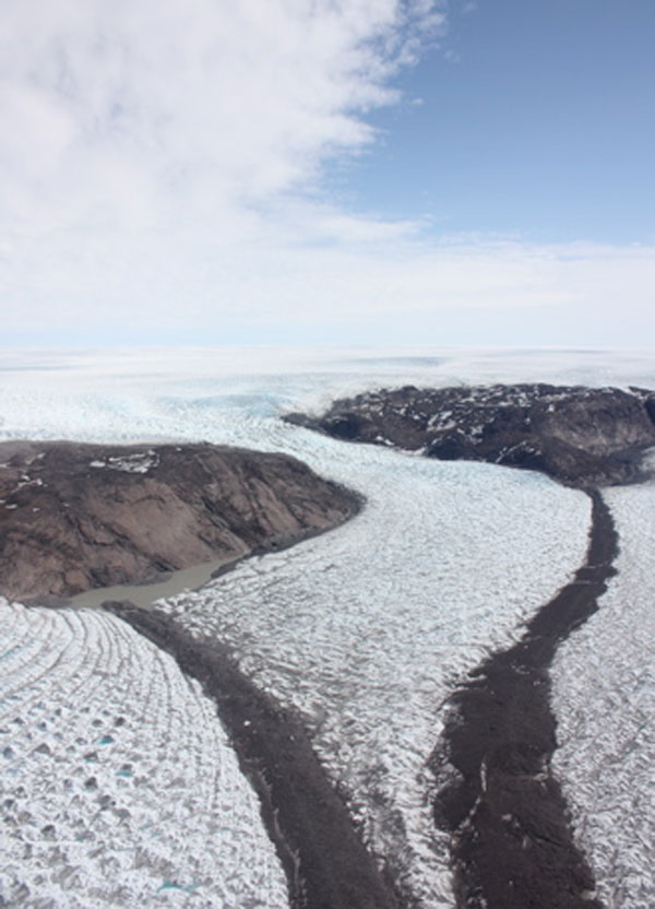
To gain a better understanding of what's going on at Earth's poles, NASA has embarked on a six-year campaign to survey and monitor areas of Earth's polar ice sheets, glaciers and sea ice. Researchers for this mission, called IceBridge, will soon be heading out for their fourth semi-annual flight over the ice of Antarctica.
The IceBridge mission is the largest airborne survey of Earth's polar ice ever flown. It will yield never-before-seen 3-D images of Arctic and Antarctic ice. The flights provide a yearly, multi-perspective look at the behavior of the rapidly changing features of the Greenland and Antarctic Ice Sheets and the glaciers that run from them into the oceans.
The mission crew flew down this week to Punta Arenas, Chile, where they will be based for the remainder of the campaign. They plan to start making flights in the next few days.
A new season begins
This season of IceBridge will continue measurements begun in previous years over the Antarctic Peninsula, the Wedell Sea, the Amundsen Sea and along the Amundsen Sea Coast.
This mission has various objectives, one of which is to continue the scientific investigation of polar sea ice and polar ice sheets begun with NASA's ICESat. ICESat was a satellite that launched in 2003 and died in 2009. The satellite used a laser to measure altitude, which researchers used to determine the height of polar ice.
Sign up for the Live Science daily newsletter now
Get the world’s most fascinating discoveries delivered straight to your inbox.
"We are going to be flying over the lines that ICESat did in order to continue collecting information as it would have, but we are going to be able to get a better picture of what is happening with the ice," Tom Wagner, a NASA cryosphere program scientist with the mission, told OurAmazingPlanet. "While ICESat only had one laser, our plane is outfitted with multiple lasers which will help us create a more accurate image of the ice."
These measurements of the sea ice provide more than just the height of the Antarctic ice, however they can also measure how thick ice is.

"Flights over sea ice are designed to measure the surface elevation of the sea ice floes above the adjacent water level from which, using buoyancy, ice thickness can be estimated," said Kenneth Jezek, the mission's science definition team co-leader from Ohio State University. "Thickness is important because sea ice is an important moderator of the heat flux from the relatively warm polar ocean to the cold polar atmosphere."
In addition, the researchers will be focusing on measuring ice shelves, the floating slabs of glacier ice that extend out over the ocean and act as an edge for the Antarctic continent .
"These ice shelves have long been believed to be diagnostic of warming signals in the Antarctic and have indeed been retreating since the late 1980s," Jezek said. "The information is important because loss of the ice shelves precipitate an increase in ice flux from the interior glaciers into the ocean, thus raising sea level."
Antarctica's gravity
In order to make these measurements, the researchers will be studying how the gravity field changes over different areas of Antarctica, which will enable them to map the bedrock of the seafloor below and the bedrock of the continent underlying the massive ice sheet. The shape of the seafloor in turn will indicate how water moves up and under the ice shelves.
"Winds in Antarctica drive ocean currents to push warm water under the ice shelf which causes thinning and melting and lets the ice on land flow into the ocean that much more quickly," Wagner said. "This is also why we are also going to fly way farther up into the middle of the continent to monitor how the changes on the edges of the glaciers telegraph into the interior and cause the ice to flow toward the ocean."
The focus of all these components comes down to the thinning of the ice, which can have a major effect on the rest of the planet.

"GRACE satellite [Gravity Recovery and Climate Experiment] says that we are losing ice mass in this area. This ice is so heavy that it is actually weighing down the Antarctic continent, so if it continues losing mass, the continent will physically pop up in the water," Wagner said. "This is the most important thing to think about when it comes to rapid sea level rise, and that's why we are focusing the program there."
The flyovers will be done in repurposed DC-8 planes. The converted jetliner and its team of scientists and flight crew will fly up to 145 hours over Antarctica during the next two months.


