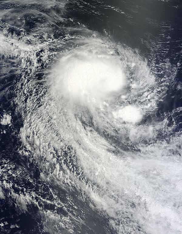
Tropical Cyclone Abele Moves Through Indian Ocean

Get the world’s most fascinating discoveries delivered straight to your inbox.
You are now subscribed
Your newsletter sign-up was successful
Want to add more newsletters?
Join the club
Get full access to premium articles, exclusive features and a growing list of member rewards.
While the last day in November marks the end of the Atlantic hurricane season , tropical cyclones are always present somewhere on Earth; right now Tropical Cyclone Abele is making its way through the Indian Ocean.
"Tropical cyclone" is the all-encompassing term for tropical storms, hurricanes and typhoons, all of which are the same type of phenomenon; what they are called depends on which ocean basin they originate in.
NASA's Terra Satellite took this image of Tropical Cyclone Abele (originally called Tropical Cyclone 3S), which formed over the southern Indian Ocean on Nov. 29. While there, Abele generated 16-foot-high waves (5 meters), but luckily was not a threat to any landmasses.
Article continues belowThe next day, the U.S. Navy's Joint Typhoon Warning Center reported that Abele had maximum sustained winds of 47 mph (76 kph) with gusts up to 60 mph (97 kph).
Currently, Abele spans hundreds of kilometers over the open ocean. The storm lacks a distinct eye, but sports the apostrophe shape characteristic of tropical cyclones.
Abele was located some 675 nautical miles (1,250 kilometers) west-southwest of Australia's Cocos Island, but is now moving southeastward from Cocos Island at 13 mph (21 kph).
Rainfall analysis from Dec. 2 shows that Abele had become much better organized. Increasingly well-defined bands of rainfall spiraling into the center of the storm are an indication that it has intensified, but it is about to run into cooler waters, and is expected to begin weakening as of tomorrow (Dec.3).
Get the world’s most fascinating discoveries delivered straight to your inbox.
 Live Science Plus


