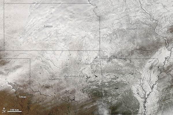
Snow Coats Southern U.S. ... Again

Get the world’s most fascinating discoveries delivered straight to your inbox.
You are now subscribed
Your newsletter sign-up was successful
Want to add more newsletters?
Join the club
Get full access to premium articles, exclusive features and a growing list of member rewards.
The icy fingers of winter 2010-11 reached down into the south central United States for the second time in a week, breaking many local records for snowfall in a month that is still only 10 days old.
Snowfall totals topped 20 inches (50 centimeters) in parts of Oklahoma, Kansas and Arkansas, according to a NASA statement, just one week after a Groundhog Day storm coated the region with several inches.
Meanwhile, temperatures dropped into the single digits in the American Plains and in Colorado. The storms moved east to dump more snow, ice and rain in Alabama, Mississippi, Tennessee and the Carolinas.
Article continues belowNASA's Aqua satellite got a view of the snow-coated region on Feb. 10. Nearly all of the white in this image is snow and ice, except for a bit of clouds in the lower right (southeast) corner.
Tulsa, Oklahoma, received 5.5 inches (14 cm) of snow on Feb. 9, bringing its total to 20.9 inches (53 cm) for the winter, the snowiest on record. In Oklahoma City, 6 inches (15 cm) fell as well, making February 2011 the second snowiest month (18 inches so far) in the state's records, behind March 1911 (20.7 inches).
News outlets reported collapsed roofs on a number of public and private buildings and the state Health Department reported 80 storm-related injuries.
Between 12 to 17 inches (30 to 43 cm) of new snow fell in eastern and south central Kansas, and it has snowed as much this February as it usually does for an entire winter, a spokesperson for the Kansas Department of Transportation told Reuters.
Get the world’s most fascinating discoveries delivered straight to your inbox.
 Live Science Plus


